
Integrated Management Planning
Placentia Bay, Newfoundland and Labrador
Table of Contents
- Complete Text
- Integrated Management (IM)
- Why Placentia Bay?
- Introduction
- Coastal Landforms (Geomorphology)
- Community Based Coastal Resource Inventories
- Shipping Lanes and Water Depth (Bathymetry)
- Plants and Animals
- Fisheries and Aquaculture
- Ecological Reserves and Special Places
- Industry
- Current Status
- References
Coastal Landforms (Geomorphology)
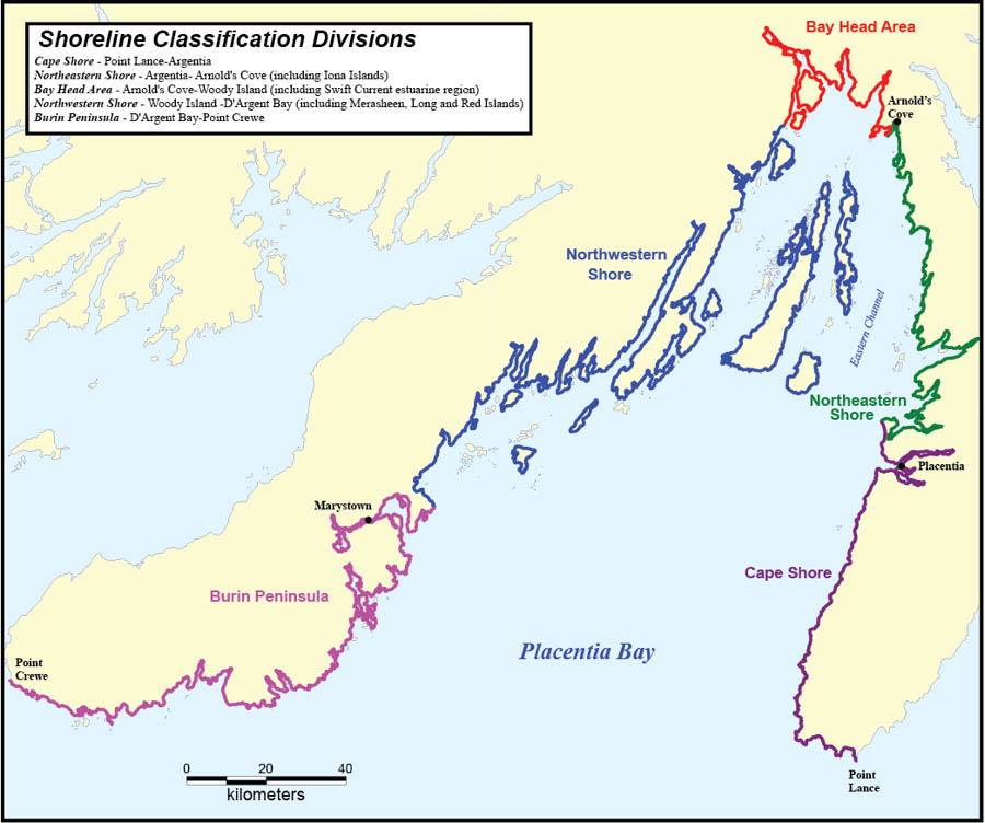
Placentia Bay is a large bay on the south coast of Newfoundland. The opening, or mouth, of the bay is approximately 145 km wide, and the bay is approximately 125 km long. At its midpoint, the bay is approximately 240 m deep.Footnote 7 Placentia Bay has many islands, shoals, reefs and banks as well as three well-defined channels. The Western Channel lies between the Burin Peninsula and Merasheen Island, the Central Channel lies between Merasheen Island and Long Island and the Eastern Channel lies between Long Island and the Avalon Peninsula. The Eastern Channel is the largest of the three in both width and depth and is the principal channel in the bay used for shipping and transportation.Footnote 17
Placentia Bay is characterized by deep water and exposure to southwesterly winds and currents. The bay entrance is unobstructed, allowing waves unrestricted access to the region. Shorelines are dominated by coarse-grained gravel deposits and cliffs; mixed sand and gravel beaches are uncommon and sand dominated systems are rare. Estuaries develop at the heads of most deep embayments along the northeastern and northwestern areas of the shore and the development of tidal flats is rare.Footnote 4 Shorelines are dominated by onshore-offshore movement of sediment, with little shore-parallel movement. This pattern implies that sediments and contaminants, once introduced into the system, will remain for a considerable amount of time within individual coves and smaller embayments.
Beaches throughout the region are marked by seasonal and yearly changes in form and texture. The amount that these beaches change over time is exceptional; stability is not a characteristic of most of these shores.
The divisions for shoreline classification have been adopted from Catto et al. (1997) and are listed in the map shown above.
- Date modified: