
The State of the Ocean Report for the Pacific North Coast Integrated Management Area
The ecosystem reported on, in the State of the Ocean report for the Pacific North Coast Integrated Management Area (PNCIMA), encompasses approximately 102,000 km² from the edge of the continental shelf east to the British Columbia mainland. The region extends from the British Columbia-Alaska border south to Bute Inlet on the mainland, across to Campbell River on the east side of Vancouver Island and the Brooks Peninsula on the west side of Vancouver Island.
Highlights of the State of the Ocean Report for the Pacific North Coast Integrated Management Area

Wet windy winters and drier, relatively calmer summers dominate the seasonal weather, resulting from very different air pressure patterns in the Gulf of Alaska in summer and winter. Frequent winter storms with strong southerly winds (blowing from the south) bring not only high waves, but also warmer waters from the south and deep downwelling and mixing of surface waters. Large rivers from the BC interior snowfields and glaciers dominate the fresh water runoff in other seasons, especially in late spring. The summer-winter change in weather dominates PNCIMA, but there have been variations in the weather over past decades, and their impacts, are discussed in the report.
- Two recent winters illustrate the increasingly frequent shifts between strong El Niño (2010 - stronger southerly winds, relatively warmer ocean waters in PNCIMA) and La Niña (2011 -stronger westerly winds, cooler waters) conditions.
- In general, the last two decades have seen warmer, less saline ocean waters.
- Recent declines in sub-surface oxygen concentrations may lead to negative effects on marine species such as groundfish.
- The timing of spring plankton blooms in Queen Charlotte Sound appears to have a major influence on the survival of certain marine birds as well as young salmon.
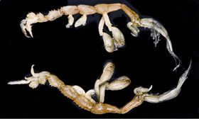
- PNCIMA provides important habitat for ancient colonies of corals and sponge reef communities; a recently released conservation strategy was designed to protect these rare and sensitive components of our marine ecosystem.
- While many native invertebrate species are harvested, two are doing poorly: Northern abalone is listed as endangered, and Olympia oyster are listed as a species of special concern by COSEWIC.
- Groundfish catches constitute about half of the total groundfish catches within BC with Pacific hake the single largest species catch both coast-wide and within PNCIMA.
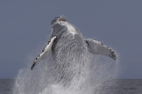
- The region provides essential spawning and rearing habitat for local salmon populations and is also important as a marine migration corridor for more southerly populations. Marine waters are especially important for juvenile salmon during summer and fall.

For more information on trends in Pacific North Coast ocean conditions, marine mammals, shellfish, corals, species at risk, and more, please see the full report on: Pacific North Coast LOMA
Want to know more?
These additional reports and Internet sites offer more information:
- State of physical, biological, and selected fishery resources of Pacific Canadian marine ecosystems in 2010 (CSAS ResDocs - 2011/054) offers a review of all coastal waters of British Columbia. Watch for annual updates of this publication.
- Ecosystem overview of PNCIMA up to 2007 describes the main components of this ecosystem and introduces 11 appendices on specific aspects of the ecosystem and its geographical, oceanographic and meteorological setting.
- Ecosystem Status and trends of PNCIMA (CSAS resdocs - 2010/045) presents an update to the year 2010 of the ecological component of the ecosystem overview of PNCIMA published in 2007.
- Atlas of the Pacific North Coast Integrated Management Area presents many maps of marine life, geographical setting and human use of this area.
- The Pacific North Coast Integrated Management Area (PNCIMA) Initiative maintains an Internet site with links to additional valuable publications, and news of collaborative management planning of this area.
- Date modified: