
The ins and outs of Canada's Oceans
Release date: March 2021
Description: The ins and outs of Canada's Oceans
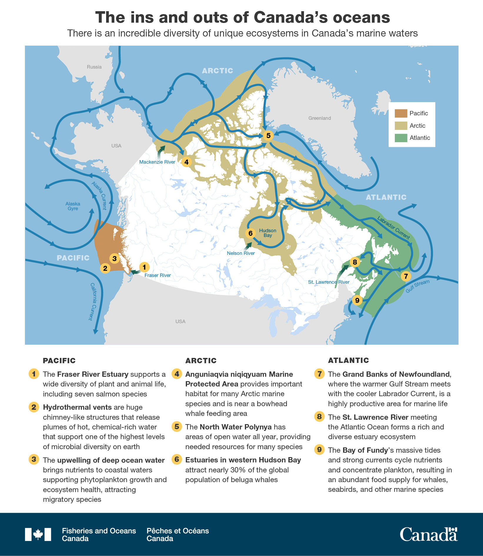
A map of Canada shows the major currents using blue arrows connecting the Pacific (outlined in orange), Arctic (outlined in yellow), and Atlantic (outlined in green) oceans. Nine yellow numbered circles are on the map which are listed below the map with text highlighting three areas of significance in each ocean.
Text
The ins and outs of Canada's oceans
There is an incredible diversity of unique ecosystems in Canada's marine waters
Pacific
- The Fraser River Estuary supports a wide diversity of plant and animal life, including seven salmon species.
- Hydrothermal vents are huge chimney-like structures that release plumes of hot, chemical-rich water that support one of the highest levels of microbial diversity on earth.
- The upwelling of deep ocean water brings nutrients to coastal waters supporting phytoplankton growth and ecosystem health, attracting migratory species.
Arctic
- Anguniaqvia niqiqyuam Marine Protected Area provides important habitat for many Arctic marine species and is near a bowhead whale feeding area
- The North Water Polynya has areas of open water all year, providing needed resources for many species.
- Estuaries in western Hudson Bay attract nearly 30% of the global population of beluga whales.
Atlantic
- The Grand Banks of Newfoundland, where the warmer Gulf Stream meets with the cooler Labrador Current, is a highly productive area for marine life.
- The St. Lawrence River meeting the Atlantic Ocean forms a rich and diverse estuary ecosystem.
- The Bay of Fundy's massive tides and strong currents cycle nutrients and concentrate plankton, resulting in an abundant food supply for whales, seabirds, and other marine species.
Related links
- Date modified: