Canada's Oceans Now: Pacific Ecosystems, 2021 - Features that shape Canada's Pacific coast
Release date: June 2022

Description: Canada’s Oceans Now: Pacific Ecosystems, 2021 - Features that shape Canada's Pacific coast
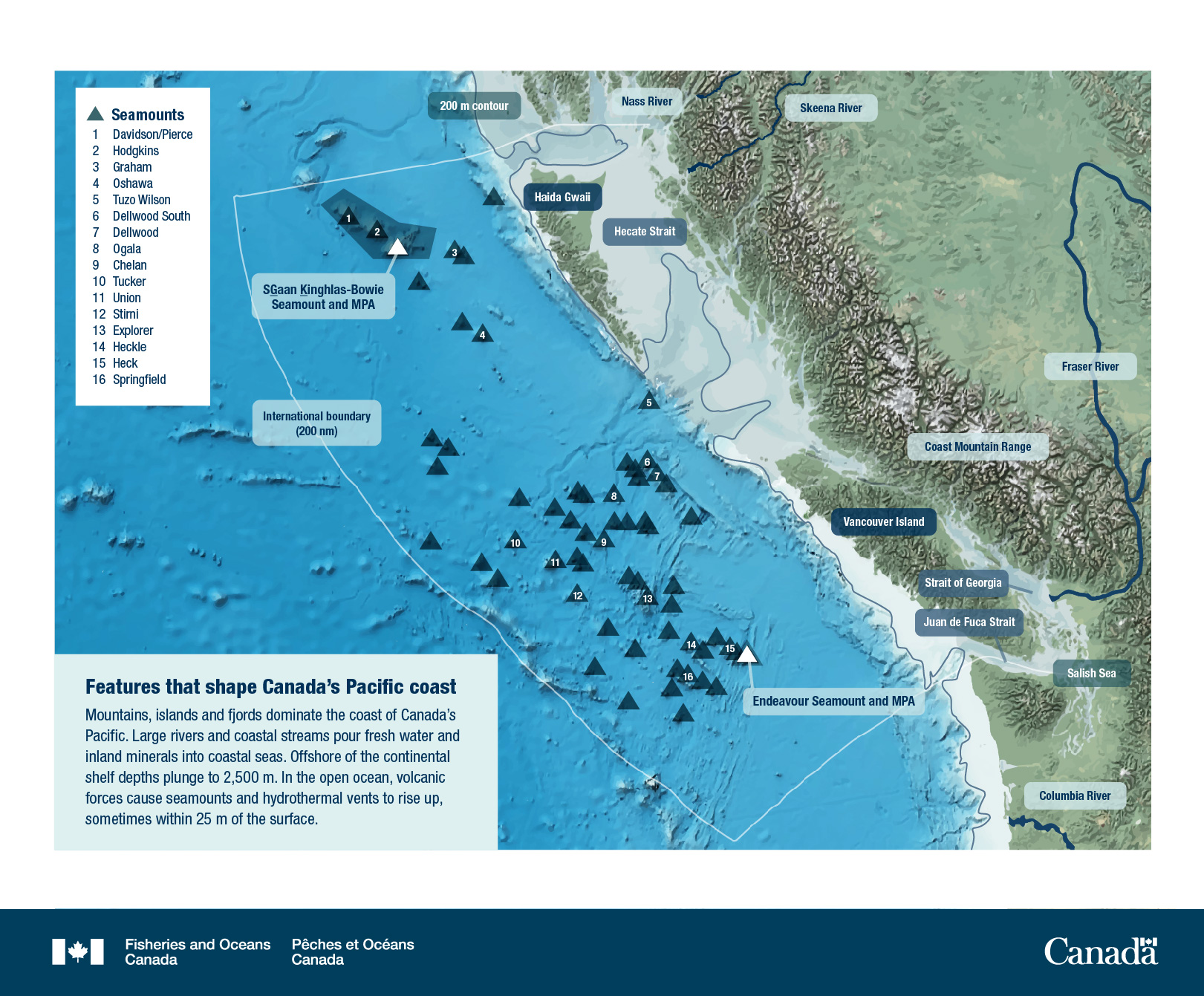
Topographic map of Canada's Pacific coast which shows the continental shelf, seamounts and hydrothermal vents off the British Columbia coast. Triangle icons show locations of seamounts with numbered locations. Geographic features are highlighted as well as rivers, Marine Protected Areas and the International ocean boundary.
Features that shape Canada's Pacific coast
Mountains, islands and fjords dominate the coast of Canada's Pacific. Large rivers and coastal streams pour fresh water and inland minerals into coastal seas. Offshore of the continental shelf depths plunge to 2,500 m. In the open ocean, volcanic forces cause seamounts and hydrothermal vents to rise up, sometimes within 25 m of the surface.
Seamounts
- Davidson/Pierce
- Hodgkins
- Graham
- Oshawa
- Tuzo Wilson
- Dellwood South
- Dellwood
- Ogala
- Chelan
- Tucker
- Union
- Stirni
- Explorer
- Heckle
- Heck
- Springfield
- Nass River
- Skeena River
- Fraser River
- Columbia River
- Coast Mountain Range
- Salish Sea
- International boundary (200 nm)
- 200 m contour
- SG̲áan K̲ínghlas-Bowie Seamount and MPA
- Endeavour Seamount and MPA
- Strait of Georgia
- Hecate Strait
- Juan de Fuca Strait
Related links
- Date modified: