
Charting the Labrador Coast… White Bear Island to Cape Chidley
Description: Charting the Labrador Coast… White Bear Island to Cape Chidley
Background
The inshore route along the Newfoundland and Labrador coast took 77 years to complete. The survey was terminated in 1934 due to high cost and very little anticipated shipping activity in the area. The last area to be surveyed along the Labrador coast since 1930 on board the HMS Challenger was the section between White Bear Island and Cape Chidley.
Recent Surveys
In 1990, the arrival of the CSS Matthew allowed for an ongoing annual survey on the Labrador coast. The northern half of inshore Labrador is one of the most dangerous stretches of coastline on the east coast of Canada. The northern survey consisted of over 360 kilometres of near-shore route through completely uncharted waters where there was little knowledge of the area. The very rugged and shoal infested coastline between Cape Mugford and Cape Chidley was the last section of this coastline to be surveyed for the completion of this program in 2007.
NIF-SAR Project
The New Initiative Funds, provided by CCG came to meet Search and Rescue (SAR) requirements along the Labrador Coast. Obtained in 2003, this fund allowed CHS to deal with a substantial survey project of four years. In addition to surveys along the Labrador Coast with the CCGS Matthew, CHS took the opportunity to resolve discrepancies. Those discrepancies were in many cases shorelines that were out of position by up to half a mile in some areas.
With the acquisition of digital aerial photographs that were registered by CHS, the shoreline was established along 360 km, including numerous islands.
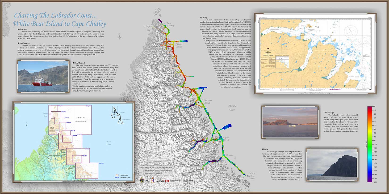
Charting
To chart the area from White Bear Island to Cape Chidley, chart production was initially planned for five charts at a scale of 1:100 000; however, once the areas were surveyed it was determined that either several insets or charts at 1:40 000 would be necessary to appropriately portray the information. Shoal areas and narrow corridors with severe currents considered hazardous to mariners benefited from being presented at a larger scale. New formats were submitted for a total of eleven new charts; cancelling twelve off datum charts.
Chart production started in the summer of 2008 and is now completed two years later. Having all shoreline data available from CARIS-GIS, the decision was taken to build those charts using traditional manner with CARISs GIS applications. Once paper charts are completed, they are converted to ENC. ln total 19 ENCs are created. All of them will be loaded in CARIS' Hydrographic Production Database (HPD). The 11 charts created consist of one at 1:200 000; three at 1:100 000 and finally seven at 1:40 000. Charts are metric and compiled with new data with corridors in grey pecked line. The delivery of provisional charts incorporated modern and historical bathymetric data and with accurate shorelines will enhance safe navigation in the Nain to Button Islands region. In the future, with increasing interest in the Arctic, this inshore route along Northern Labrador will definitely be more popular in addition to serving the safe transport of goods for commercial mariners and support SAR operations when required.
Cruise Ships
The Labrador coast offers splendid views of the Torngat Mountains; breathtaking landscapes, fjords to discover and wildlife to observe. Cruise ship companies have realized that there is a clientele with the enthusiasm for these remote places, which promotes Ecotourism and the discovery of the marine environment.
Clients
Full coverage surveys were impossible for a territory of approximately 10 000 square km. Navigation requirements were established through consultations with different clients, CCG captains, transport companies, as well as cruise ship companies. To satisfy clients as much as possible, navigation corridors were identified, as well as three entrances from offshore to safely navigate through long barriers of shoals located 10 miles offshore. Several inshore routes were surveyed to allow access to large, deep bays as ports of refuge to areas in this isolated, hostile territory.
- Date modified: