
Habitat Highlight: Managing aquatic invasive species in Nova Scotia watersheds
This Habitat Highlight provides an overview of the establishment and spread of 2 aquatic invasive species in Nova Scotia, smallmouth bass and chain pickerel, as well as management actions taken to mitigate their impacts.
On this page
- Aquatic invasive species present in Nova Scotia
- Management actions to address aquatic invasive species
- Partnerships to address aquatic invasive species
- References
Aquatic invasive species present in Nova Scotia
Several aquatic invasive species are found in the lakes and rivers in Nova Scotia, including smallmouth bass and chain pickerel.
This Habitat Highlight focuses on the establishment and spread of these 2 invasive species as well as management actions taken to mitigate their impacts in Nova Scotia. This management is important. Smallmouth bass and chain pickerel can transform freshwater ecosystems and impact the native fish populationFootnote 1.
The following maps show the spread of smallmouth bass and chain pickerel over time. They are based on data from the Nova Scotia Department of Fisheries and Aquaculture. The data includes the location and timeframe of each detection. The distributions of these species are likely more widespread than indicated in these maps as fish go through a number of life stages before they are likely to be caught and then reported, meaning they are often present in a location before they are reported. Further, there is limited capacity by the province to investigate every angler report of smallmouth bass or chain pickerelFootnote 1.
Smallmouth bass
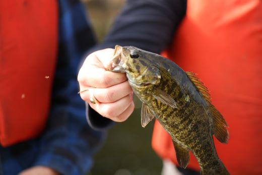
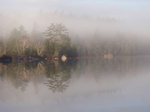
Smallmouth bass are primarily found in cool, clear lakes but they may also be found in slow moving streams with deep poolsFootnote 2. This invasive species impacts freshwater ecosystems by eating small-bodied fish or by outcompeting native fish for foodFootnote 1.
Smallmouth bass pose a significant threat to the survival of the last remaining population of Atlantic whitefish as both a competitor and predatorFootnote 3. Although the interactions between smallmouth bass and Atlantic salmon have not been extensively studied, there may be competition between the young-of-the-year of both species, which occupy similar habitats. Smallmouth bass may also prey on salmon fry, parr or smoltsFootnote 4.
The map below shows how smallmouth bass have spread since they were first found in the province. They were first recorded in Yarmouth, Halifax and Hants counties in the 1940s. The species was initially introduced by the provincial government for recreational fishing. Through the 1950s, 1960s and 1970s, additional detections were recorded, primarily in areas in close proximity to the original detections. The greatest rate of spread occurred in the 1990s, with smallmouth bass being detected in watersheds throughout southwestern Nova Scotia and into Colchester and Cumberland counties. Between 2000 and 2009, the first detections of smallmouth bass were recorded in Cape Breton. Smallmouth bass has now been recorded in 26 of the province’s 46 primary watersheds. The species is spreading via illegal transfers, natural dispersal within watersheds and accidental releases. The federal government considers smallmouth bass an invasive species throughout Nova Scotia. However, the province of Nova Scotia manages a significant recreational sport fishery for smallmouth bass in southern areas of the province. In northern regions, the province considers the species invasive.
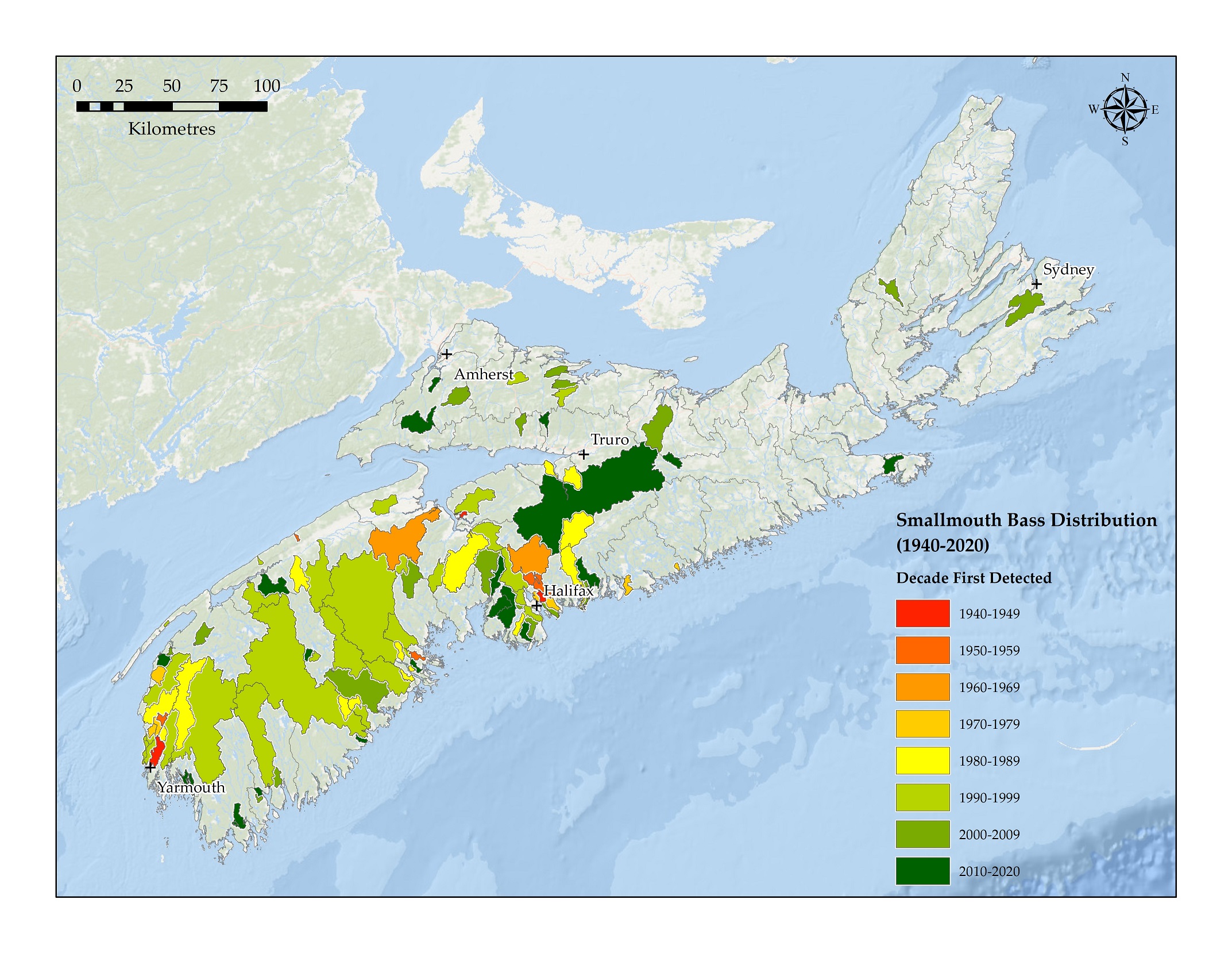
Spread of smallmouth bass in Nova Scotia from 1940 to 2020 – Text version and data sources
Data sources and methods
In order to assess the distribution of smallmouth bass and chain pickerel across Nova Scotia, this report used a dataset of aquatic invasive species detections from the Nova Scotia Department of Fisheries and Aquaculture (NSDFA). If there is a suspected, but unconfirmed presence of aquatic invasive species or if a report is received from the public, the NSDFA will assess the waterbody. NSDFA uses common angling practices to detect invasive species; visual observations may also be used to confirm presence. If invasive species are captured, their presence is documented and the date of ‘confirmation’ is recorded in the dataset. It is important to note that the rate of detection is often a function of effort; in other words, years without new detections may not mean that the invasive species are not spreading, but may be due to limited monitoring efforts.
The dataset was parsed by date of detection to produce separate species-decade datasets based on the species and decade of first recorded occurrence. The species-decade locations were joined with watershed polygon boundaries (1:10,000 watershed boundaries – tertiary and secondary from the NS Open Data portal) to identify watersheds containing locations of aquatic invasive species detections for a given species and decade.
| Decade | Primary watershed | Secondary watershed |
|---|---|---|
| 1940 to 1949 | Sackville | Dartmouth Lakes |
| 1940 to 1949 | Kennetcook | Kennetcook River |
| 1940 to 1949 | Tusket River | Ohio Millstream Brook |
| 1950 to 1959 | Annapolis | Shore Direct 1DC-SD29 |
| 1950 to 1959 | Gold | Shore Direct 1EG-SD12 |
| 1950 to 1959 | Tusket River | Ohio Millstream Brook |
| 1950 to 1959 | Meteghan | Salmon River (Digby County) |
| 1950 to 1959 | Shubenacadie / Stewiacke | Shubenacadie River |
| 1950 to 1959 | Shubenacadie / Stewiacke | Shubenacadie River |
| 1950 to 1959 | Shubenacadie / Stewiacke | Shubenacadie River |
| 1950 to 1959 | Shubenacadie / Stewiacke | Shubenacadie River |
| 1950 to 1959 | Shubenacadie / Stewiacke | Shubenacadie River |
| 1960 to 1969 | Sackville | Dartmouth Lakes |
| 1960 to 1969 | Shubenacadie / Stewiacke | Shubenacadie River |
| 1960 to 1969 | Gaspereau | Gaspereau/Black River |
| 1970 to 1979 | Meteghan | Salmon River (Digby County) |
| 1970 to 1979 | Tusket River | Cedar Lake (Un-named river) |
| 1970 to 1979 | Meteghan | Shore Direct 1DA-SD6 |
| 1970 to 1979 | Gaspereau | Gaspereau/Black River |
| 1970 to 1979 | Sackville | Shore Direct 1EJ-SD3 |
| 1970 to 1979 | Sackville | Cow Bay River |
| 1970 to 1979 | Shubenacadie / Stewiacke | Shubenacadie River |
| 1970 to 1979 | Shubenacadie / Stewiacke | Shubenacadie River |
| 1970 to 1979 | Tangier | Shore Direct 1EL-SD4 |
| 1970 to 1979 | Tangier | Shore Direct 1EL-SD15 |
| 1980 to 1989 | Tusket River | Cedar Lake (Un-named river) |
| 1980 to 1989 | Meteghan / Tusket River | Salmon River (Digby County) |
| 1980 to 1989 | Tusket River | Tusket River |
| 1980 to 1989 | Annapolis | Annapolis River |
| 1980 to 1989 | Herring Cove / Medway | Medway River |
| 1980 to 1989 | Mersey | Mersey River |
| 1980 to 1989 | LaHave | Shore Direct 1EF-SD2 |
| 1980 to 1989 | LaHave | Shore Direct 1EF-SD8 |
| 1980 to 1989 | LaHave | Marsh Brook |
| 1980 to 1989 | Gaspereau | Gaspereau/Black River |
| 1980 to 1989 | St. Croix | St. Croix River |
| 1980 to 1989 | Sackville | Partridge River |
| 1980 to 1989 | Shubenacadie / Stewiacke | Shubenacadie River |
| 1980 to 1989 | Shubenacadie / Stewiacke | Shubenacadie River |
| 1980 to 1989 | Shubenacadie / Stewiacke | Shore Direct 1DG-SD3 |
| 1980 to 1989 | Shubenacadie / Stewiacke | Shubenacadie River |
| 1980 to 1989 | Shubenacadie / Stewiacke | Shubenacadie River |
| 1980 to 1989 | Musquodoboit | Porters Lake |
| 1990 to 1999 | Tusket River | Annis River |
| 1990 to 1999 | Tusket River | Shore Direct 1EA-SD15 |
| 1990 to 1999 | Tusket River | Tusket River |
| 1990 to 1999 | Roseway / Sable / Jordan | Roseway River |
| 1990 to 1999 | Tusket River | Shore Direct 1EA-SD14 |
| 1990 to 1999 | Tusket River | Cedar Lake (Un-named river) |
| 1990 to 1999 | Meteghan / Tusket River | Salmon River (Digby County) |
| 1990 to 1999 | Meteghan | Meteghan River |
| 1990 to 1999 | Annapolis | Lequille River |
| 1990 to 1999 | Annapolis | Shore Direct 1DC-SD54 |
| 1990 to 1999 | Sissiboo / Bear | Shore Direct 1DB-SD21 |
| 1990 to 1999 | Mersey | Mersey River |
| 1990 to 1999 | Herring Cove / Medway | Herring Cove Brook |
| 1990 to 1999 | Herring Cove / Medway | Medway River |
| 1990 to 1999 | Herring Cove / Medway | Medway River |
| 1990 to 1999 | Herring Cove / Medway | Petite Rivière |
| 1990 to 1999 | LaHave | Marsh Brook |
| 1990 to 1999 | LaHave | LaHave River |
| 1990 to 1999 | Gold | Mushamush River |
| 1990 to 1999 | Annapolis | Annapolis River |
| 1990 to 1999 | Gold | Gold River |
| 1990 to 1999 | Gaspereau | Cornwallis River |
| 1990 to 1999 | St. Croix | Avon River |
| 1990 to 1999 | Shubenacadie / Stewiacke | Shubenacadie River |
| 1990 to 1999 | Sackville | Cow Bay River |
| 1990 to 1999 | St. Croix | St. Croix River |
| 1990 to 1999 | Kennetcook | Cogmagun River |
| 1990 to 1999 | Sackville | Sackville River |
| 1990 to 1999 | Sackville | Kearney Run |
| 1990 to 1999 | Sackville | McIntosh Run |
| 1990 to 1999 | Philip / Wallace | Pugwash River |
| 1990 to 1999 | River John | French River |
| 2000 to 2009 | Sackville | Dartmouth Lakes |
| 2000 to 2009 | Tusket River | Annis River |
| 2000 to 2009 | Gold | Shore Direct 1EG-SD12 |
| 2000 to 2009 | Shubenacadie / Stewiacke | Shubenacadie River |
| 2000 to 2009 | Meteghan / Tusket River | Salmon River (Digby County) |
| 2000 to 2009 | Tusket River | Tusket River |
| 2000 to 2009 | LaHave | LaHave River |
| 2000 to 2009 | St. Croix | St. Croix River |
| 2000 to 2009 | Roseway / Sable / Jordan | Roseway River |
| 2000 to 2009 | Annapolis | Lequille River |
| 2000 to 2009 | Mersey | Mersey River |
| 2000 to 2009 | Herring Cove / Medway | Medway River |
| 2000 to 2009 | Herring Cove / Medway | Petite Rivière |
| 2000 to 2009 | LaHave | Marsh Brook |
| 2000 to 2009 | Gold | Mushamush River |
| 2000 to 2009 | Annapolis | Annapolis River |
| 2000 to 2009 | Gold | Gold River |
| 2000 to 2009 | St. Croix | Avon River |
| 2000 to 2009 | Sackville | Sackville River |
| 2000 to 2009 | Sackville | Kearney Run |
| 2000 to 2009 | Sackville | McIntosh Run |
| 2000 to 2009 | Tusket River | Tusket River |
| 2000 to 2009 | Herring Cove / Medway | Medway River |
| 2000 to 2009 | River John | Dewar River |
| 2000 to 2009 | Musquodoboit | Shore Direct 1EK-SD3 |
| 2000 to 2009 | Sackville | Shore Direct 1EJ-SD2 |
| 2000 to 2009 | Sissiboo / Bear | Shore Direct 1DB-SD2 |
| 2000 to 2009 | Roseway / Sable / Jordan | Shore Direct 1EC-SD6 |
| 2000 to 2009 | Roseway / Sable / Jordan | Shore Direct 1EC-SD20 |
| 2000 to 2009 | Sissiboo / Bear | Sissiboo River |
| 2000 to 2009 | Gold | Gold River |
| 2000 to 2009 | Kelly / Maccan / Hebert | Maccan River |
| 2000 to 2009 | River John | French River |
| 2000 to 2009 | Economy | Portapique River |
| 2000 to 2009 | Sackville | Nine Mile River |
| 2000 to 2009 | Sackville | Pennant River |
| 2000 to 2009 | East / Middle / West (Pictou) | Middle River Pictou |
| 2000 to 2009 | East / Indian River | Indian River (Halifax County) |
| 2000 to 2009 | St. Croix | Avon River |
| 2000 to 2009 | Margaree | Margaree River |
| 2000 to 2009 | Gold | Gold River |
| 2000 to 2009 | River John | Dewar River |
| 2000 to 2009 | Musquodoboit | Shore Direct 1EK-SD3 |
| 2000 to 2009 | Sackville | Shore Direct 1EJ-SD2 |
| 2000 to 2009 | Sissiboo / Bear | Shore Direct 1DB-SD2 |
| 2000 to 2009 | Roseway / Sable / Jordan | Shore Direct 1EC-SD6 |
| 2000 to 2009 | Roseway / Sable / Jordan | Shore Direct 1EC-SD20 |
| 2000 to 2009 | Sissiboo / Bear | Sissiboo River |
| 2000 to 2009 | Kelly / Maccan / Hebert | Maccan River |
| 2000 to 2009 | River John | French River |
| 2000 to 2009 | Economy | Portapique River |
| 2000 to 2009 | Sackville | Nine Mile River |
| 2000 to 2009 | Sackville | Pennant River |
| 2000 to 2009 | East / Middle / West (Pictou) | Middle River Pictou |
| 2000 to 2009 | East / Indian River | Indian River (Halifax County) |
| 2000 to 2009 | St. Croix | Avon River |
| 2000 to 2009 | Margaree | Margaree River |
| 2000 to 2009 | East / Indian River | Indian River (Halifax County) |
| 2000 to 2009 | East / Middle / West (Pictou) | Middle River Pictou |
| 2000 to 2009 | Salmon / Mira | Sydney River |
| 2010 to 2020 | Shubenacadie / Stewiacke | Shubenacadie River |
| 2010 to 2020 | Shubenacadie / Stewiacke | Shubenacadie River |
| 2010 to 2020 | Shubenacadie / Stewiacke | Shubenacadie River |
| 2010 to 2020 | Sackville | Shore Direct 1EJ-SD3 |
| 2010 to 2020 | Sackville | Cow Bay River |
| 2010 to 2020 | Shubenacadie / Stewiacke | Shubenacadie River |
| 2010 to 2020 | Shubenacadie / Stewiacke | Shubenacadie River |
| 2010 to 2020 | Meteghan / Tusket River | Salmon River (Digby County) |
| 2010 to 2020 | Sackville | Partridge River |
| 2010 to 2020 | Shubenacadie / Stewiacke | Shubenacadie River |
| 2010 to 2020 | Shubenacadie / Stewiacke | Shubenacadie River |
| 2010 to 2020 | Tusket River | Annis River |
| 2010 to 2020 | Tusket River | Tusket River |
| 2010 to 2020 | Roseway / Sable / Jordan | Roseway River |
| 2010 to 2020 | Tusket River | Shore Direct 1EA-SD14 |
| 2010 to 2020 | Meteghan / Tusket River | Salmon River (Digby County) |
| 2010 to 2020 | Mersey | Mersey River |
| 2010 to 2020 | Herring Cove / Medway | Herring Cove Brook |
| 2010 to 2020 | Herring Cove / Medway | Medway River |
| 2010 to 2020 | Herring Cove / Medway | Petite Rivière |
| 2010 to 2020 | LaHave | LaHave River |
| 2010 to 2020 | Shubenacadie / Stewiacke | Shubenacadie River |
| 2010 to 2020 | Sackville | Cow Bay River |
| 2010 to 2020 | Sackville | Sackville River |
| 2010 to 2020 | Tusket River | Annis River |
| 2010 to 2020 | Shubenacadie / Stewiacke | Shubenacadie River |
| 2010 to 2020 | Meteghan / Tusket River | Salmon River (Digby County) |
| 2010 to 2020 | LaHave | LaHave River |
| 2010 to 2020 | Roseway / Sable / Jordan | Roseway River |
| 2010 to 2020 | Mersey | Mersey River |
| 2010 to 2020 | Herring Cove / Medway | Medway River |
| 2010 to 2020 | Herring Cove / Medway | Petite Rivière |
| 2010 to 2020 | Sackville | Sackville River |
| 2010 to 2020 | Herring Cove / Medway | Medway River |
| 2010 to 2020 | Sissiboo / Bear | Sissiboo River |
| 2010 to 2020 | Gold | Gold River |
| 2010 to 2020 | Sackville | Pennant River |
| 2010 to 2020 | Sissiboo / Bear | Sissiboo River |
| 2010 to 2020 | Sackville | Pennant River |
| 2010 to 2020 | East / Indian River | Indian River (Halifax County) |
| 2010 to 2020 | Shubenacadie / Stewiacke | Shubenacadie River |
| 2010 to 2020 | Sackville | Nine Mile River |
| 2010 to 2020 | East / Indian River | Northeast River |
| 2010 to 2020 | Musquodoboit | Chezzetcook River |
| 2010 to 2020 | Sackville | Woodens River |
| 2010 to 2020 | New Hbr / Salmon | Shore Direct 1EQ-SD17 |
| 2010 to 2020 | Meteghan | Shore Direct 1DA-SD8 |
| 2010 to 2020 | Gold | Shore Direct 1EG-SD16 |
| 2010 to 2020 | Mersey | Shore Direct 1ED-SD4 |
| 2010 to 2020 | Tusket River | Shore Direct 1EA-SD3 |
| 2010 to 2020 | Tusket River | Shore Direct 1EA-SD2 |
| 2010 to 2020 | Roseway / Sable / Jordan | Shore Direct 1EC-SD19 |
| 2010 to 2020 | Herring Cove / Medway | Medway River |
| 2010 to 2020 | Barrington / Clyde | Clyde River |
| 2010 to 2020 | Annapolis | Annapolis River |
| 2010 to 2020 | Kelly / Maccan / Hebert | Maccan River |
| 2010 to 2020 | Salmon / Debert | Folly River |
| 2010 to 2020 | Barrington / Clyde | Clyde River |
| 2010 to 2020 | St. Mary’s | St. Mary's River |
| 2010 to 2020 | Kelly / Maccan / Hebert | River Hebert |
| 2010 to 2020 | Sackville | Pennant River |
Data sources for base map
General Bathymetric Chart of the Oceans GEBCO_08 Grid, National Oceanic and Atmospheric Administration, National Geographic, Garmin, HERE, Geonames.org and Esri.
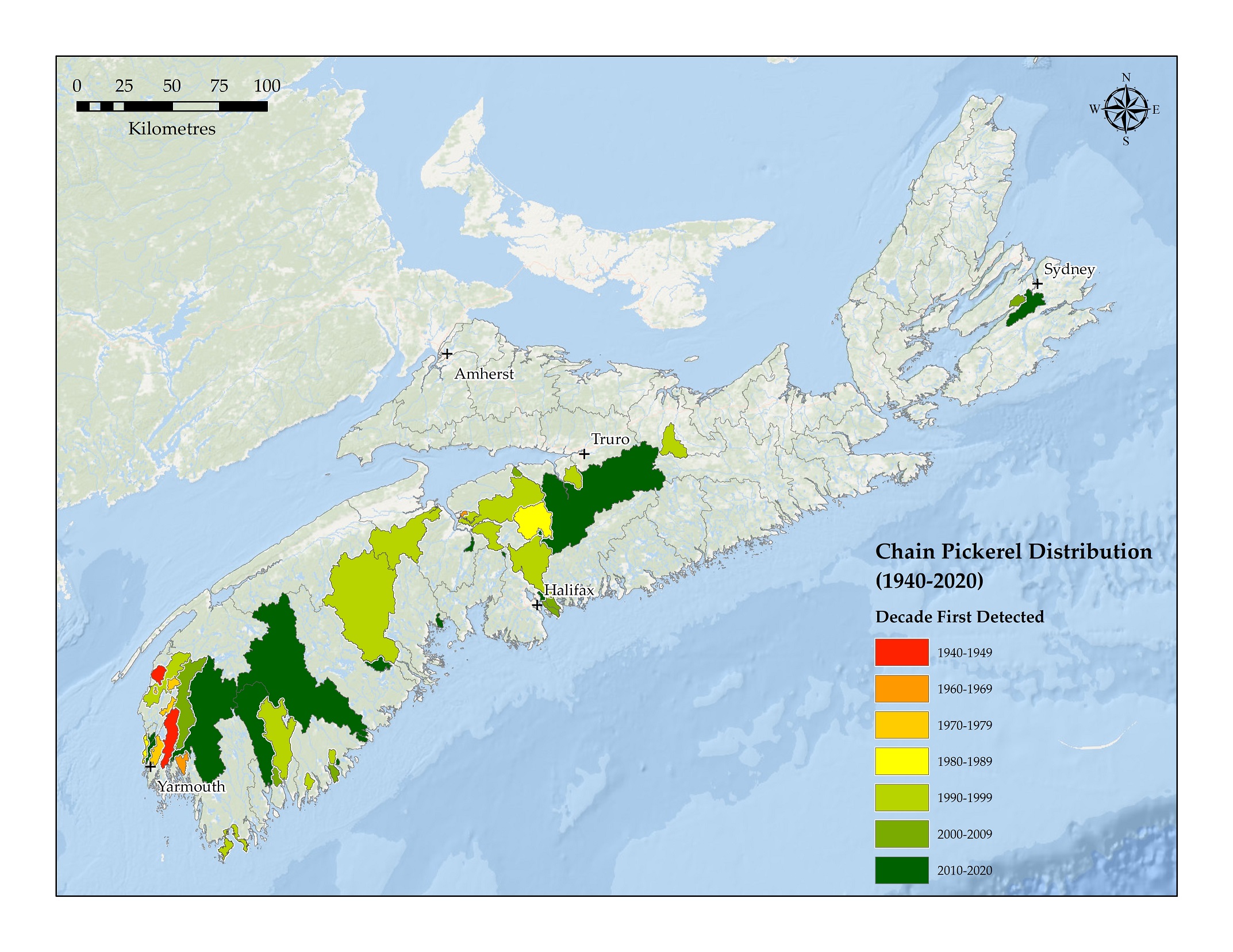
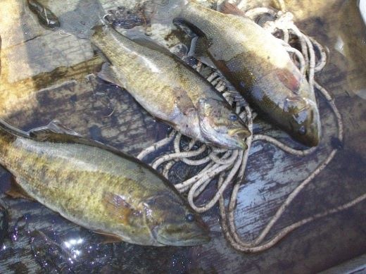
Chain pickerel
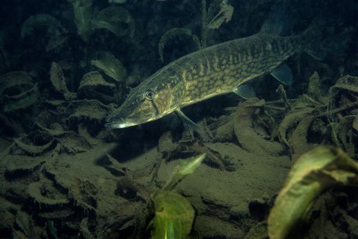
Chain pickerel is a voracious predator and few soft-bodied fish can coexist with the species. The ecological impacts of this invasive species can extend beyond the aquatic environment to include impacts to birds and mammalsFootnote 1.
Chain pickerel were introduced into Nova Scotia in the 1940s. The first detections were recorded in the same decade in a few discrete locations in Yarmouth and Digby counties. The spread of chain pickerel was quite limited through the 1970s and did not extend outside these counties, other than a discrete location in Hants County. However, during the 1990s, there was a significant increase in the distribution of this invasive species throughout southwestern Nova Scotia. Between 2000 and 2009, the first detections in Cape Breton were also recorded. Chain pickerel has now been recorded in 12 of Nova Scotia’s primary watersheds, as shown in the map below. In some cases, the species is moving freely between connected waterbodies within a watershed. The other main way the species is spreading is via deliberate, illegal introduction by people motivated to increase recreational angling opportunities.
Spread of chain pickerel in Nova Scotia from 1940 to 2020 – Text version and data sources
Data sources and methods
In order to assess the distribution of smallmouth bass and chain pickerel across Nova Scotia, this report used a dataset of aquatic invasive species detections from the Nova Scotia Department of Fisheries and Aquaculture (NSDFA). If there is a suspected, but unconfirmed presence of aquatic invasive species or if a report is received from the public, the NSDFA will assess the waterbody. NSDFA uses common angling practices to detect invasive species; visual observations may also be used to confirm presence. If invasive species are captured, their presence is documented and the date of ‘confirmation’ is recorded in the dataset. It is important to note that the detection rate depends on effort. Years without new detections may not mean the invasive species are not spreading. They may be due to limited monitoring.
The dataset was parsed by date of detection to produce separate species-decade datasets based on the species and decade of first recorded occurrence. The species-decade locations were joined with watershed polygon boundaries (1:10,000 watershed boundaries – tertiary and secondary from the NS Open Data portal) to identify watersheds containing locations of aquatic invasive species detections for a given species and decade.
| Decade | Primary watershed | Secondary watershed |
|---|---|---|
1940 to 1949 |
Tusket River |
Annis River |
1940 to 1949 |
Meteghan |
Shore Direct 1DA-SD6 |
1960 to 1969 |
Meteghan |
Shore Direct 1DA-SD6 |
1960 to 1969 |
Tusket River |
Ste Anne du Ruisseau |
1960 to 1969 |
Kennetcook |
Kennetcook River |
1970 to 1979 |
Tusket River |
Ohio Millstream Brook |
1970 to 1979 |
Tusket River |
Annis River |
1970 to 1979 |
Meteghan |
Meteghan River |
1970 to 1979 |
Meteghan |
Meteghan River |
1970 to 1979 |
Meteghan / Tusket River |
Salmon River (Digby County) |
1980 to 1989 |
Tusket River |
Annis River |
1980 to 1989 |
Tusket River |
Shore Direct 1EA-SD15 |
1980 to 1989 |
Shubenacadie / Stewiacke |
Shubenacadie River |
1990 to 1999 |
Meteghan |
Shore Direct 1DA-SD6 |
1990 to 1999 |
Meteghan |
Meteghan River |
1990 to 1999 |
Roseway / Sable / Jordan |
Jordan River |
1990 to 1999 |
Mersey |
Shore Direct 1ED-SD25 |
1990 to 1999 |
Mersey |
Shore Direct 1ED-SD14 |
1990 to 1999 |
Barrington / Clyde |
Shore Direct 1EB-SD7 |
1990 to 1999 |
Barrington / Clyde |
Shore Direct 1EB-SD9 |
1990 to 1999 |
LaHave |
LaHave River |
1990 to 1999 |
Gaspereau |
Gaspereau/Black River |
1990 to 1999 |
St. Croix |
St. Croix River |
1990 to 1999 |
Shubenacadie / Stewiacke |
Shubenacadie River |
1990 to 1999 |
Kennetcook |
Kennetcook River |
1990 to 1999 |
Shubenacadie / Stewiacke |
Shubenacadie River |
1990 to 1999 |
East / Middle / West (Pictou) |
East River Pictou |
2000 to 2009 |
Tusket River |
Annis River |
2000 to 2009 |
Tusket River |
Annis River |
2000 to 2009 |
Meteghan / Tusket River |
Salmon River (Digby County) |
2000 to 2009 |
Tusket River |
Annis River |
2000 to 2009 |
Meteghan |
Meteghan River |
2000 to 2009 |
LaHave |
LaHave River |
2000 to 2009 |
Gaspereau |
Gaspereau/Black River |
2000 to 2009 |
St. Croix |
St. Croix River |
2000 to 2009 |
Shubenacadie / Stewiacke |
Shubenacadie River |
2000 to 2009 |
Kennetcook |
Kennetcook River |
2000 to 2009 |
East / Middle / West (Pictou) |
East River Pictou |
2000 to 2009 |
Sackville |
Cow Bay River |
2000 to 2009 |
Kennetcook |
Noel River |
2000 to 2009 |
Sackville |
Shore Direct 1EJ-SD2 |
2000 to 2009 |
Mersey |
Shore Direct 1ED-SD15 |
2000 to 2009 |
Roseway / Sable / Jordan |
Shore Direct 1EC-SD6 |
2000 to 2009 |
Tusket River |
Tusket River |
2000 to 2009 |
Salmon / Mira |
Sydney River |
2010 to 2019 |
Tusket River |
Annis River |
2010 to 2019 |
Tusket River |
Annis River |
2010 to 2019 |
Tusket River |
Annis River |
2010 to 2019 |
Shubenacadie / Stewiacke |
Shubenacadie River |
2010 to 2019 |
Meteghan |
Meteghan River |
2010 to 2019 |
Roseway / Sable / Jordan |
Jordan River |
2010 to 2019 |
LaHave |
LaHave River |
2010 to 2019 |
Gaspereau |
Gaspereau/Black River |
2010 to 2019 |
Shubenacadie / Stewiacke |
Shubenacadie River |
2010 to 2019 |
East / Middle / West (Pictou) |
East River Pictou |
2010 to 2019 |
Tusket River |
Annis River |
2010 to 2019 |
Tusket River |
Annis River |
2010 to 2019 |
Tusket River |
Annis River |
2010 to 2019 |
Meteghan |
Meteghan River |
2010 to 2019 |
LaHave |
LaHave River |
2010 to 2019 |
Gaspereau |
Gaspereau/Black River |
2010 to 2019 |
Shubenacadie / Stewiacke |
Shubenacadie River |
2010 to 2019 |
East / Middle / West (Pictou) |
East River Pictou |
2010 to 2019 |
Sackville |
Cow Bay River |
2010 to 2019 |
Tusket River |
Tusket River |
2010 to 2019 |
Salmon / Mira |
Sydney River |
2010 to 2019 |
Mersey |
Mersey River |
2010 to 2019 |
Tusket River |
Tusket River |
2010 to 2019 |
Roseway / Sable / Jordan |
Roseway River |
2010 to 2019 |
Mersey |
Shore Direct 1ED-SD4 |
2010 to 2019 |
Tusket River |
Shore Direct 1EA-SD14 |
2010 to 2019 |
Mersey |
Shore Direct 1ED-SD12 |
2010 to 2019 |
Tusket River |
Cedar Lake (Un-named river) |
2010 to 2019 |
Herring Cove / Medway |
Petite Rivière |
2010 to 2019 |
Sackville |
Dartmouth Lakes |
2010 to 2019 |
Shubenacadie / Stewiacke |
Shubenacadie River |
2010 to 2019 |
Salmon / Mira |
Sydney River |
2010 to 2019 |
Gold |
Shore Direct 1EG-SD2 |
2010 to 2019 |
Sackville |
Sackville River |
2010 to2019 |
St. Croix |
St. Croix River |
Data sources for base map
General Bathymetric Chart of the Oceans GEBCO_08 Grid, National Oceanic and Atmospheric Administration, National Geographic, Garmin, HERE, Geonames.org and Esri.
Aquatic invasive species and climate change
Climate change is an on-going consideration in the management of aquatic invasive species. Under predicted climate scenarios, it is expected that waters will warm, reducing the availability of summer thermal refugia (cold water areas) in Nova Scotia. This will impact cold-water species, such as Atlantic salmon and trout, while it will increase available habitat for species that are more tolerant to temperature fluctuations, such as smallmouth bass and chain pickerelFootnote 2.
Management actions to address aquatic invasive species
Regulatory tools
In Nova Scotia, DFO works closely with the Nova Scotia Department of Fisheries and Aquaculture to implement the Aquatic Invasive Species Regulations as well as the 4 management pillars (prevention, early detection, response and control/management). The Aquatic Invasive Species Regulations help protect waterbodies across Canada by preventing the spread and introduction of aquatic invasive species into Canadian waters and managing them once introducedFootnote 5. The regulations provide a national framework that enables provincial and federal governments to manage and control aquatic invasive species.
The Live Fish Possession Regulations were established by the province of Nova Scotia under the Fisheries and Coastal Resources Act to address the illegal introduction of fish species into provincial waters. These regulations prohibit the unlawful possession of live fish in Nova Scotia. More information on these regulations (142 KB) is available.
For more information about the management of aquatic invasive species in Nova Scotia, please refer to the Nova Scotia Department of Fisheries and Aquaculture (142 KB).
Report Aquatic Invasive Species or Illegal Fishing Activities
If the public observes an aquatic invasive species, DFO asks that you:
- Take photos;
- Note the exact location (GPS coordinates), observation date and identifying details; and,
- Contact the Department to report it.
In Nova Scotia, sightings can be reported to DFO Maritimes Region Aquatic Invasive Species.
The public is also asked to report illegal fishing activities or introductions to:
- a local office of the Nova Scotia Department of Natural Resources and Renewables: 1-800-565-2224, or
- Nova Scotia Crime Stoppers: 1-800-565-TIPS (8477).
Partnerships to address aquatic invasive species
The management of aquatic invasive species is a collaborative effort between DFO, other federal government departments, the province of Nova Scotia and many non-governmental partners.
Eradication of smallmouth bass from Piper Lake
In 2019, smallmouth bass were detected in Piper Lake, a small headwater lake in the St. Mary’s River watershed. The Nova Scotia Department of Fisheries and Aquaculture (NSDFA) led response efforts aimed at eradicating smallmouth bass from Piper Lake before they could spread any further into this important Atlantic salmon and trout river, which has otherwise not been impacted by invasive species. The lake was closed to recreational fishing and a containment berm was constructed at the outflow of the lake to prevent smallmouth bass moving downstream. NSDFA conducted electrofishing and other survey efforts to monitor smallmouth bass numbers. To mitigate the risk of smallmouth bass moving past the barrier structure, the NSDFA led an effort to eradicate this invasive species from Piper Lake. After mechanical removal methods proved unsuccessful, chemical treatment using rotenone was conducted and has now been considered successful in the eradication of smallmouth bass from Piper Lake. DFO authorized the province to deposit a deleterious substance under section 19(3) of the Aquatic Invasive Species Regulations.
Outreach and education
DFO partners with organizations like the Nova Scotia Invasive Species Council (NSISC). They work to inform the public about aquatic invasive species and actions to stop their spread. With funding from DFO’s Habitat Stewardship Program for Aquatic Species at Risk, the NSISC is undertaking an education and outreach campaign to build awareness about the impacts of invasive species on aquatic species at risk in Nova Scotia. Two key education campaigns endorsed by DFO, Clean Drain Dry and Don’t Let It Loose, are being implemented to help prevent the spread of aquatic invasive species. Working with pet and aquarium owners, recreational boaters, fishers and anglers, and tourism operations, the NSISC is helping to raise awareness about the impacts of invasive species on Nova Scotia’s lakes and rivers, and to prevent their introduction and spread. As part of the Clean Drain Dry campaign, the NSISC has installed boat-cleaning stations and educational signs across the province. These signs teach the public about actions they can take to stop the spread of invasive species. The NSISC also maintains a website where the public can report sightings of invasive species so that populations can be monitored, helping to ensure early detection and rapid response to aquatic invasive species.
Citizen Science
The Clean Annapolis River Project (CARP), along with several partners, is delivering a comprehensive program aimed at raising public awareness of invasive species, their impacts on freshwater ecosystems and, specifically, impacts on species at risk with funding from the Habitat Stewardship Program for Aquatic Species at Risk. As part of the project, CARP has developed a citizen science angling project, Fishing for Info Nova Scotia (FINS). Through FINS, volunteer anglers are recording and reporting species caught and observed, allowing for ongoing monitoring and potential early detection of aquatic invasive species. Data is shared with DFO and the Nova Scotia Department of Fisheries and Aquaculture so that it contributes to the overall understanding of the threat across the province of Nova Scotia. To learn more about FINS, view the Volunteer Citizen Science Fish Monitoring Program Development in Nova Scotia video by CARP.
Removal of smallmouth bass and chain pickerel from the Petite Rivière watershed
Coastal Action is a key partner in mitigating the threat posed by aquatic invasive species to the endangered Atlantic whitefish. The Petite Rivière watershed is the only location globally where Atlantic Whitefish are found. One of the primary threats to their survival is invasive species, particularly chain pickerel and smallmouth bass. Coastal Action has led a number of initiatives, both in collaboration with DFO Science and funded by the Habitat Stewardship Program for Aquatic Species at Risk, to mitigate the impacts of aquatic invasive species in the Petite Rivière. Efforts have targeted the removal of chain pickerel and smallmouth bass from the watershed, using both established methods such as scientific angling and boat electrofishing, as well as trialing novel techniques such as nest destruction and light traps. Coastal Action conducts surveys for smallmouth bass nests by boat and snorkeling. When a nest is located, various measurements are recorded such as location and bottom substrate, then the male smallmouth bass nest guard is angled off the nest and the nest is destroyed. Another technique being used is light traps anchored in the water with a flashlight attached at the top of each trap to attract fish. Traps are checked regularly; if a native species is found it is released with minimal handling; however, if chain pickerel or smallmouth bass are found, they are measured and euthanized. This video by Coastal Action provides an overview of invasive species removal methods.
- Date modified: