
Map of bioregions
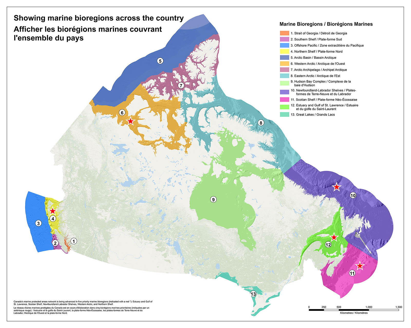
In 2009, Canadian Science Advisory Secretariat advice (CSAS SAR - 2009/056) identified 13 regions in Canada’s waters that are defined by their attributes and similarities, and which inform marine planning exercises such as MPA network development. These spatial units are known as “bioregions.”
NOTE:
The bioregional boundaries displayed in this map adhere to recommended biogeographic units from a 2009 scientific peer review process (CSAS SAR - 2009/056) . For operational reasons, network planners in certain bioregions (Estuary and Gulf of St. Lawrence, Scotian Shelf, and Newfoundland-Labrador Shelves) engage their partners and stakeholders using slightly different bioregional planning areas that better reflect administrative boundaries. In areas where administrative boundaries do not align with recommended biogeographic units, a high level of interregional collaboration and cooperation is required.
Click image to download
(JPEG, 27.5mb)
Canada’s marine protected areas network is being advanced in five priority bioregions (indicated with a red star): Estuary and Gulf of St. Lawrence, Scotian Shelf, Newfoundland-Labrador Shelves, Western Arctic, and Northern Shelf.
Marine Bioregions
- Strait of Georgia
- Southern Shelf
- Offshore Pacific
- Northern Shelf
- Arctic Basin
- Western Arctic
- Arctic Archipelago
- Eastern Arctic
- Hudson Bay Complex
- Newfoundland-Labrador Shelves
- Scotian Shelf
- Estuary and Gulf of St. Lawrence
- Great Lakes
- Date modified: