
About the Canada Marine Planning Atlas (the atlas)
Fisheries and Oceans Canada (DFO) is working with federal, provincial and Indigenous partners to implement marine spatial planning (MSP) in Canada: a transparent, inclusive and sustainable oceans planning and management process.
Since MSP is about planning and management in marine spaces, decision-makers need a tool that helps them understand data and information in many dimensions. The atlas is an interactive mapping tool that supports MSP and management by providing decision-makers with an overview of activities, and ecological processes and features, occurring in a given planning area. It will also serve as a place where all Canadians can go to find data on Canada's oceans and marine spaces.
While other marine atlases exist that cover Canadian marine data, this application distinguishes itself as an atlas that adds value in several ways:
- It was developed using an agile, user-focused design process, through extensive collaboration with partners and stakeholders, to cater to a range of user expertise.
- The version 1 prototype provides an invitation for partners to evolve the final product, while making use of the current functionality.
- The scope of the data is curated to focus on published data that meets a national level of data quality standards and enables decision makers to answer questions specific to MSP.
On this page:
Areas
The ways in which Canada's marine spaces are managed differ greatly between our Atlantic and Pacific oceans, and so 2 versions of the atlas have been developed:
- The Atlantic atlas includes data for the regions of Newfoundland and Labrador, the Maritimes, Gulf of St. Lawrence, Quebec, and the Eastern Arctic.
- The Pacific atlas covers data for the north and south coast of British Columbia, from southern Vancouver Island to Dixon Entrance, North of Haida Gwaii.
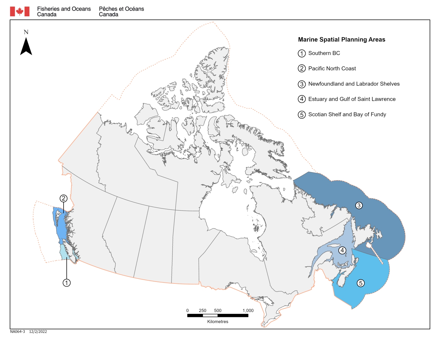
The atlas will provide the best available data to support MSP priorities in 5 initial Canadian marine spatial planning areas:
Users
Once fully developed, a wide range of end users will benefit from the atlas. The atlas will be of particular use to MSP decision-makers at the federal, provincial and municipal levels, Indigenous communities and Indigenous organizations. It has also been designed to be relevant and useful to other users, such as:
- academia
- industry
- public educational institutions
- non-governmental organizations
- research institutions
- general public
Benefits
The atlas will support collaborative and sector-based planning and management processes, providing benefits that fall under 4 themes:
- Improving access to science-based ocean data
The atlas will better inform decision-making by improving access to science-based ocean data and allowing users to overlay this with their own information. By consolidating MSP-related information in one place, it will be an important data visualization resource, supporting education and awareness. - Increasing transparency
DFO collects and manages enormous amounts of data. The data and products included in the atlas will support partners and users in decision-making and planning for human activities and conservation, increasing the transparency of these processes. Also, the ongoing development and enhancement of the atlas in response to changing user needs and as additional information is identified and available will serve to inform data priorities for the department. - Aiding in conflict resolution
The atlas will support consultation processes and conflict resolution by identifying overlapping interests, activities and sensitive areas. - Identifying information gaps
Users will be able to identify information gaps, which in turn will help to improve planning for current and future issues, and incompatible activities in marine areas.
Data use, functionality and layers
The atlas has built-in functionalities, and its data layers can be downloaded and used outside of the mapping application for other uses. These could include designing scenarios, complex analysis and/or a detailed analysis of all sectors.
The atlas is a simple, interactive web mapping application. Basic functionality includes navigation tools, locating, comparing, printing, bookmarking and measurement tools. There is also a reporting function that can summarize layers in a user-defined area.
Embedded layers in the atlas are publicly available. Information pop-ups appear when a feature is selected on the map. These pop-ups include data characteristics (attribute information) and links to the GOC Open Data portal or other public descriptions of the layer.
The atlas presents data in layers. These layers are collections of geographic or other similar data. For example, one data layer in the atlas shows the locations of all Oceans Act marine protected areas.
The most relevant data appears embedded and ready to be toggled when the map is opened. Users have the option to include region-specific or topic-specific data using the Add Data widget.
The embedded data is divided into multiple data layer themes. Furthermore, the following categories are used to divide data found under the Add Data widget:
- Ecosystem and ocean knowledge – includes biological and physical data:
- Bathymetry
- DFO marine spatial planning areas
- Nautical Charts
- Boundaries and management areas – includes federal, provincial/territorial jurisdictional and legislated boundaries and management areas:
- Indigenous communities and boundaries
- MSP areas
- protected and conservation areas
- Local, socio-cultural, and traditional knowledge – includes local and community knowledge, socio-cultural knowledge and traditional knowledge.
- Human use – includes economic and recreational human uses:
- aquaculture
- commercial fishing
- marine transportation
- Synthesis areas – includes data layers developed through analysis or layers that represent combinations of data inputs:
- important ecological areas
- species at risk
- Impacts and threat assessments – includes data showing impacts to the marine environment or potential threats:
- Program Activity Tracking for Habitat (PATH) system
For more information on using the atlas, see the user guide.
Next steps
Development of the atlas is ongoing and DFO continues to gather insights from partners and stakeholders into how to evolve the fully functional prototype of the atlas into an even better application that meets the needs of multiple partners and stakeholders. Information on how to provide feedback on data, technical concerns or increased functionality is under the Contact Us widget of the atlas application.
- Date modified: