
Tutorial: Print
To find widgets in the atlas, see the user guide.
To share an image of the atlas, you can use the Print widget. This widget exports our current view of the map with some added cartographic functions.

- First select the Print widget in the toolbar.
Name your map with a title. In this example, we chose Queen Charlotte Strait Marine Activities and Features. We kept the default settings, but you can also select advanced settings, which gives a few more options, such as:
- choosing the spatial reference
- whether to include a legend or not
- output resolution
- Select the Print button. This generates a new map printout which can then be opened in your internet browser or downloaded for later use. You will see a blue bar loading that indicates the print is being created. It can take up to 2 minutes to load. Once this is complete, you can press the PDF icon that appears. This will open up in a new tab in your internet browser.
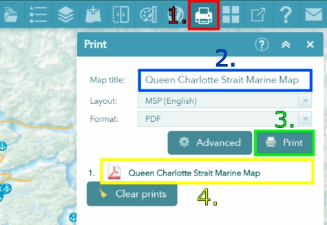
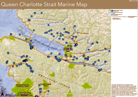
- After pressing the PDF icon, you will see your map. It has a legend with the selected features, a title and additional map features, such as a north arrow or scale bar. Data sources are listed in the bottom right corner of the map.
- Date modified: