
Southern Newfoundland priority place (Newfoundland and Labrador)
Location
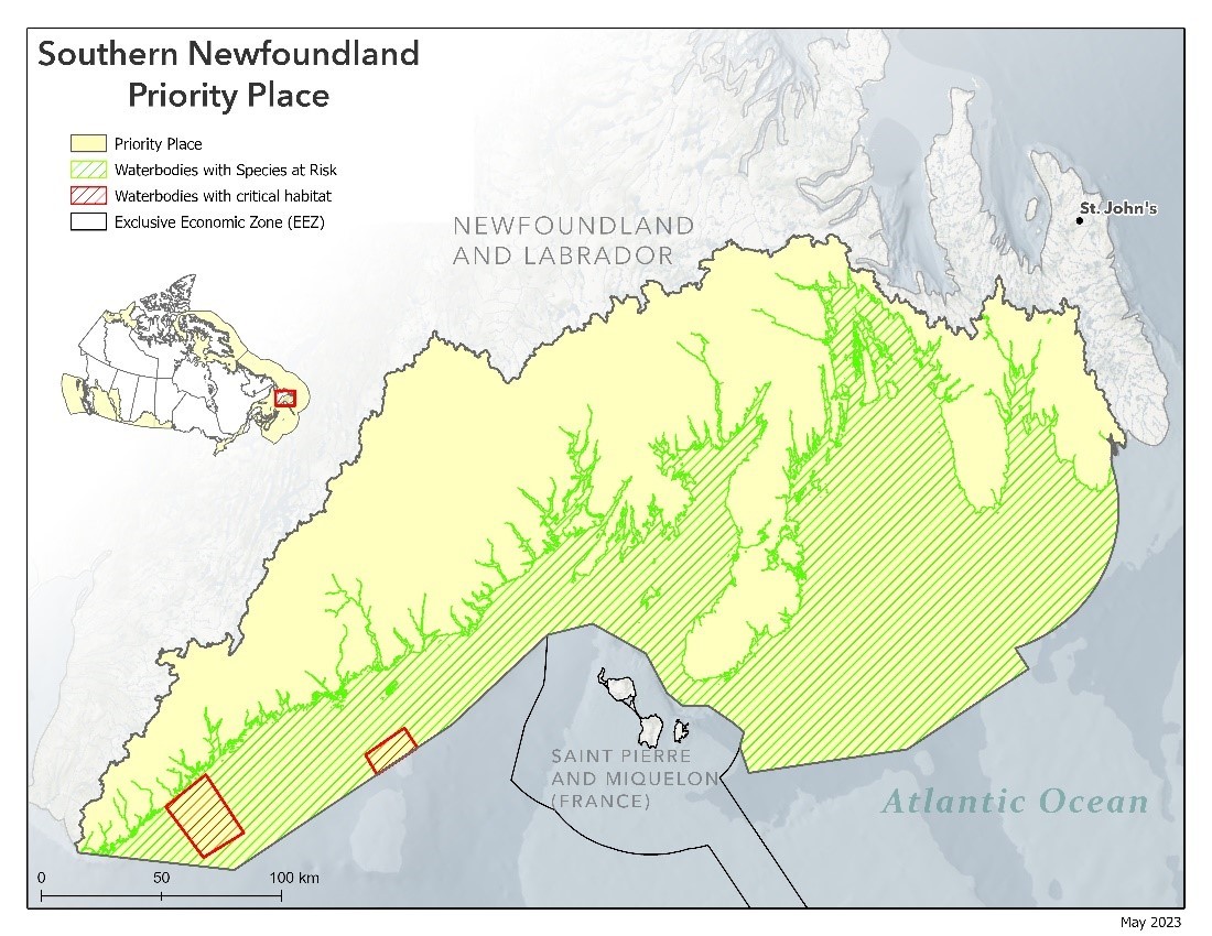
The priority place includes the watersheds in Newfoundland that drain south into the Atlantic Ocean along the south coast and includes a portion of the marine area extending from Cape Ray in the west, and extends eastward following the SPM international waters boundary, and encompasses Placentia Bay and St. Mary's Bay.
Key threats
Habitat degradation/alteration, barriers to migration, and fisheries are threats to freshwater species at risk in these watersheds. In addition to physical and acoustic disturbance and fishing interactions, threats include ecosystem change and marine pollution.
Aquatic SARA Schedule 1-listed species at risk found at the Southern Newfoundland priority place
| Priority Places and Marine Threats | Species, Population | SARA status |
|---|
Examples of recovery activities that DFO is seeking to support in the Southern Newfoundland priority place
- Necessary or vital research to address key knowledge gaps and better understand species at risk in the area, their habitat, and how threats affect species at risk in the priority place
- Restoring habitat affected by fragmentation and degradation, through means such as the removal/alteration of barriers to fish passage (culverts, barrier removal, flow alteration), mitigating bank erosion, planting native plants, and stream bank stabilization
- Support for partnerships, relationship building, and the establishment of venues for continued collaboration, and information and knowledge sharing to support recovery actions
- Promote, support, and undertake stewardship and education activities to increase local awareness of regional species at risk and their threats and engage Indigenous Peoples, recreational users, industry, non-governmental organizations, and others in stewardship activities that directly contribute to their recovery, including the collection, documentation and incorporation of Indigenous Knowledge into recovery planning and implementation
- Targeted outreach to improve awareness of SAR, their habitat requirements, and threats
- The detection and monitoring of aquatic species at risk including the development, testing and/or implementation of technologies for detection of the presence/location of aquatic species
- Development, refinement and/or implementation of alternative technologies, best practices or tools to prevent, mitigate or monitor impacts from fishing interactions on aquatic species at risk. This may include a variety of initiatives such as, but not limited to: measures to minimize marine mega-plastics from commercial fishing activities (e.g. bait box “liners”, and plastic “strappings” around new fish/shellfish product bags & boxes); methods to accurately update estimates of and measures to reduce “struck and loss” marine mammals at risk during subsistence hunting activities; development or testing of modifications to fishing gear and/or practices to reduce the frequency or severity of interactions with species at risk
- Date modified: