
Canso Bank and Channels
Canso Bank and Channels is proposed as a Tier 2 site for the Marine Conservation Network in the Scotian Shelf-Bay of Fundy Bioregion.
On this page
Location
Canso Bank and Channels is located approximately 45 km southeast of Canso, Nova Scotia. This area encompasses a portion of Canso Bank and some of the surrounding basin, channels, holes and mounds.
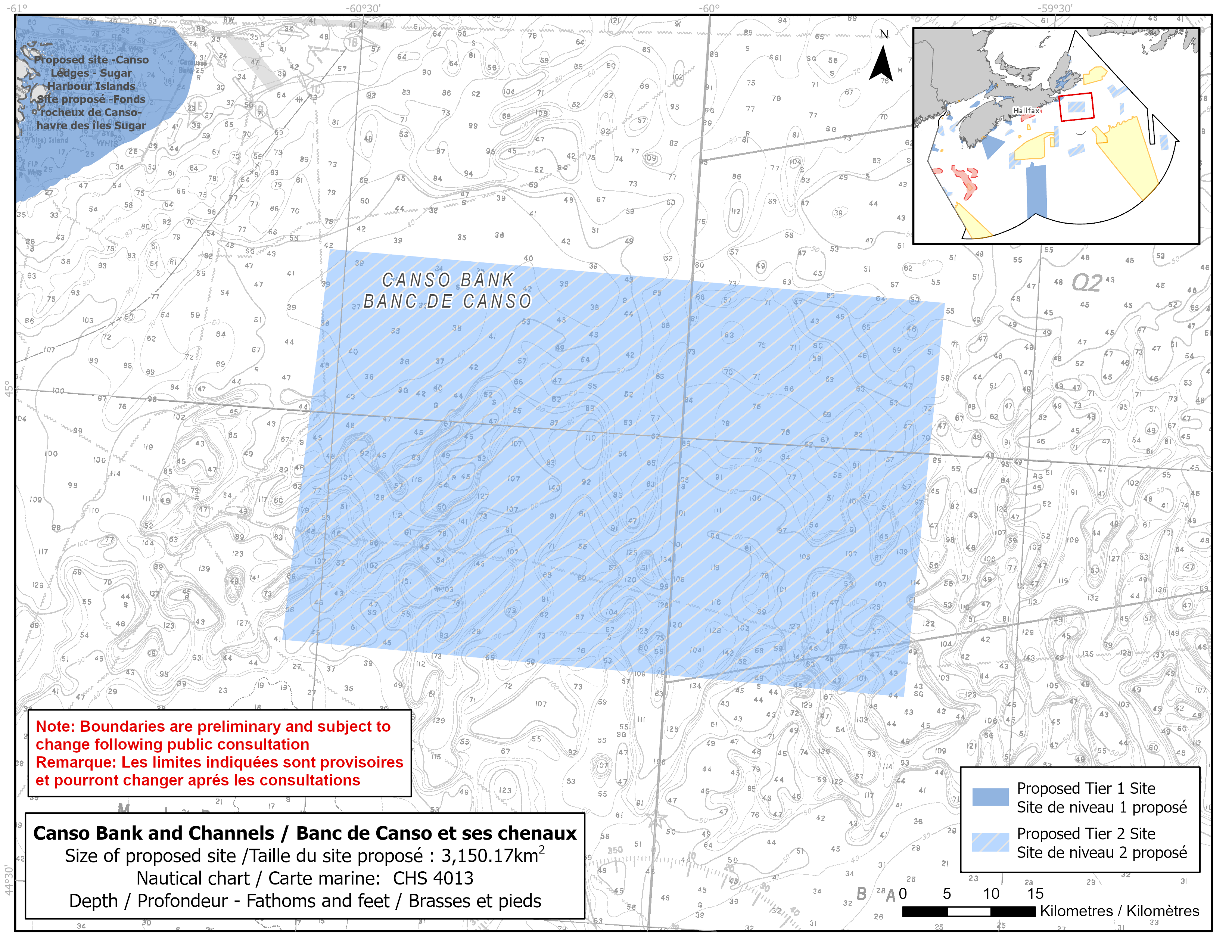
Map of the proposed Canso Bank and Channels network site
Simplified site coordinates
Boundaries are preliminary and subject to change following the public engagement.
| Point | Latitude | Longitude | Description |
|---|---|---|---|
| 1 | 44°45' 57.2" N | 60°33' 0.4" W | Starting at point 1 on the southwest side of the site |
| 2 | 45°10' 1.3" N | 60°31' 24.1" W | Connect to point 2, north of point 1 |
| 3 | 45°9' 18.4" N | 59°37' 59.7" W | Connect to point 3, east of point 2 |
| 4 | 44°45' 5.2" N | 59°39' 22.5" W | Connect to point 4, south of point 3 and connect point 4 to point 1 |
Size
3 150 km2
Features
- Significant concentrations of sponges and sand dollars
- Foraging habitat for seabirds
- Important habitat for groundfish
- Area of high larval, fish and invertebrate diversity
- Area of high primary productivity
- Diverse habitat types include sandy banks, small channels, deep holes and mounds
- Representative examples of bank and basin habitats
Species
This area supports species, including:
- Sand lance
- Depleted groundfish populations, such as:
- Atlantic cod (assessed as endangered by COSEWIC)
- American plaice (assessed as threatened by COSEWIC)
- Thorny skate (assessed as special concern by COSEWIC)
- Atlantic Wolffish (listed as special concern under SARA)
- Sponges and sand dollars
Use
- Current fisheries include clam, groundfish (fixed and mobile gear), sea cucumber, snow crab, shrimp, swordfish and tuna.
- There is currently a moratorium on fishing cod and haddock on the Eastern Scotian Shelf.
- Licences issued to First Nations and Indigenous communities provide access to this area to fish for food, social and ceremonial purposes.
- High amount of shipping traffic.
- Date modified: