
Approach for creating the marine conservation network plan for the Scotian Shelf-Bay of Fundy
Call for public feedback
Public engagement on the marine conservation network plan is open from April 29 to June 29, 2024.
Please visit our consultation page to learn how you can get involved or submit a survey.
Fisheries and Oceans Canada (DFO) has worked with partners and ocean users to create a marine conservation network plan for the Scotian Shelf-Bay of Fundy Bioregion. We have sought feedback from partners and stakeholders including:
- Governments of Nova Scotia and New Brunswick
- First Nations and Indigenous organizations
- Commercial users, including the fishing industry
- Environmental non-governmental organizations
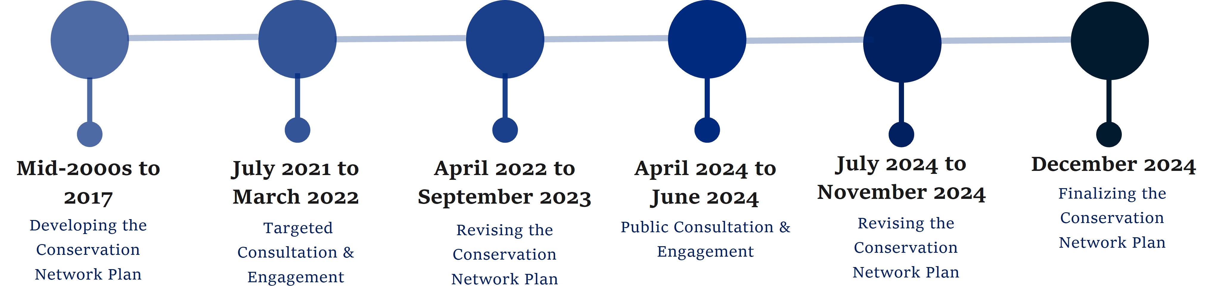
This work led to the 2017 draft conservation network plan. The 2017 draft plan was updated after targeted consultations from 2021 to 2022. The latest network plan reflects new science information on climate change, updated human-use activities (such as fisheries data), and feedback from consultations.
Text version
Mid-2000s to 2017
Designing the conservation network plan
July 2021 to March 2022
Targeted consultation and engagement
April 2022 to September 2023
Revising the conservation network plan
April 2024 to June 2024
Public consultation and engagement
July 2024 to November 2024
Revising the conservation network plan
December 2024
Finalizing the conservation plan network
Creating the network plan
The department followed international, national and regional scientific guidance and best practices to develop the network plan. The aim is to meet the Convention on Biological Diversity (CBD) guidelines for effective conservation networks. The plan also considered human use information to help minimize negative economic impacts.
A working group of conservation planning experts was created to help develop the network plan. The group included members from DFO, the Canadian Wildlife Service, Parks Canada and several Canadian universities. The network planning process followed 4 steps:
- Gather available information
- Set conservation objectives
- Select conservation priorities
- Conduct the data analysis
Gathering information
The department collected available environmental and human use information.
Environmental information
Ecologically and Biologically Significant Areas (EBSAs) were identified using scientific and local ecological knowledge.
EBSAs provided important information on the distribution of species, habitats and other important features. EBSA information was particularly useful for coastal areas and the Bay of Fundy where widespread environmental survey data are limited.
For offshore sites, research survey information was used to map species distribution, habitats, and other natural features. The reliability of this information was evaluated through scientific review processes.
Limited biodiversity information was available for water depths greater than 1500 metres. There was also limited information on the distribution of whales, dolphins, and large pelagic fish (such as tunas and sharks).
Human use information
Human use information included:
- fisheries landings
- offshore petroleum licences
- shipping traffic
- aquaculture sites
- submarine cables
- tourism and recreational activities
This information was used to identify important areas for each sector.
An effort was made to avoid areas of higher importance to particular industries in the network plan.
The department will continue to take into account negative economic impacts as individual conservation areas are created.
Low-impact activities are often compatible with MPAs and OECMs. For example, sustainable coastal fisheries using fixed-gears (e.g., lobster) and ecotourism activities (e.g., kayaking, whale watching) are usually permitted in coastal conservation areas. Food, Social and Ceremonial (FSC) fishing by First Nations and Indigenous communities is also generally permitted.
Working with First Nations
Though limited, information on culturally important marine species and areas was also included. Indigenous traditional and ecological knowledge was identified as a gap.
DFO is committed to continuing to work with the Mi'kmaq of Nova Scotia, the Mi'gmaq of New Brunswick, the Wolastoqey and the Peskotomuhkati to collect and use this information. This information would be valuable for the marine conservation network plan, as well as individual site design and management.
Setting conservation objectives
Conservation objectives outline what the conservation network hopes to achieve. Objectives aim to provide long-term protection of marine biodiversity, ecosystem function and special natural features.
Objectives were developed with the technical working group and also reflect input from external engagement.
These objectives also stem from the national goals for a marine conservation network.
The objectives for the conservation network in the bioregion are:
- Protect unique, rare, or sensitive ecological features
- Protect representative examples of identified ecosystem and habitat types
- Help maintain ecosystem structure, functioning and resilience (including resilience to climate change)
- Contribute to the recovery and conservation of depleted species
- Help maintain healthy populations of species of Aboriginal, commercial, and/or recreational importance
Selecting conservation priorities
Conservation objectives are broken down into detailed conservation priorities. Priorities focus on the species, habitats or other features that the network aims to protect.
A regional science review from 2016 provided guidance on the conservation priorities.
Conservation priorities include:
- common, coarse-scale habitat types (e.g., offshore bank habitat)
- fine-scale habitats that provide important functions in the ecosystem (e.g., eelgrass beds)
- habitats that are highly sensitive to disturbance (e.g., significant concentrations of cold water coral)
- and species that are considered to be depleted (e.g., northern bottlenose whale, Atlantic wolffish)
Conducting the data analysis
An analysis of ecological and human use information informed the network plan.
The network plan reflects conservation priorities while minimizing overlap with human uses (such as commercial fisheries and commercial communal fisheries, oil and gas and aquaculture).
This process included the technical working group and other external experts.
The network plan will continue to be refined following consultation.
Revising the network
The marine conservation network plan was revised after targeted consultations from 2021 to 2022. Feedback and updated environmental and human use information were considered. A key consideration was new science information on climate change resilience.
Several coastal sites have been added or revised in the network plan. The additions increase the protection of marine plant habitats, like eelgrass, kelp, rockweed and salt marsh.
These marine plant habitats are important to ecosystem health. They capture and store carbon, which reduces carbon dioxide in the atmosphere and may lessen the impacts of climate change. They also protect coastlines by reducing floods, erosion and the strength of waves. Marine plants also provide habitat for commercial species, migratory shorebirds and invertebrates.
Protecting these key habitats is important for long-term conservation. Spatial protections, such as MPAs, are one tool to support the long-term health of marine habitats and ecosystems.
The conservation network is an important part of marine spatial planning in the region and will be periodically updated to inform the selection of future marine conservation areas.
Explore our interactive map with conservation network sites in the bioregion.
Related information
- Marine conservation networks
- Marine Spatial Planning
- Marine Protected Areas (MPAs)
- Marine refuges across Canada
- National wildlife areas
- National marine conservation areas
- Date modified: