
Eastern Shoal
Eastern Shoal is proposed as a Tier 2 site for the Marine Conservation Network in the Scotian Shelf-Bay of Fundy Bioregion.
On this page
Location
Eastern Shoal is a shallow, sand-bottom site located on Banquereau. It is approximately 160 km east of Sable Island and near the easternmost corner of the Scotian Shelf.
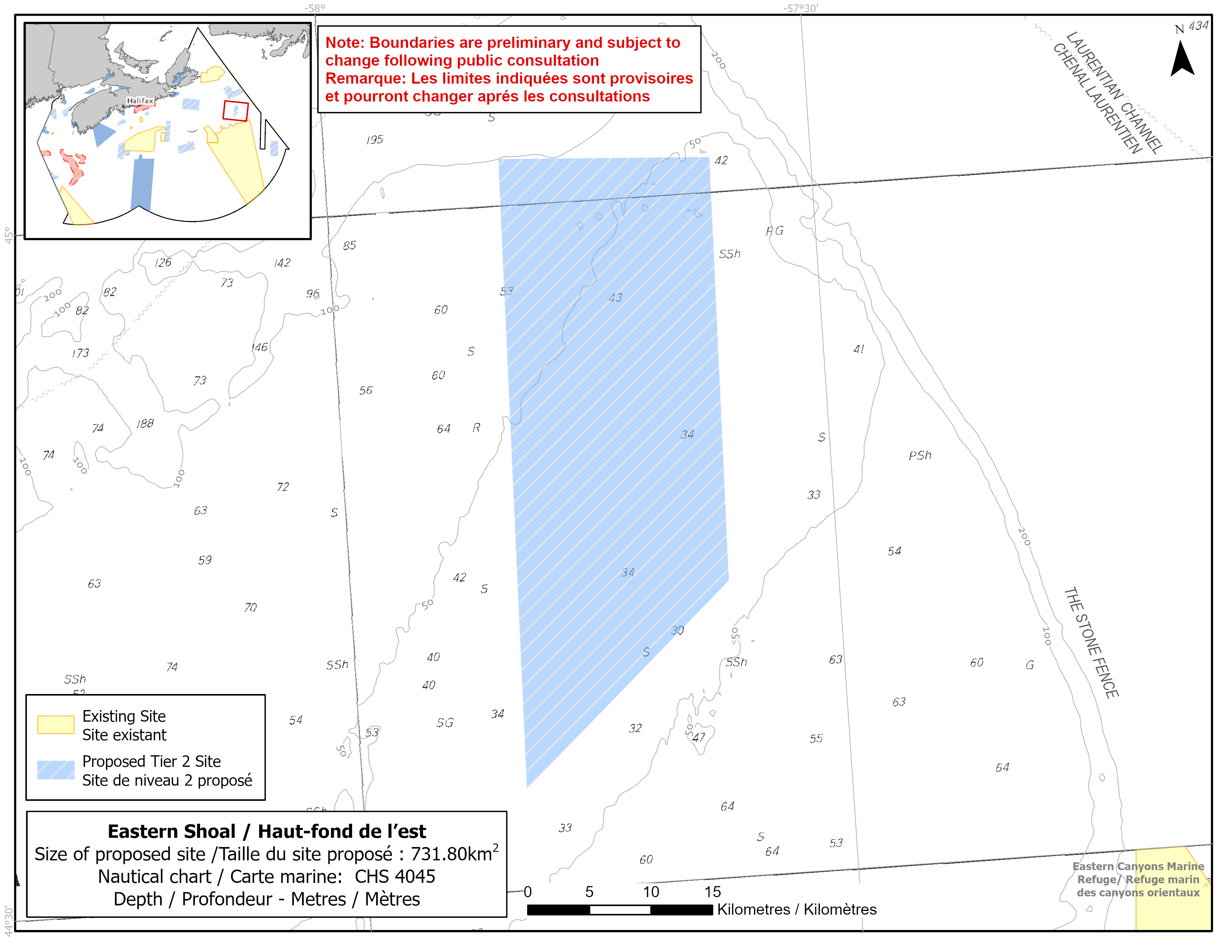
Map of proposed Eastern Shoal network site
Simplified site coordinates
Boundaries are preliminary and subject to change following the public engagement.
| Point | Latitude | Longitude | Description |
|---|---|---|---|
| 1 | 44°42' 58.8" N | 57°36' 45.9" W | Starting at point 1 in the southeast corner of the site |
| 2 | 44°34' 26.7" N | 57°49' 57.1" W | Connect to point 2 in the southwest corner |
| 3 | 45°2' 2.8" N | 57°49' 14.7" W | Connect to point 2 in the northwest corner |
| 4 | 45°1' 31.9" N | 57°36' 14.0" W | Connect to point 4 in the northeast corner and then connect point 4 to point 1 |
Size
732 km2
Features
- Significant concentrations of sand dollars
- Important groundfish habitat
- Area of high larval fish and invertebrate diversity
- Unique large and shallow sand feature
- Representative example of bank habitat
Species
This area supports species, including:
- Depleted groundfish populations, such as:
- Atlantic cod (assessed as endangered by COSEWIC)
- Winter skate (assessed as endangered by COSEWIC)
- Thorny skate (assessed as special concern by COSEWIC)
- Sand dollars
Use
- Current fisheries include clam, crab, and groundfish.
- This area has been historically important for the flounder fishery and catches have been occasional in recent years.
- There is currently a moratorium on fishing cod and haddock on the Eastern Scotian Shelf.
- Licences issued to First Nations and Indigenous communities provide access to this area to fish for food, social and ceremonial purposes.
- Date modified: