
Eel Bay
Eel Bay is proposed as a Tier 2 site for the Marine Conservation Network in the Scotian Shelf-Bay of Fundy Bioregion.
On this page
Location
Eel Bay includes the waters from Upper Port la Tour to John Point, including Eel Bay, Lyles Bay and nearby islands.
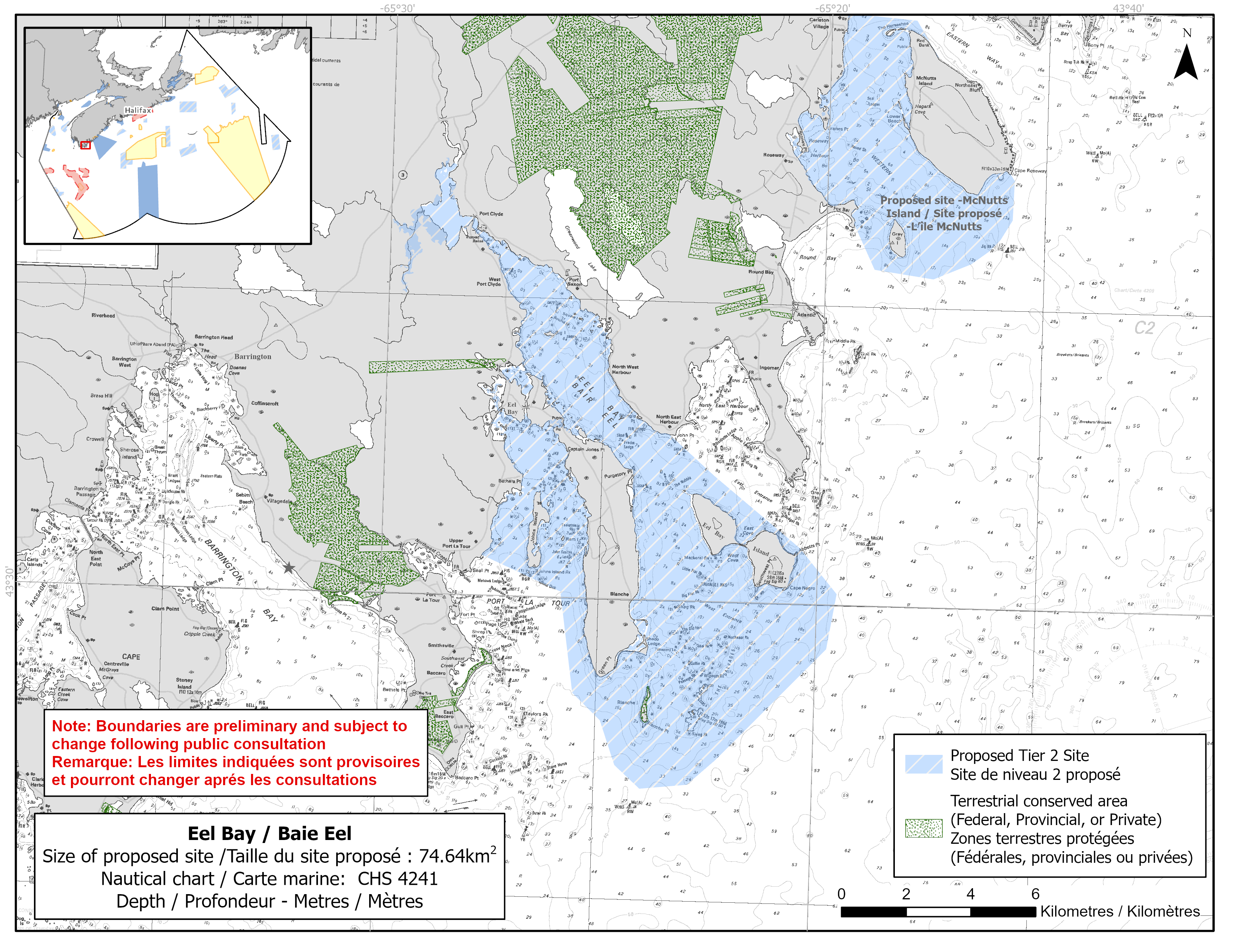
Map of proposed Eel Bay network site
Simplified site coordinates
Boundaries are preliminary and subject to change following the public engagement.
| Point | Latitude | Longitude | Description |
|---|---|---|---|
| 1 | 43°32' 47.332" N | 65°23' 29.127" W | Starting at point 1 on the coastline, in the northeast of the site |
| 2 | 43°30' 56.871" N | 65°20' 24.876" W | Connect to point 2, southeast of point 1 |
| 3 | 43°30' 11.812" N | 65°19' 32.437" W | Connect to point 3, southeast of point 2 |
| 4 | 43°29' 16.206" N | 65°19' 44.783" W | Connect to point 4, south of point 3 |
| 5 | 43°26' 56.615" N | 65°22' 51.176" W | Connect to point 5, southwest of point 4 |
| 6 | 43°26' 51.303" N | 65°23' 56.090" W | Connect to point 6, southwest of point 5 |
| 7 | 43°28' 25.488" N | 65°25' 32.113" W | Connect to point 7, northwest of point 6 |
| 8 | 43°30' 6.539" N | 65°25' 52.455" W | Connect to point 8, north of point 7 |
| 9 | 43°30' 41.140" N | 65°27' 42.395" W | Connect to point 9 on the coastline, northwest of point 8 and follow along the coastline to connect point 9 to point 1 |
Size
75 km2
Features
- Important foraging area for seabirds and shorebirds
- Significant concentrations of salt marsh and marine plants
- Important habitat for lobster
- Identified as an Important Bird Area
- Nearby terrestrial protections, including:
- Blanche Island Conservation Lands
- Port La Tour Bogs Wilderness Area
- Critical habitat for piping plover
Species
This area supports species including:
- Seabirds and shorebirds, such as:
- Piping plover (listed as endangered under SARA)
- American Black Duck
- Semipalmated plover
- Semipalmated sandpiper
- American lobster
- Salt marsh, kelp and eelgrass
Use
- Current fisheries include groundfish (fixed gear), herring (fixed gear), lobster, mackerel (fixed gear) and scallop.
- Blood worm and seaweed harvesting also occur in the area.
- Licences issued to First Nations and Indigenous communities provide access to this area to fish for food, social and ceremonial purposes.
- There is a shellfish aquaculture lease in the site.
- Recreational activities include:
- beachgoing
- Date modified: