
Ingonish
Ingonish is proposed as a Tier 2 site for the Marine Conservation Network in the Scotian Shelf-Bay of Fundy Bioregion.
On this page
Location
Ingonish is located off the northern coast of Cape Breton. It spans the coast from Ingonish to Cape Smokey Provincial Park, and includes the waters of North and South Ingonish Bay.
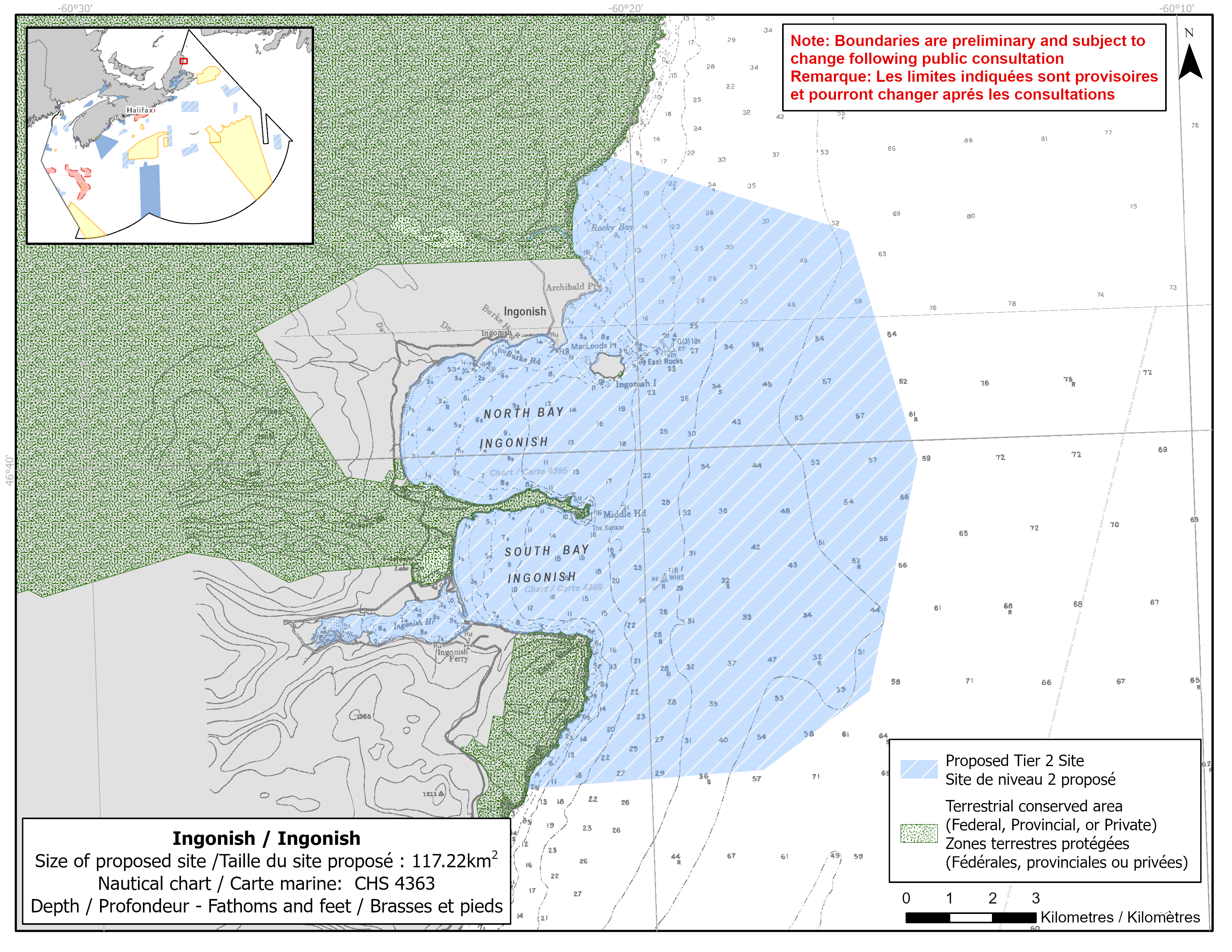
Map of proposed Ingonish network site
Simplified site coordinates
Boundaries are preliminary and subject to change following the public engagement.
| Point | Latitude | Longitude | Description |
|---|---|---|---|
| 1 | 46°43' 40.356" N | 60°20' 21.032" W | Starting at point 1 on the coastline, in the northwest of the site |
| 2 | 46°42' 38.500" N | 60°16' 5.196" W | Connect to point 2, southeast of point 1 |
| 3 | 46°39' 45.830" N | 60°14' 58.832" W | Connect to point 3, southeast of point 2 |
| 4 | 46°36' 53.759" N | 60°15' 59.935" W | Connect to point 4, southwest of point 3 |
| 5 | 46°35' 57.392" N | 60°17' 58.175" W | Connect to point 5, southwest of point 4 |
| 6 | 46°35' 49.144" N | 60°22' 15.326" W | Connect to point 6 on the coastline, west of point 5 and follow along the coastline to connect point 6 to point 1 |
Size
117 km2
Features
- Feeding area for whales
- Important foraging area for seabirds and shorebirds
- Significant nesting area for great cormorants
- Important concentrations of kelp
- Two spawning rivers for Atlantic salmon drain into the Ingonish bays
- Identified as two Important Bird Areas
- Nearby terrestrial protection, including:
- Cape Smokey Provincial Park
- Cape Breton Highlands National Park
Species
This area supports species, including:
- Cetaceans, such as:
- Fin whale (listed as special concern under SARA)
- Humpback whale
- Minke whale
- Pilot whale
- Eastern Cape Breton Atlantic salmon (assessed as endangered by COSEWIC)
- Seabirds and shorebirds, such as:
- Great black-backed gull
- Great cormorant
- Herring gull
- Kelp
Use
- Current fisheries include crab, groundfish (fixed gear), herring (fixed gear), lobster and mackerel. There is a moratorium on fishing cod and haddock on the Eastern Scotian Shelf.
- Licences issued to First Nations and Indigenous communities provide access to this area to fish for food, social and ceremonial purposes.
- Recreational activities include:
- hiking
- beachgoing
- golfing
- boating
- whale watching
- Date modified: