
LaHave Basin
LaHave Basin is proposed as a Tier 2 site for the Marine Conservation Network in the Scotian Shelf-Bay of Fundy Bioregion.
On this page
Location
LaHave Basin is located approximately 50 km south of Halifax, Nova Scotia. It includes the northeastern portion of LaHave Basin along with some inner shelf habitat to the north of the basin.
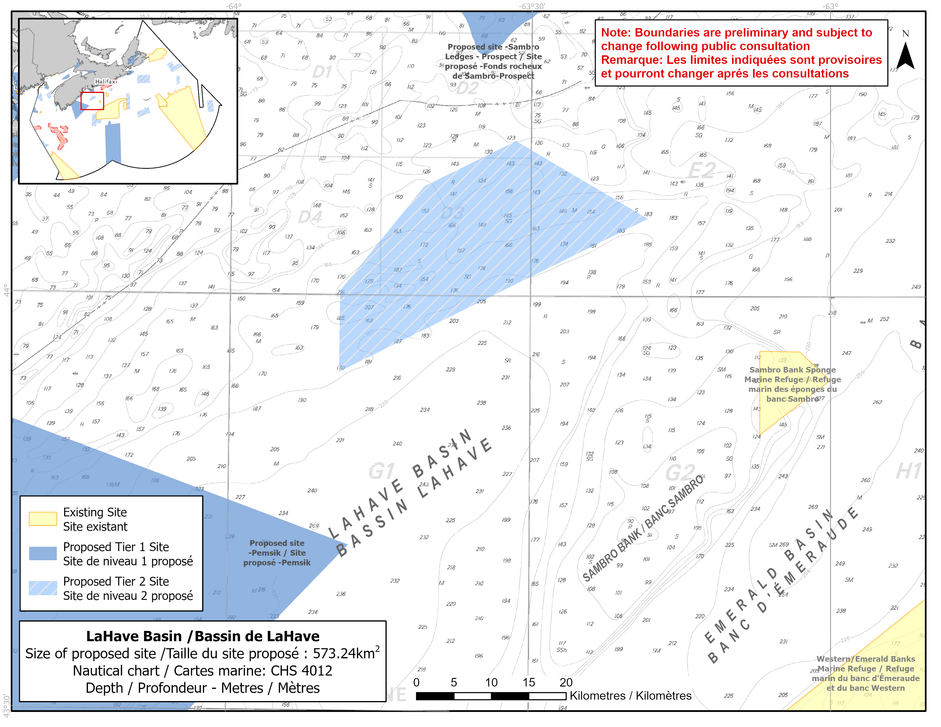
Map of proposed LaHave Basin network site
Simplified site coordinates
Boundaries are preliminary and subject to change following the public engagement.
| Point | Latitude | Longitude | Description |
|---|---|---|---|
| 1 | 43°54' 26.1" N | 63°49' 3.9" W | Starting at point 1 on the southwest side of the site |
| 2 | 44°0' 17.5" N | 63°49' 1.3" W | Connect to point 2, north of point 1 |
| 3 | 44°7' 52.6" N | 63°40' 42.0" W | Connect to point 3, northeast of point 2 |
| 4 | 44°11' 11.0" N | 63°31' 31.4" W | Connect to point 4, northeast of point 3 |
| 5 | 44°5' 37.0" N | 63°18' 16.7" W | Connect to point 5, southeast of point 4 and connect point 5 to point 1 |
Size
573 km2
Features
- Significant concentrations of glass sponges (Vazella pourtalesi)
- Important habitat for groundfish
- Area of high invertebrate and fish diversity
- Marine refuge about 25 km to the east (on Sambro Bank) to protect glass sponges
- High density of krill and other zooplankton
- Representative example of shelf basin and shelf flat habitat
Species
This area supports species, including:
- Depleted groundfish populations, such as:
- Cusk (assessed as endangered by COSEWIC)
- White hake (assessed as threatened by COSEWIC)
- Spiny dogfish (assessed as special concern by COSEWIC)
- Glass sponges (Vazella pourtalesi)
- Krill and zooplankton
Use
- Current fisheries include bluefin tuna, groundfish (fixed and mobile gear), hagfish, herring, mackerel, snow crab and swordfish.
- Inshore lobster fishing may also occur.
- Licences issued to First Nations and Indigenous communities provide access to this area to fish for food, social and ceremonial purposes.
- High shipping traffic due to its proximity to Halifax Harbour.
- Date modified: