
Logan Canyon
Logan Canyon is proposed as a Tier 2 site for the Marine Conservation Network in the Scotian Shelf-Bay of Fundy Bioregion.
On this page
Location
Logan Canyon is located approximately 40 km south of Sable Island on the central Scotian Shelf.
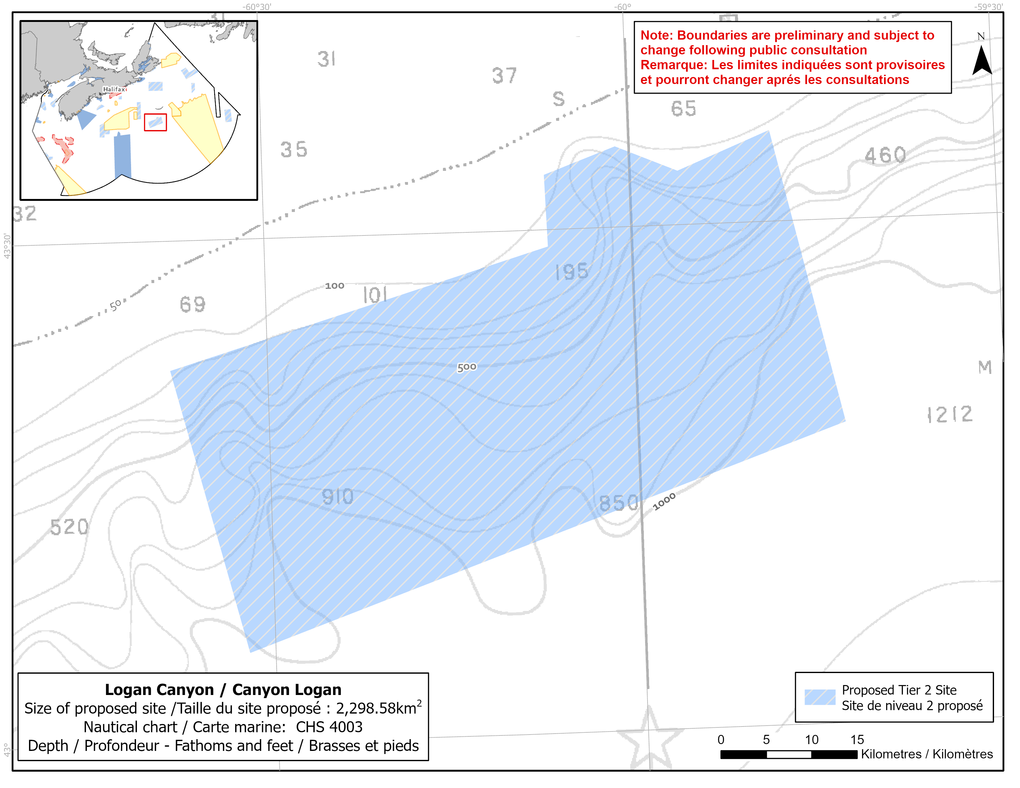
Map of proposed Logan Canyon network site
Simplified site coordinates
Boundaries are preliminary and subject to change following the public engagement.
| Point | Latitude | Longitude | Description |
|---|---|---|---|
| 1 | 43°5' 22.960" N | 60°32' 6.462" W | Starting at point 1 in the southwest of the site |
| 2 | 43°22' 18.160" N | 60°37' 58.064" W | Connect to point 2, northwest of point 1 |
| 3 | 43°29' 0.442" N | 60°6' 48.405" W | Connect to point 3, northeast of point 2 |
| 4 | 43°33' 16.654" N | 60°6' 56.289" W | Connect to point 4, north of point 3 |
| 5 | 43°34' 49.506" N | 60°1' 3.057" W | Connect to point 5, northeast of point 4 |
| 6 | 43°33' 14.478" N | 59°56' 0.124" W | Connect to point 6, southeast of point 5 |
| 7 | 43°35' 27.412" N | 59°48' 23.090" W | Connect to point 7, northeast of point 6 |
| 8 | 43°17' 57.018" N | 59°43' 2.111" W | Connect to point 8, southeast of point 7 and the connect point 8 to point 1 |
Size
2 299 km2
Features
- Suspected concentrations of bubblegum coral, sea pens, soft coral and small gorgonian coral
- Important habitat to support coral connectivity
- Area of high finfish diversity
- One of several shelf-incising submarine canyons on the central Scotian Shelf
Species
- Depleted groundfish, such as:
- Cusk (assessed as endangered by COSEWIC)
- White hake (assessed as threatened by COSEWIC)
- Roundnose grenadier (assessed as endangered by COSEWIC)
- Paragorgia (bubblegum) coral, sea pens and soft corals
Use
- Current fisheries include bluefin tuna, crab, groundfish (fixed and mobile gear), hagfish, herring (mobile gear), mackerel, swordfish and other tunas. There is a moratorium on fishing cod and haddock on the Eastern Scotian Shelf.
- Licences issued to First Nations and Indigenous communities provide access to this area to fish for food, social and ceremonial purposes.
- Low shipping traffic.
- Date modified: