
MacNamaras Island
MacNamaras Island is proposed as a Tier 2 site for the Marine Conservation Network in the Scotian Shelf-Bay of Fundy Bioregion.
On this page
Location
MacNamaras Island is located off the southeastern shore of Cape Breton. The site includes the waters surrounding MacNamaras Island, Walshs Island, Rabbit Island and Boudreaus Island.
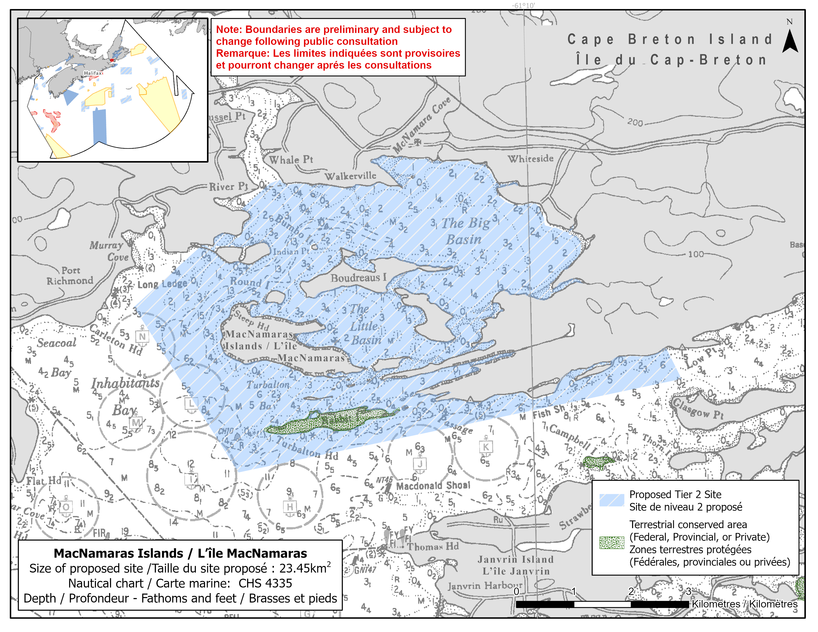
Map of proposed MacNamaras Island network site
Simplified site coordinates
Boundaries are preliminary and subject to change following the public engagement.
| Point | Latitude | Longitude | Description |
|---|---|---|---|
| 1 | 45°34' 20.876" N | 61°8' 11.936" W | Starting at point 1 on the coastline, in the southeast of the site |
| 2 | 45°34' 2.871" N | 61°7' 59.855" W | Connect to point 2, southeast of point 1 |
| 3 | 45°33' 15.750" N | 61°13' 57.407" W | Connect to point 3, west of point 2 |
| 4 | 45°34' 50.464" N | 61°15' 18.394" W | Connect to point 4, northwest of point 3 |
| 5 | 45°35' 23.118" N | 61°14' 24.938" W | Connect to point 5, northeast of point 4 |
| 6 | 45°35' 43.961" N | 61°13' 50.802" W | Follow along the coastline south of point 5 to point 6 |
| 7 | 45°35' 58.324" N | 61°13' 27.270" W | Connect to point 7, northeast of point 6 |
| 8 | 45°36' 0.623" N | 61°13' 18.729" W | Connect to point 8, northeast of point 7 and follow along the coastline east to connect point 8 to point 1 |
Size
23 km2
Features
- Significant concentrations of marine plants
- Nearby terrestrial protection, including:
- Janvrin Island Nature Reserve
Species
This area supports species including:
- Eelgrass and rockweed
Use
- Current fisheries include lobster and scallop.
- Licences issued to First Nations and Indigenous communities provide access to this area to fish for food, social and ceremonial purposes.
- There is a proposed shellfish aquaculture lease in the site.
- Recreational activities include:
- watersports
- recreational fishing
- Date modified: