
Sambro Ledges-Prospect
Sambro Ledges-Prospect is proposed as a Tier 1 site for the Marine Conservation Network in the Scotian Shelf-Bay of Fundy Bioregion.
The lead agency for this site is Fisheries and Oceans Canada.
On this page
Location
Sambro Ledges-Prospect, located just southwest of Halifax Harbour, includes the inshore waters between Prospect and Chebucto Head.
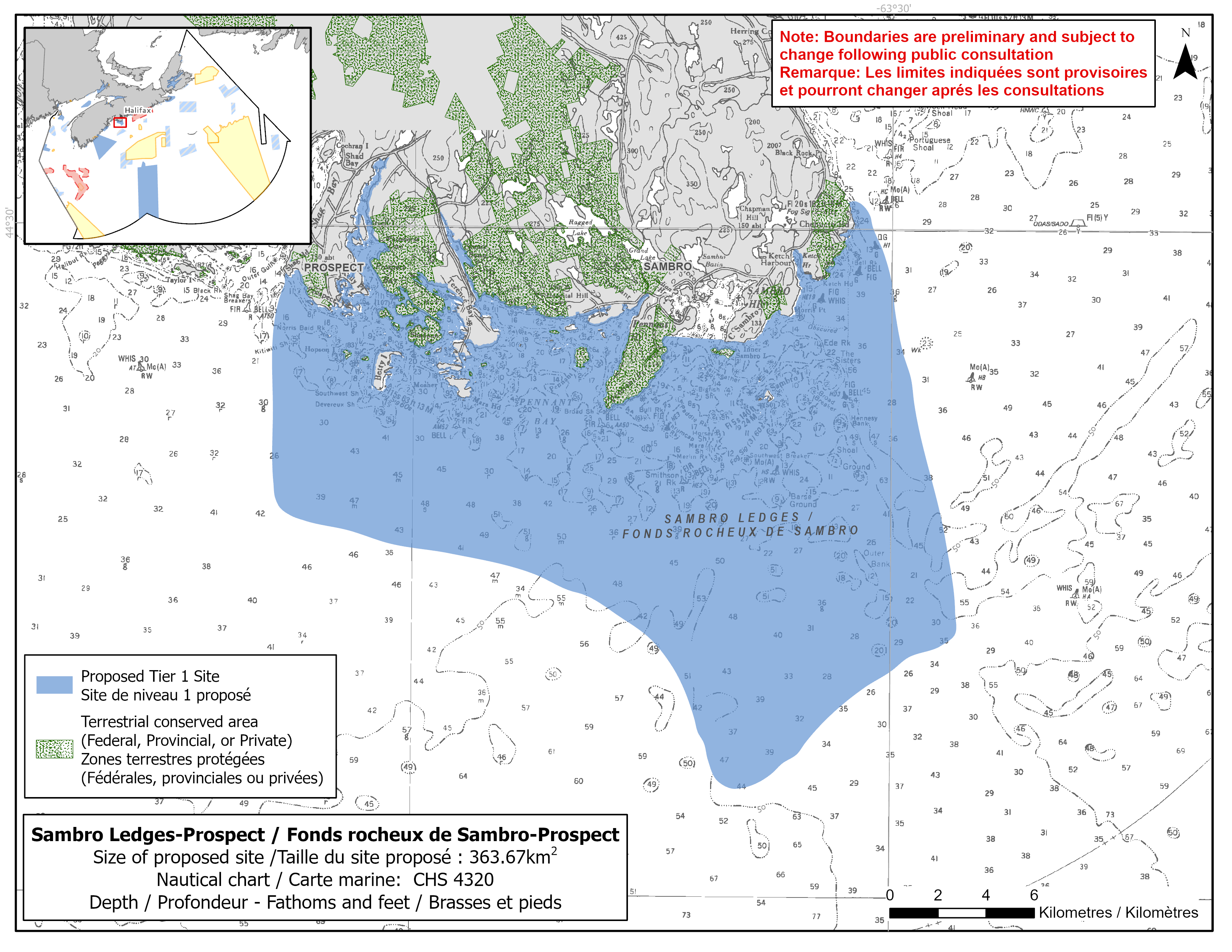
Map of proposed Sambro Ledges-Prospect network site
Simplified site coordinates
Boundaries are preliminary and subject to change following the public engagement.
| Point | Latitude | Longitude | Description |
|---|---|---|---|
| 1 | 44°28' 56.2" N | 63°49' 2.6" W | Starting at point 1 in the northwest of the site |
| 2 | 44°23' 36.4" N | 63°49' 5.1" W | Connect to point 2, south of point 1 |
| 3 | 44° 21' 38.5" N | 63° 39' 15.3" W | Connect to point 3, southeast of point 2 |
| 4 | 44°17' 26.7" N | 63°35' 1.1" W | Connect to point 4, southeast of point 3 |
| 5 | 44°21' 7.2" N | 63°27' 55.8" W | Connect to point 5, northeast of point 4 |
| 6 | 44°30' 36.0" N | 63°31' 24.8" W | Connect to point 6, northwest of point 5, |
| 7 | 44°27' 30.8" N | 63°35' 16.0" W | Follow the coastline west to point 7 on northeast side of Sambro harbour |
| 8 | 44°27' 35.5" N | 63°37' 8.5" W | Connect to point 8 on northwest side of Sambro harbour, follow the coastline west to point 1 |
Size
364 km2
Features
- Feeding area for whales, dolphins and porpoises
- Important foraging area for seabirds and shorebirds
- Significant concentrations of marine plants
- Overwintering area for Atlantic herring
- Juvenile and nursery areas for pollock
- Next to terrestrial protection, including:
- Terrence Bay and Rogues Roost Provincial Wilderness Areas
- Duncan's Cove Provincial Nature Reserve
- Crystal Crescent Beach Provincial Park
- the Nature Conservancy of Canada's Prospect Head Conservation Lands
- High naturalness (Terence Bay and Pennant Bay)
- High productivity due to enhanced upwelling in the area
- Complex bottom topography
Species
This area supports species, including:
- Fin whale and dolphins
- Atlantic herring and mackerel
- Seabirds and shorebirds, such as:
- Roseate tern (listed as endangered under SARA)
- Harlequin duck (listed as special concern under SARA)
- Barrow's goldeneye (listed as special concern under SARA)
- Kelp and eelgrass
- Stalked tunicate (also known as "sea potato")
Use
- Current fisheries include bluefin tuna, crab, groundfish (mostly fixed gear), herring (fixed gear), lobster, mackerel, scallop, sea urchin (dive), and swordfish.
- Irish moss and rockweed harvesting also occurs.
- Licences issued to First Nations and Indigenous communities provide access to this area to fish for food, social and ceremonial purposes.
- Recreational activities include:
- kayaking
- boating
- beach going
- bird and whale watching
- scuba diving
- High shipping traffic due to its proximity to the main shipping lanes to and from Halifax Harbour.
- Date modified: