
Scotian Gulf
Scotian Gulf is proposed as a Tier 2 site for the Marine Conservation Network in the Scotian Shelf-Bay of Fundy Bioregion.
On this page
Location
Scotian Gulf is located approximately 150 km south of Halifax, Nova Scotia, on the edge of the Scotian Shelf. It is between LaHave Bank and Emerald Bank. It shares a border with the western side of the Emerald and Western Banks Marine Refuge.
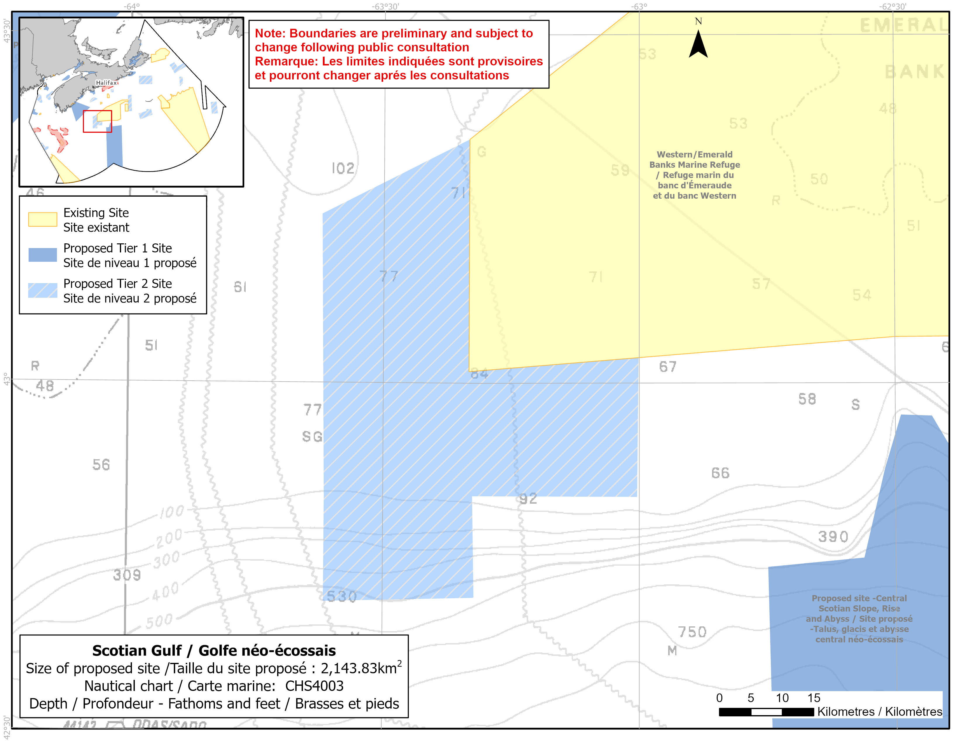
Map of proposed Scotian Gulf network site
Simplified site coordinates
Boundaries are preliminary and subject to change following the public engagement.
| Point | Latitude | Longitude | Description |
|---|---|---|---|
| 1 | 43°21' 0.0" N | 63°19' 57.1" W | Starting at point 1 on the northeast side of the site |
| 2 | 43°1' 0.0" N | 63°19' 57.1" W | Connect to point 2, south of point 1 |
| 3 | 43°2' 14.3" N | 63°0' 4.8" W | Connect to point 3, east of point 2 |
| 4 | 42°50' 15.0" N | 63°0' 15.0" W | Connect to point 4, south of point 3 |
| 5 | 42°50' 16.4" N | 63°19' 32.7" W | Connect to point 5, west of point 4 |
| 6 | 42°41' 31.4" N | 63°19' 20.5" W | Connect to point 6, south of point 5 |
| 7 | 42°41' 12.2" N | 63°36' 54.6" W | Connect to point 7, west of point 6 |
| 8 | 42°50' 15.0" N | 63°36' 53.0" W | Connect to point 8, north of point 7 |
| 9 | 43°14' 33.2" N | 63°37' 15.7" W | Connect to point 9, north of point 8 and connect point 9 to point 1 |
Size
2 144 km2
Features
- Significant concentrations of glass sponges (Vazella pourtalesi)
- Important habitat for groundfish
- Area of high fish diversity
- Emerald and Western Banks Marine Refuge is to the east
- Representative example of the shelf flat habitat that divides the Eastern and Western Scotian Shelf
Species
This area supports species, including:
- Depleted groundfish populations, such as:
- Cusk (assessed as endangered by COSEWIC)
- White hake (assessed as threatened by COSEWIC)
- Roundnose grenadier (assessed as endangered by COSEWIC)
- Roughhead grenadier
- Glass sponges (Vazella pourtalesi)
Use
- Current fisheries include crab, groundfish (fixed and mobile gear), hagfish, swordfish and tuna.
- There is currently a moratorium on fishing Atlantic cod and haddock on the Eastern Scotian Shelf.
- Licences issued to First Nations and Indigenous communities provide access to this area to fish for food, social and ceremonial purposes.
- High shipping traffic.
- Date modified: