
Southwest Bank
Southwest Bank is proposed as a Tier 2 site for the Marine Conservation Network in the Scotian Shelf-Bay of Fundy Bioregion.
On this page
Location
Southwest Bank is located just outside the mouth of the Bay of Fundy, approximately 45 km southwest of Grand Manan Island, New Brunswick, along the border between Canadian and United States waters.
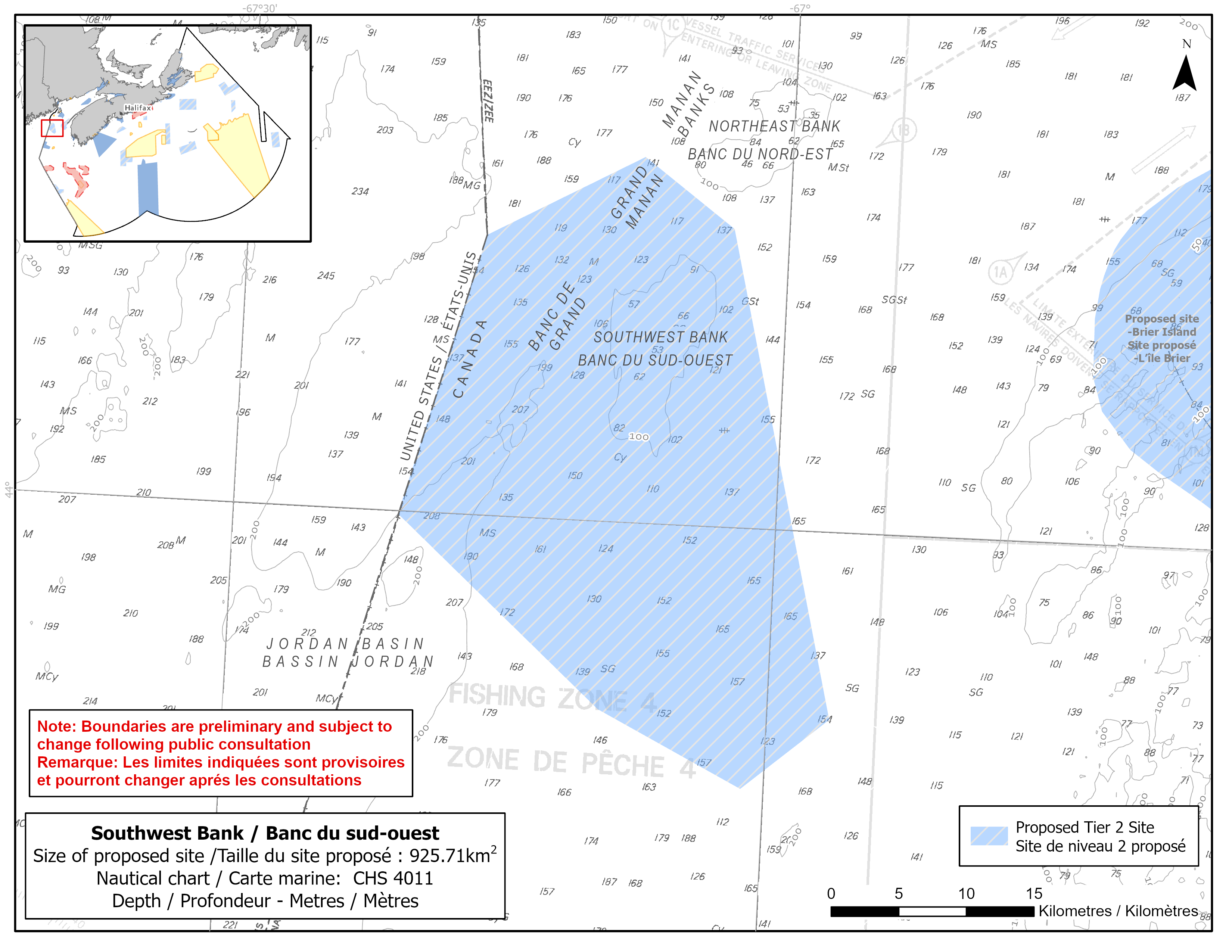
Map of proposed Southwest Bank network site
Simplified site coordinates
Boundaries are preliminary and subject to change following the public engagement.
| Point | Latitude | Longitude | Description |
|---|---|---|---|
| 1 | 44°11' 54.9" N | 67°3' 3.0" W | Starting at point 1 on the northeast side of the site |
| 2 | 43°52' 31.8" N | 66°56' 30.6" W | Connect to point 2, southeast of point 1 |
| 3 | 43°49' 36.4" N | 67°1' 14.0" W | Connect to point 3, southwest of point 2 |
| 4 | 43°52' 30.2" N | 67°9' 17.8" W | Connect to point 4, northwest of point 3 |
| 5 | 43°59' 53.2" N | 67°20' 52.3" W | Connect to point 5, northwest of point 4 and on the Canada/US boundary |
| 6 | 44°11' 11.4" N | 67°16' 43.6" W | Follow the Canada/US boundary north to point 6 |
| 7 | 44°14' 36.6" N | 67°8' 10.6" W | Connect to point 7, northeast of point 6 and then connect point 7 to point 1 |
Size
926 km2
Features
- Foraging habitat for seabirds
- Important habitat for groundfish
- Area of high fish and invertebrate species diversity
- Area of persistent high primary productivity
- Representative examples of basin and shelf flat habitats
Species
This area supports species, including:
- Whales, dolphins and porpoises
- Depleted groundfish populations, such as:
- Atlantic cod (assessed as endangered by COSEWIC)
- Cusk (assessed as endangered by COSEWIC)
- White hake (assessed as threatened by COSEWIC)
- American plaice (assessed as threatened by COSEWIC)
- Spiny dogfish (assessed as special concern by COSEWIC)
- Thorny skate (assessed as special Concern by COSEWIC)
- Ocean pout
- Seabirds
- Sea pens
Use
- Current fisheries include crabs, groundfish (fixed and mobile gear), herring, lobster, and scallop.
- Licences issued to First Nations and Indigenous communities provide access to this area to fish for food, social and ceremonial purposes.
- High shipping traffic due to its proximity to the shipping lanes in the Bay of Fundy (about 15 km to the east).
- Date modified: