
Oceanographic activities
Canada’s oceans and waterways support vibrant ecosystems, transportation networks, and fishery businesses. Preserving these oceans and waterways for future generations requires significant long-term data about our oceans and added insights from analyses and models to understand the current state and how it might be changing in the years to come.
On this page
Services and information
Observations
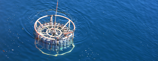
Ocean data on a range of physical, chemical and biological features (for example, tides, ocean currents, pH, salinity, temperature, ocean colour, phytoplankton, etc.) are acquired by Fisheries and Oceans Canada as part of zonal research and monitoring initiatives in Canada's three oceans. Ocean observations form the backbone of our understanding the state of the oceans and how they are changing over time. Observational data are also critical for developing predictive ocean models.
Atlantic ocean monitoring
The Atlantic Zone Monitoring Program in Atlantic Canada was developed with the aim of collecting and analyzing the biological, chemical, and physical data to detect and monitor seasonal and inter-annual variability in Eastern Canadian waters.
- Atlantic Zone Monitoring Program (AZMP)
- Atlantic Zone Off-Shelf Monitoring Program
- Bedford Basin Plankton Monitoring Program
- Coastal Shallow Water Temperature Climatology for Atlantic Canada
- Tides, currents, and water levels
Pacific ocean monitoring
In the Pacific zone, the Line P Time Series is one of the longest running oceanographic monitoring programs. Due to the long term nature of this program, oceanographic changes can be evaluated, which is especially relevant when monitoring global climate change.
The following are other oceanographic observation programs in the Pacific zone:
- BC Lighthouse Data
- BC inlets- Water Properties Trends
- Coastal Monitoring with BC Ferries
- Haida Eddies
- Line P Time Series
- Plankton Productivity
- Southern BC Coastal Waters Monitoring
- Tides, currents, and water levels
Arctic ocean monitoring
DFO scientists led 6 of the 51 Canadian International Polar Year (IPY) projects and were contributors to many of the other IPY projects.
Observations of the Arctic Ocean have been made since the 1800s at varying levels of intensity. Recently, Arctic monitoring has focused on understanding the impacts of climate change on Arctic waters (for example, increasing temperature, decreasing pH, decreasing salinity, changing ice conditions, etc.).
- The National Centre for Arctic Aquatic Research Excellence (N-CAARE)
- Tides, currents, and water levels
National programs
National
Satellite
- Advanced Very High Resolution Radiometer (AVHRR) remote sensing satellite
- MERIS remote sensing satellite
- MODIS remote sensing satellite
- Operational Remote Sensing at BIO
- Sea-viewing Wide Field-of view Sensor (SeaWiFS) remote sensing satellite
- Virtual Centre for Ocean Satellite Salinity (VCOSS) remote sensing satellite
Partners in ocean monitoring
In acquiring ocean observations, Fisheries and Oceans Canada works closely with partners within the Federal Government with other ocean monitoring programs funded by the Government of Canada, and with international agencies.
Other Governmental Departments
National
International
- Arctic Council
- Arctic Monitoring Assessment Program
- Arctic Ocean Sciences Board
- Circumpolar Biodiversity Monitoring Program
- International Arctic Science Committee
- International Oceanographic Commission
- National Oceanic and Atmospheric Administration
- National Snow and Ice Data Centre
- Sustaining Arctic Observing Networks
- The Partnership for the Observation of the Global Oceans (POGO)
Data management
Fisheries and Oceans Canada provides for the management of data collected through Departmental regional and zonal programs and from foreign sources. Data are assembled, processed and disseminated through Science and Data Centres operating in all regions.
The Oceans Science Branch's Marine Environmental Data Section (MEDS) maintains archives of in-situ physical, chemical, and biological properties, helps coordinate national data management activities through participation in DFO's Science Data Management Sub-Committee and acts as the focal point for international cooperation in data management.
Ease of access to ocean data, both historical and recent, is essential for determining status and trends in biological and physical environments as well as for providing timely in-situ inputs and validation to modelling and forecasting activities. For reasons of public trust and to preserve the results of public investment in science, data management of this magnitude falls under the purview of government. DFO is the primary public source of ocean observations collected by Canadians.
- Pacific Region - Data and Products Archive
- Bedford Institute of Oceanography - Ocean and Ecosystem Science
- Quebec Region - Data and Products as served by the St. Lawrence Global Observatory
- The Polar Data Catalogue - provides access to Arctic Data
Modelling
Ocean models are computer-generated. They represent an ocean, or a region within an ocean, in three dimensions and depict its evolution over time. Models are based on ocean observations collected by earth observation satellites and direct measurement of conditions such as temperature, salinity, currents and wave heights.
Since the atmosphere also influences the state of the ocean, models also include atmospheric data including wind stress, precipitation, evaporation, and cloud coverage. Modellers call this "atmospheric forcing".
There is increasing recognition that accurate ocean forecast models need to be "coupled models" that couple or incorporate information on atmospheric, ice, and ocean conditions. Based on this coupled information, the model can be run to predict various aspects of ocean conditions which can then be used for operational oceanography, emergency preparedness planning, and to determine health of the oceans.
A few of the Modelling programs at DFO...
National:
Canadian Operational Network of Coupled Environmental Prediction Systems (CONCEPTS): CONCEPTS is an initiative to establish an operational Canadian-global atmosphere-ocean-ice assimilation and modelling system. It aims to take advantage of improvements in ocean models and new near real time global oceanographic data sets in order to produce new ocean products and improve weather predictions and seasonal to inter-annual climate forecasts.
Centre for Ocean Model Development for Applications (COMDA): COMDA's goals include the development of a common set of modelling tools that can be shared and built upon over time and an increased availability of information and forecasts for ocean currents, temperature, salinity, sea levels, and other variables. COMDA's models have many practical applications including ship routing, search and rescue, oil spill response, habitat assessment and ecosystem management.
Storm Surge Preparedness: DFO scientists use models to make predictions about the potential impacts that a storm surge may have on coastal communities/cities. This modelling helps inform public policy regarding procedures for storm surge preparedness.
Regional:
Atlanticogsl.ca Tsunami Modelling: DFO scientists in the Atlantic region are working on models that simulate the propagation of a tsunami wave in real time. These models enable DFO and emergency preparedness managers to better understand how tsunamis will move across oceans and thereby enable Canadians to be better prepared for emergency response.
Canada-Newfoundland Operational Ocean Forecasting System (C-NOOFS): C-NOOFS is a COMDA pilot project that aims to develop a regional ocean forecasting system for the North West Atlantic waters. By using a combination of satellite based ocean data and data gathered by equipping diving animals with sensors that measure ocean salinity and temperature C-NOOFS hopes to be able to provide the best available ocean analysis.
Ocean Waves: Meteorological buoys continuously monitor waves and winds so that DFO scientists can establish a reliable wave climate and improve daily wave forecasting produced by the weather office of Environment Canada.
Pacific Tsunami Modelling: On the Pacific Coast, DFO scientists are working on models of large tsunamis generated by Cascadia subduction zone earthquakes. These models enable DFO and emergency preparedness managers to better understand how tsunamis will move across oceans and thereby enable Canadians to be better prepared for emergency response.
St. Lawrence Operational Oceanography: DFO scientists use several different types models, such as surface currents, sea ice concentrations, fresh water run-off, etc, to inform ships of oceanographic conditions in the St. Lawrence. As one of the major transport routes for Eastern Canada, these models play an important role in fulfilling DFO's mandate of ensuring that users of the St. Lawrence have access to a safe and secure waterway.
DFO works closely with a range of partners to deliver the best forecasts of accurate and current ocean conditions.
Consult our directory to find scientists who have created ocean models.
What we are doing
Videos
- Date modified: