
Five Years of Coastal Science - The Coastal Environmental Baseline Program 2018 – 2023

The cover of the Five Years of Coastal Science – Coastal Environmental Baseline Program 2018-2023 Report
Contents
- Introduction
- Coastal Environmental Baseline Program – An Overview
- Coastal Ecosystems
- Six Distinct Coastal Areas
- Science in Action
- 80+ Accessible Datasets
- Partnering for Data
- Acknowledgements
Introduction
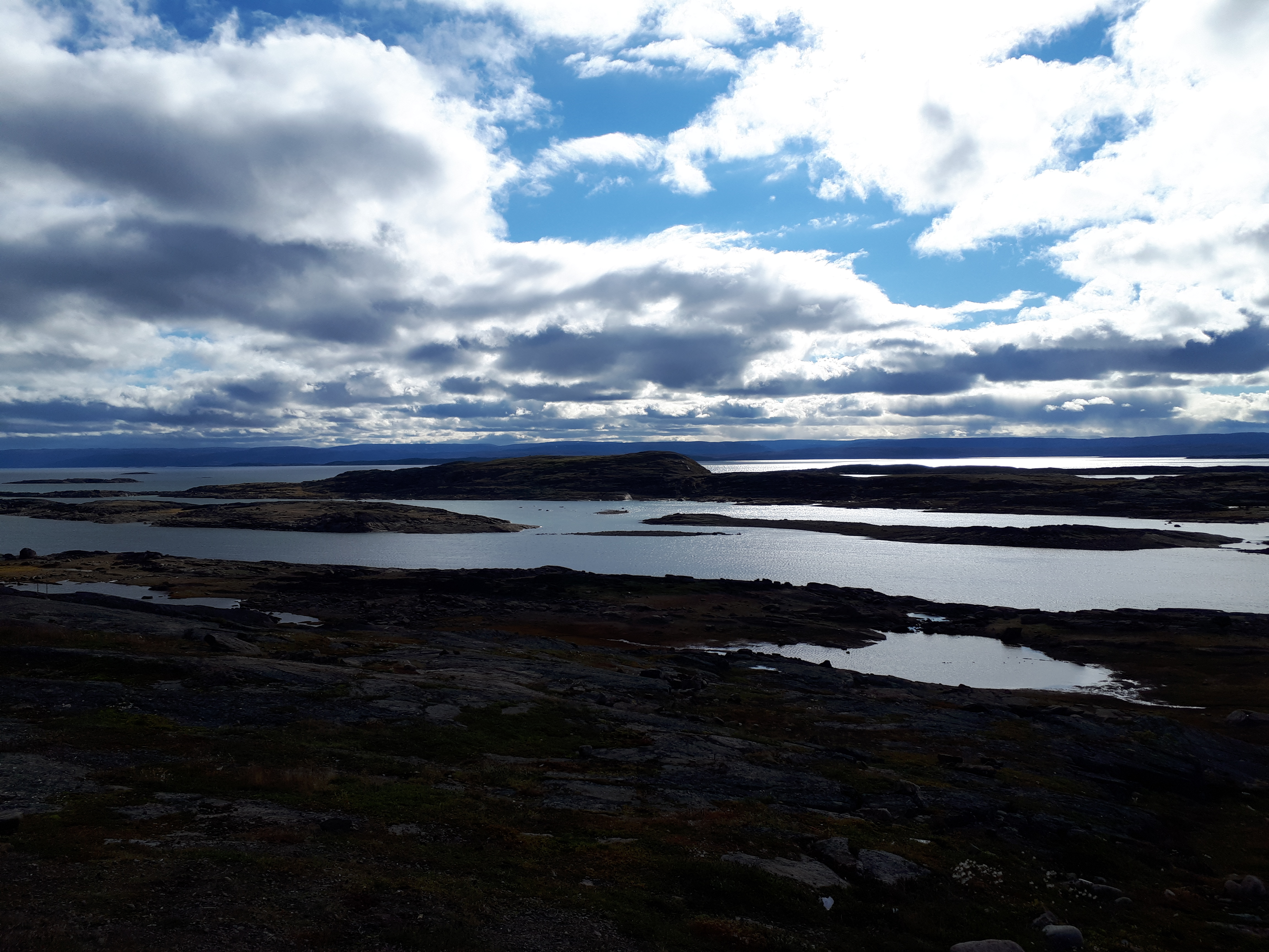
Frobisher Bay, near Iqaluit, Nunavut
Photo: Fisheries and Oceans Canada
To better understand and manage our coasts and waterways, Fisheries and Oceans Canada launched the Coastal Environmental Baseline Program in 2018 as part of the Government of Canada's Oceans Protection Plan.
$50.8 million was invested over five years to capture important information about the current state of six key coastal areas. New open datasets now provide Canadians living and working in these coastal ecosystems a starting point for science-informed decision-making.
Baseline data – Term to Know
What is it? Information that supports a more complete understanding of the current - or baseline - state of an ecosystem. To create a baseline, data must be collected over several seasons, cover a large enough geographic area, and provide information on many parts of a particular ecosystem like animals, plants and water.
Why does it matter? Baseline data are the starting point for understanding ecosystems and detecting future changes.
Coastal Environmental Baseline Program – An Overview
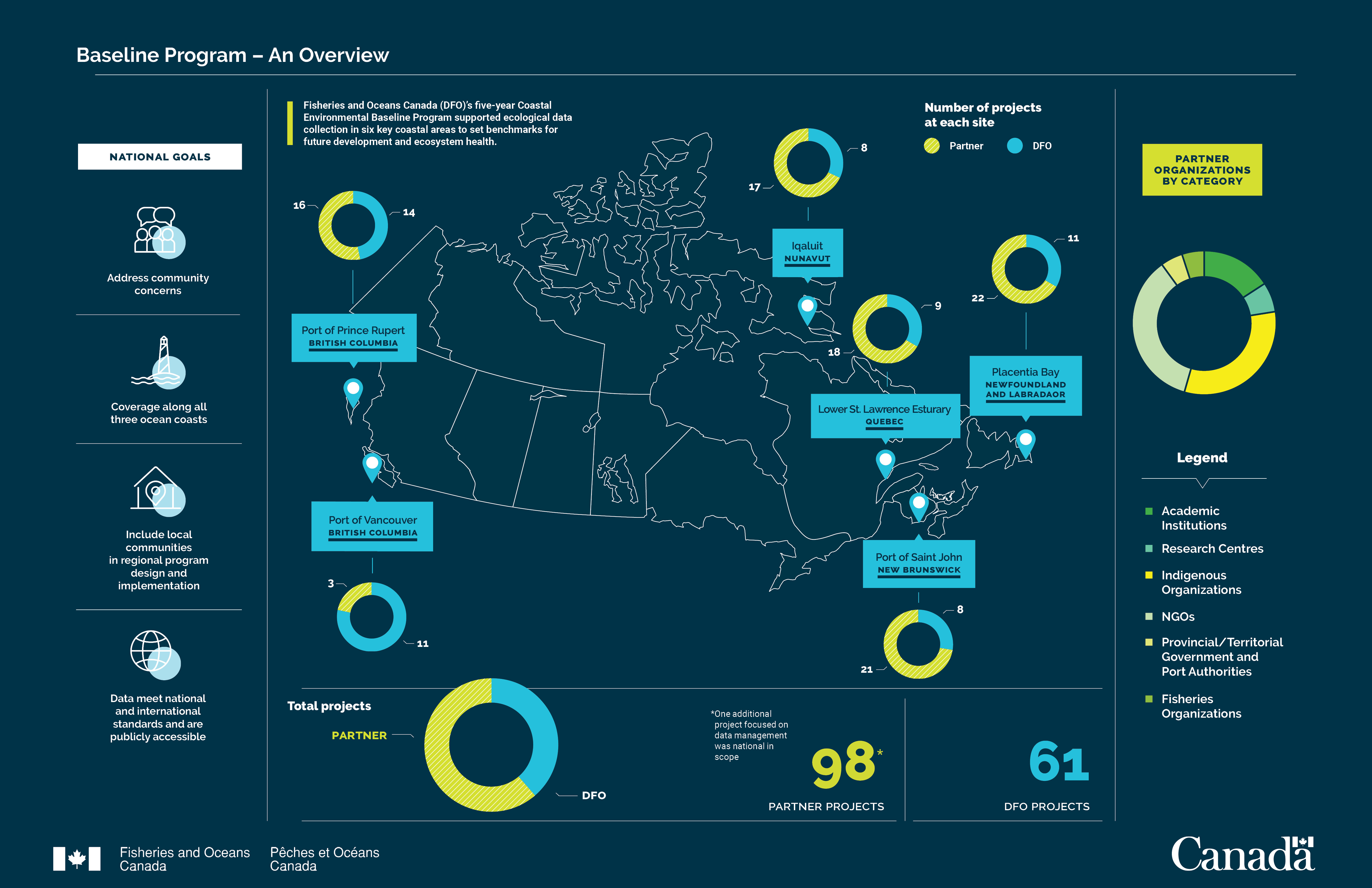
Infographic: Overview of the Coastal Environmental Baseline Program, it’s goals, project partners and locations.
Coastal Ecosystems
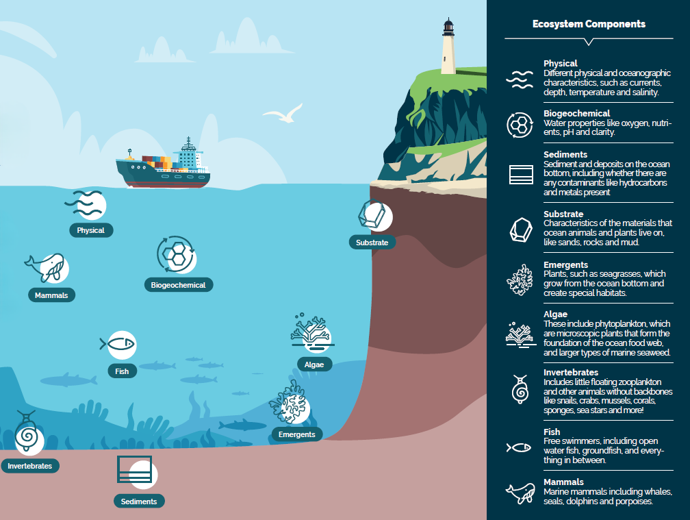
Overview of the coastal ecosystem components being studied by the Coastal Environmental Baseline Program.
Bordered by the Pacific, Arctic and Atlantic oceans, Canada's coastline is rich in biodiversity and home to unique coastal ecosystems. These environments provide important habitat for marine species. They support the social, cultural and economic health and well-being of communities located along shorelines - and deliver benefits to all Canadians.
Coastal ecosystems are under pressure from human activities including increasing levels of marine vessel traffic and expanding development. The more that is known about these ecosystems, the better we can plan for and support coastal management.
To improve our understanding of coastal ecosystems, the Baseline Program collected scientific data on many parts of what makes up an ecosystem. Each of these “components” is represented by an icon in the illustration on the right.
Six Distinct Coastal Areas
Baseline ecological data were collected in six, distinct and important coastal areas, all of which are experiencing increased development pressures and marine vessel traffic. When this program began, there a variety of knowledge gaps for these coastal areas, which the program has helped to address.
Pacific Ocean
Port of Vancouver, British Columbia
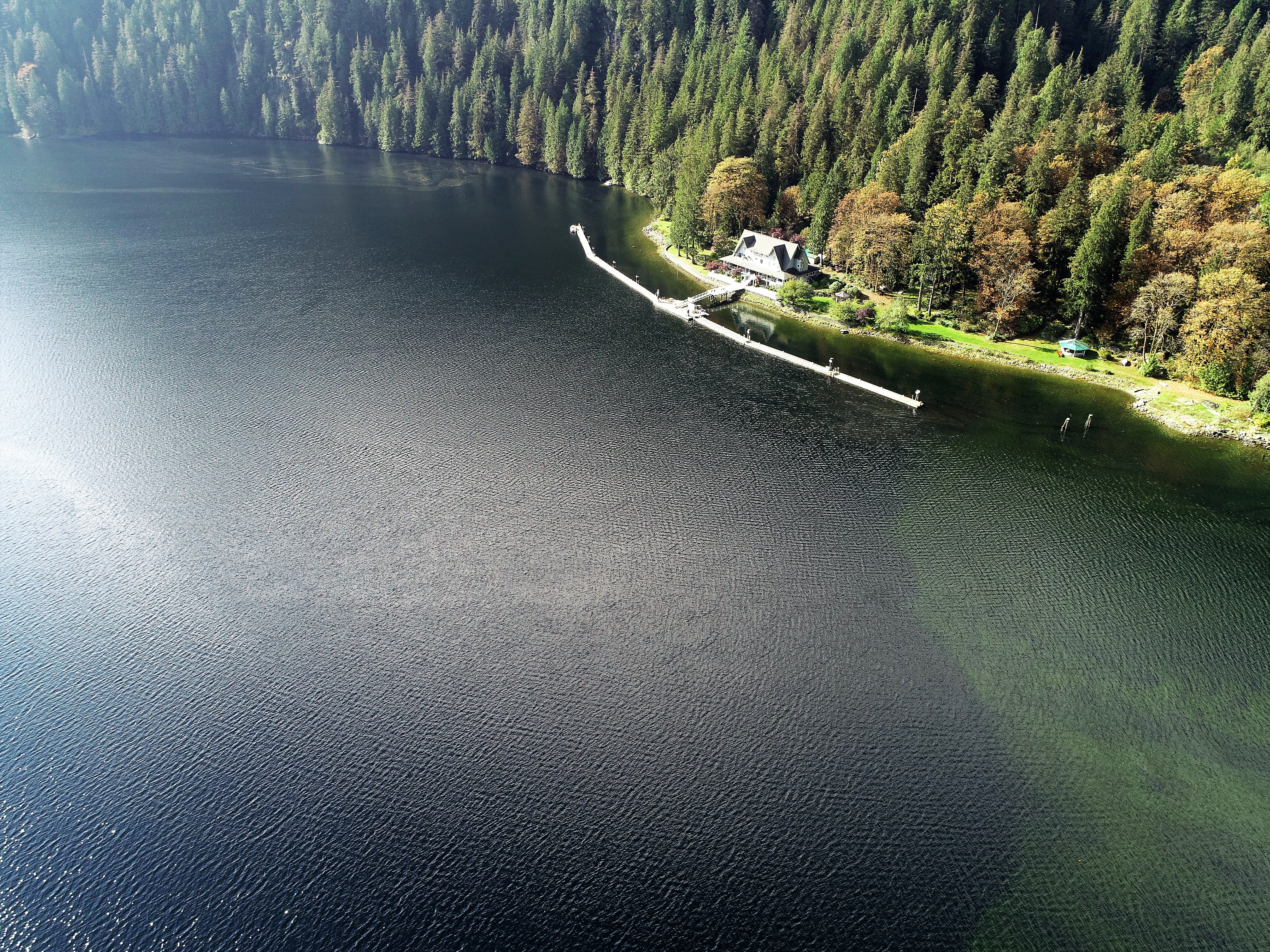
Port of Vancouver, British Columbia
Photo: Fisheries and Oceans Canada
Surrounded by Canada's third largest urban area, the Port of Vancouver sits atop the Fraser River Estuary and west coast fjord of Burrard Inlet, part of the traditional and ancestral territories of the Coast Salish Peoples. It is home to rich marine life including iconic mammals and fish species such as the southern resident killer whale and white sturgeon, kelps and seagrasses.
Port of Prince Rupert, British Columbia
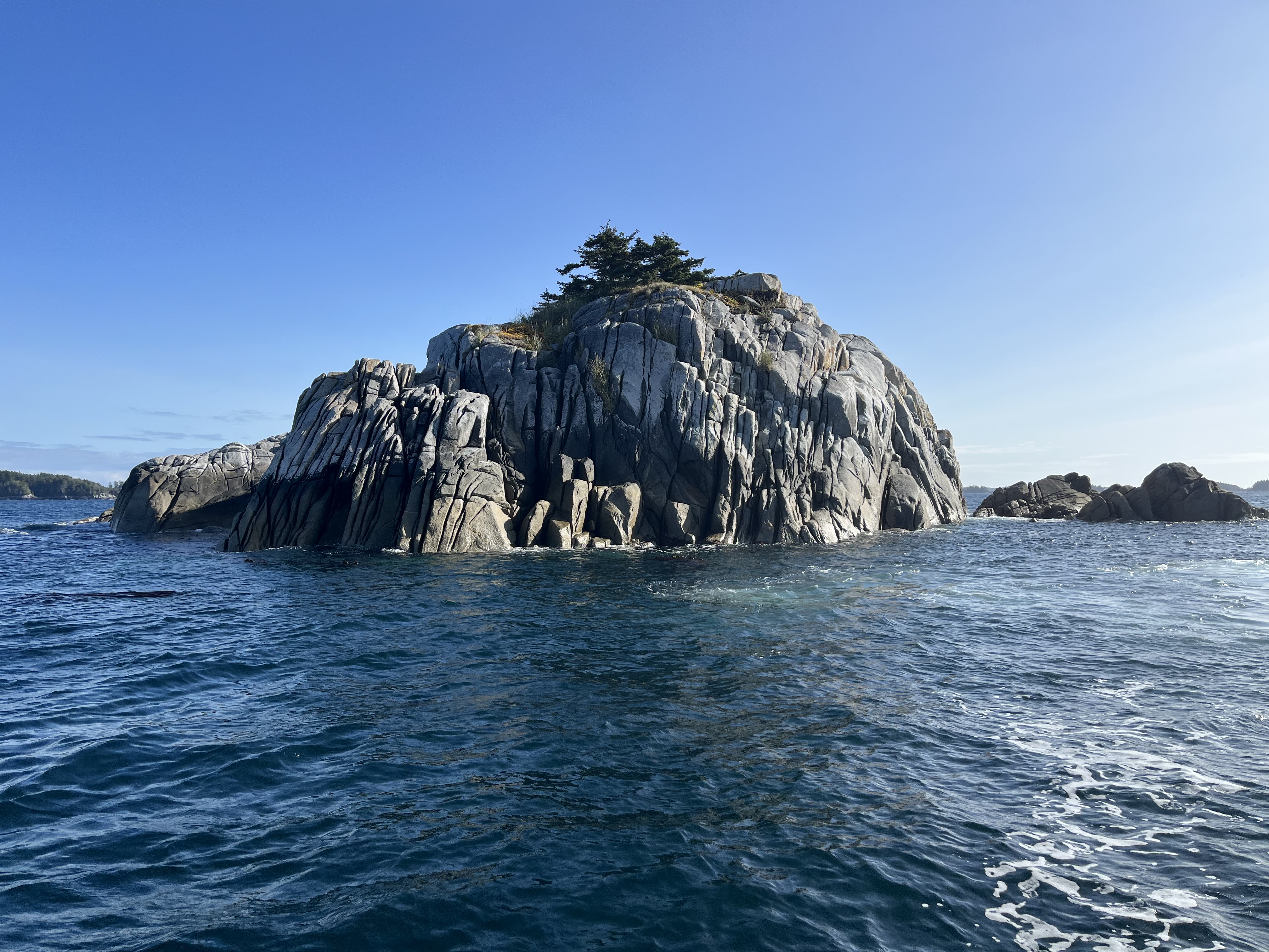
Port of Prince Rupert, British Columbia
Photo: Fisheries and Oceans Canada
The Port of Prince Rupert is the second largest on Canada's west coast, and is located in the traditional and ancestral territories of the Tsimshian People. Bounded by rugged coastal mountains to the east and rocky islands to the west, freshwater flows in during the spring from the Skeena River. Passageways to the north and west connect the port to the Pacific Ocean. The Nass River estuaries provide migration routes and spawning habitat for salmon and forage fish, and the shorelines and beaches support kelp forest ecosystems, glass sponge reefs, and invertebrates and fish.
Arctic Ocean
Iqaluit, Nunavut
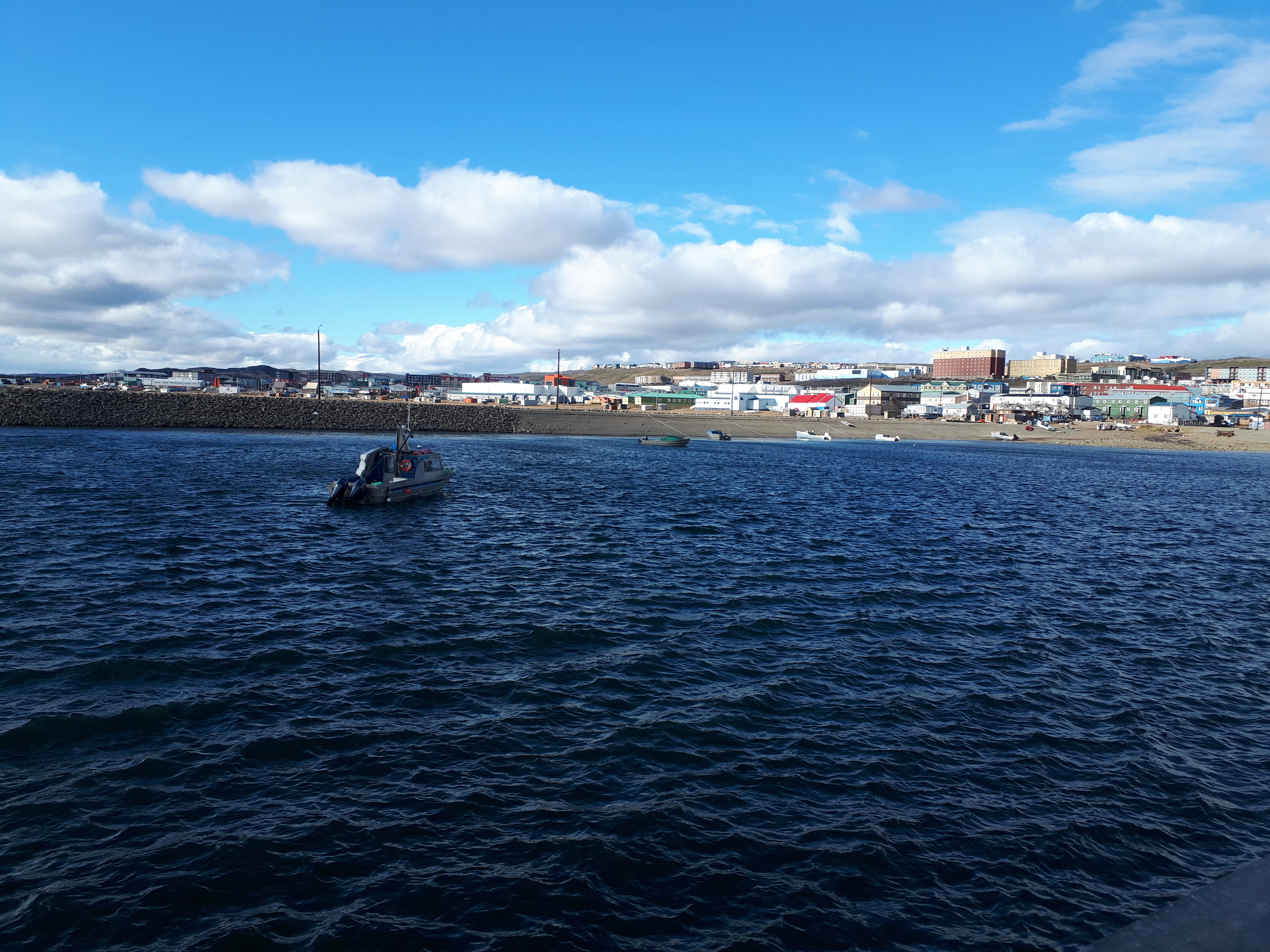
Iqaluit, Nunavut
Photo: Fisheries and Oceans Canada
Iqaluit, located within Inuit homelands (Inuit Nunangat) on southeastern Baffin Island at the head of Frobisher Bay, has some of the world's highest tides. The twice-daily intertidal changes, ranging between seven and 11 metres, create extensive mud-like intertidal and benthic habitats that host many different animal species. There are typically five months of open water near Iqaluit each year, from July to November.
Atlantic Ocean
Lower St. Lawrence Estuary, Québec
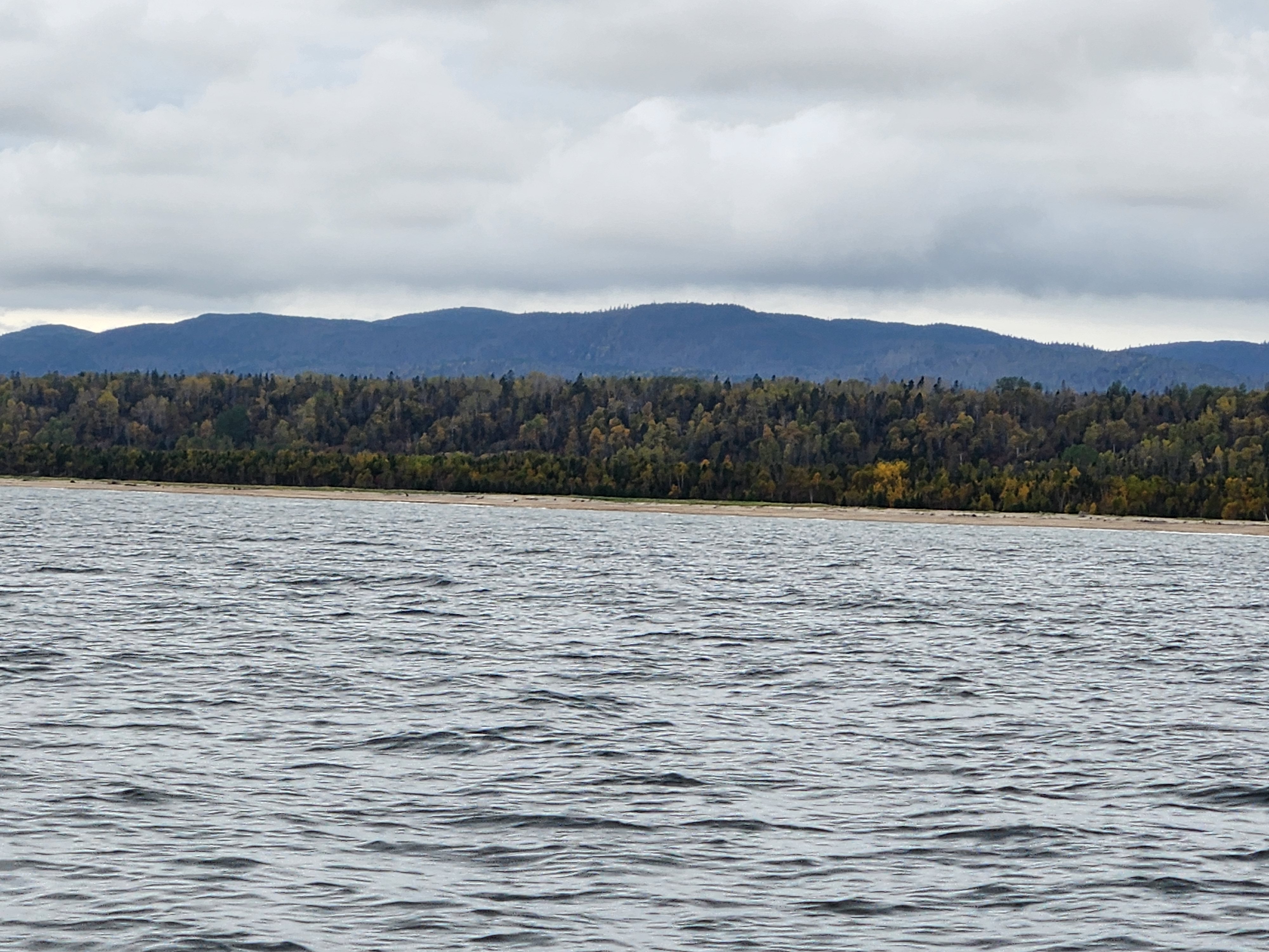
Lower St. Lawrence Estuary, Québec
Photo: Fisheries and Oceans Canada
The Estuary and Gulf of St. Lawrence is one of the world's largest and most productive marine ecosystems and is home to many marine mammal species. Its north shore, part of the unceded traditional territories of the Nitassinan, is dominated by rocky outcrops alternating with sand and glacial clay deposits, and bogs. Salt marshes and eelgrass beds abound and the mouths of several rivers punctuate the coastline.
Port of Saint John, New Brunswick
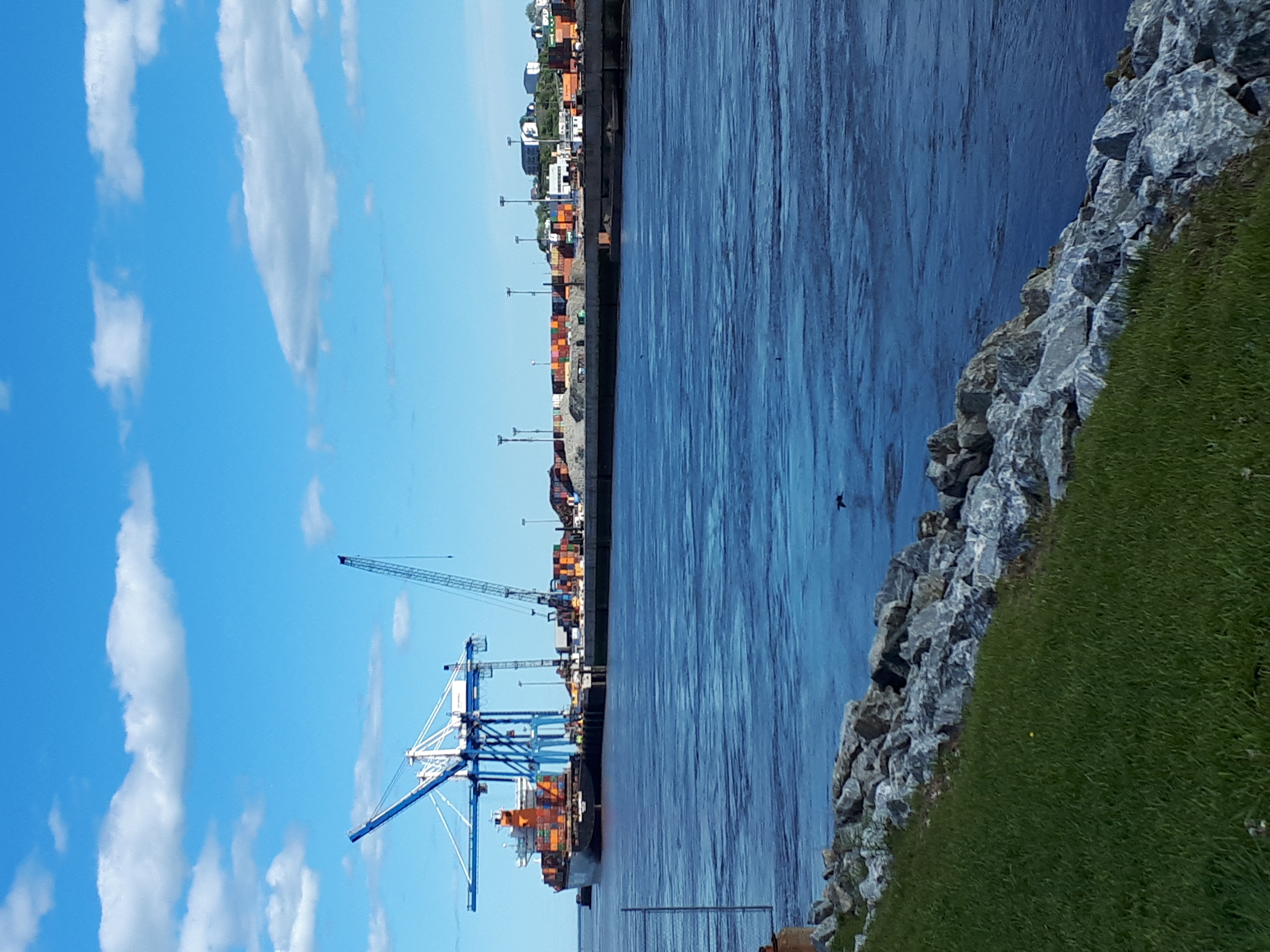
Port of Saint John, New Brunswick
Photo: Fisheries and Oceans Canada
The Saint John Harbour, part of the unceded traditional territory of the WƏlastƏkwey, Peskotomuhkati and Mi'kmaq peoples, is located at the intersection of the Bay of Fundy and the Wolastoq (Saint John River) and is characterized by marshes, mudflats and estuaries. The Bay of Fundy has some of the highest tides in the world, and the extreme tidal range, fresh and salt water mixing, and topography create an environment that provides an abundant food supply for diverse populations of fish, invertebrates and birds.
Placentia Bay, Newfoundland and Labrador
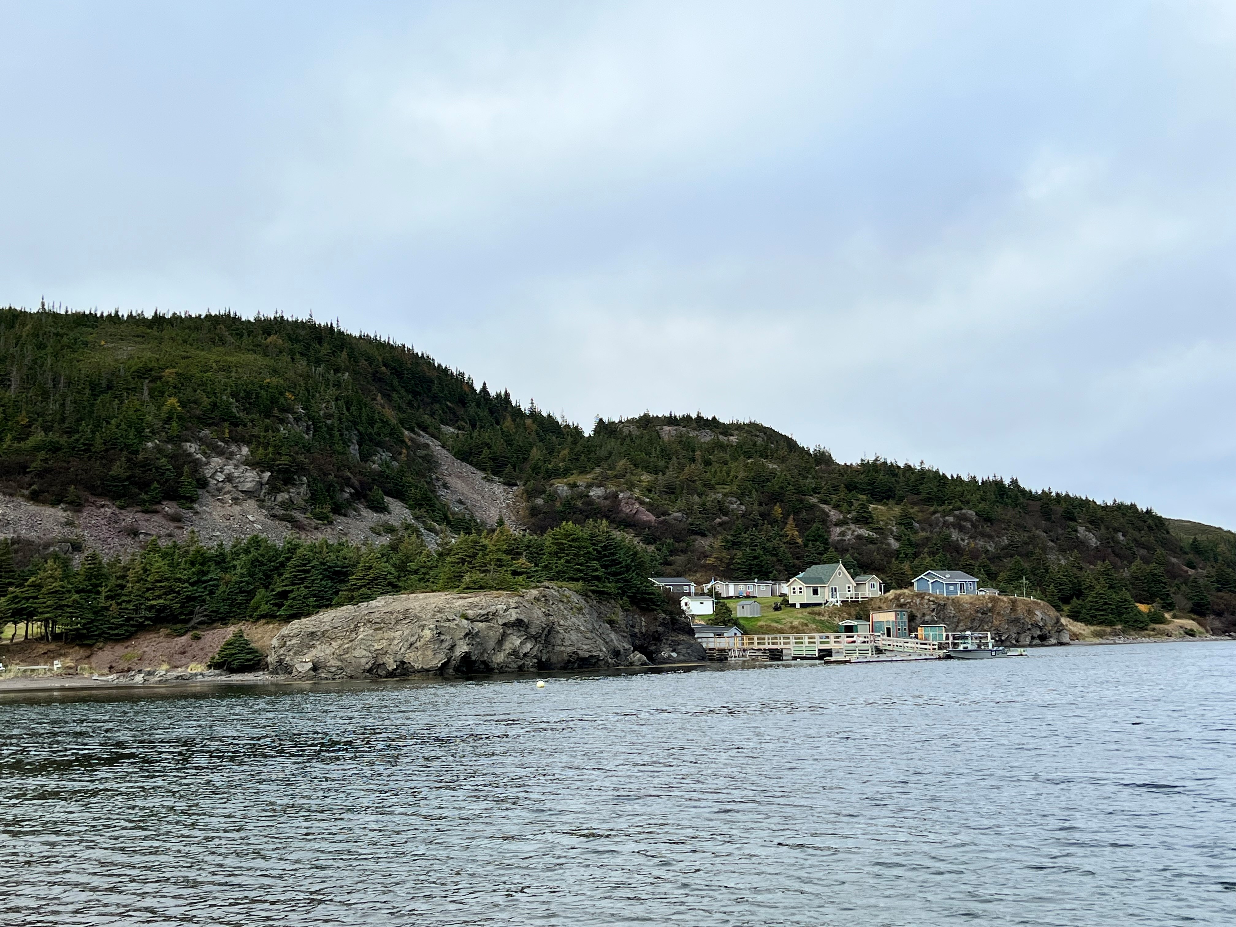
Placentia Bay, Newfoundland and Labrador
Photo: Fisheries and Oceans Canada
Located on the southeast coast of the island of Newfoundland, the unceded traditional territory of the Beothuk and the Mi'kmaq peoples, Placentia Bay is characterized by rocky shorelines, bays, inlets and coastal islands surrounded by steep cliffs. It has been identified as an Ecologically and Biologically Significant Area due to the crucial habitat it provides for vulnerable, threatened and endangered species.
Science in Action
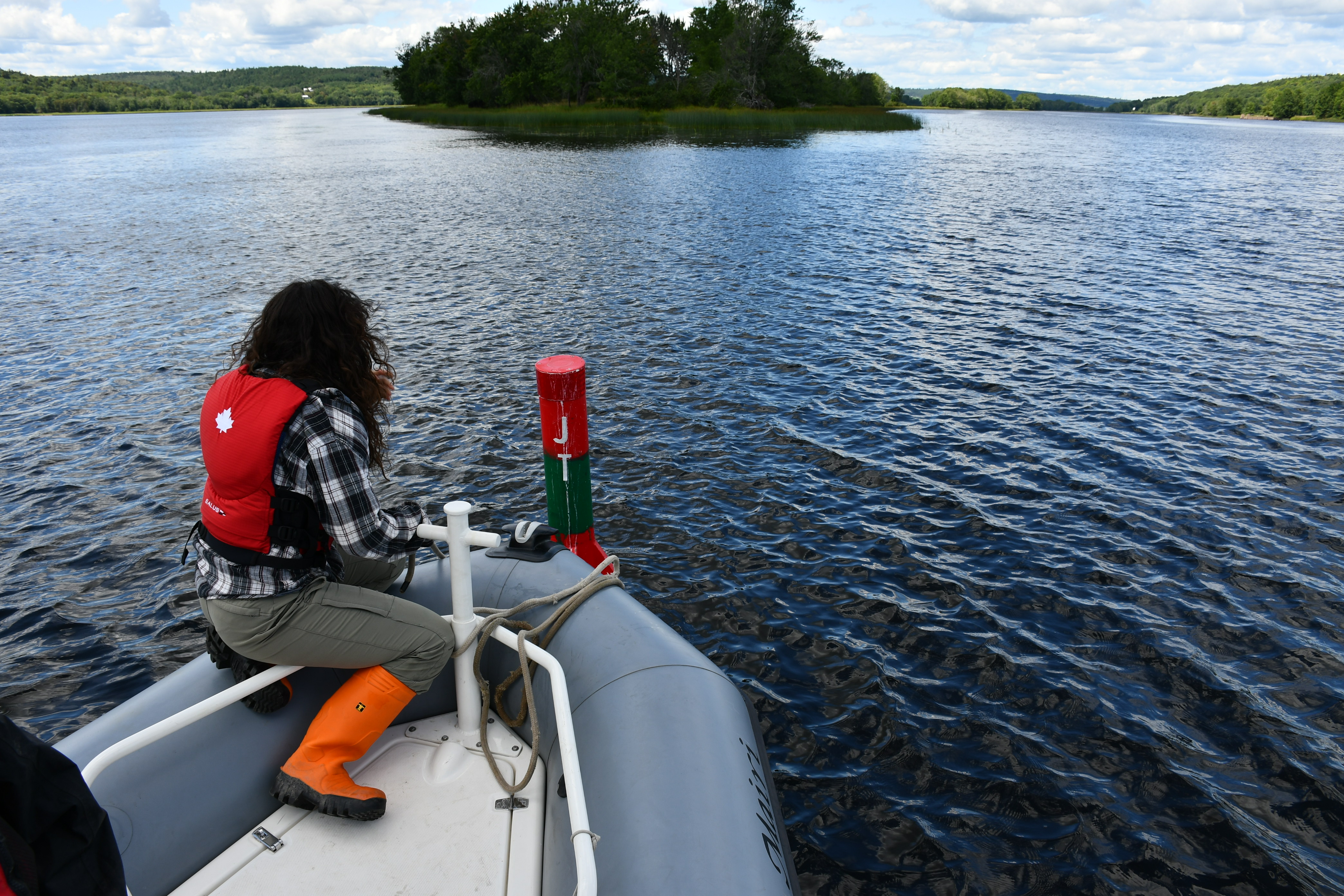
Scientists testing the water in the lower Saint John River in New Brunswick.
Photo: Fisheries and Oceans Canada
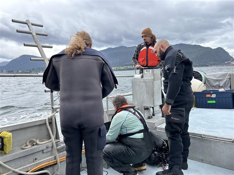
Scientists collecting data in the coastal waters near the Port of Prince Rupert, British Columbia.
Photo: Fisheries and Oceans Canada
As a result of the Coastal Environmental Baseline Program, each of the six areas is now more fully characterized across a range of ecosystem components. Detecting and measuring future change in each ecosystem can be benchmarked against these datasets. The following are examples of new data that can inform future, evidence-based decision making and planning at local and national levels. To access a full list of available baseline datasets visit Coastal Environmental Baseline Program - Projects, Open data and Publications.
Pacific Ocean
Port of Vancouver, British Columbia
Eulachon is a small and important schooling fish in the lower Fraser River. This small silver fish is preyed upon by other fish, marine mammals and seabirds, and its exceptionally high fat content makes it an important traditional food source for Indigenous peoples. New data insights were gained into Fraser River Eulachon by using egg mats to record spawning preferences and tiny acoustic transmitters to track migration patterns. This information can help inform future habitat protection and management.
Port of Prince Rupert, British Columbia
High-resolution aerial images were taken of the shoreline in Chatham Sound, the Prince Rupert Harbour, and near the outflows of the Skeena and Nass Rivers. The images are a new collection of data that provide information on how the shoreline is impacted by waves, how expansive algae is in certain areas and can identify various types of substrates. These images can be used to understand the environmental impacts of events such as oil spills.
Arctic Ocean
Iqaluit, Nunavut
A holistic or ecosystems-approach was used in Iqaluit to develop a first-ever, comprehensive overview of physical and biological features of its coastal ecosystem. Working closely with the Amaruq Hunters and Trappers Association and the local community, new data were collected including underwater noise, the structure of water columns, nutrients, water quality and contaminants, and the diversity and distribution of phytoplankton, zooplankton, invertebrates and fish. All this information taken together can provide a benchmark to help detect future ecological change.
Atlantic Ocean
Lower St. Lawrence Estuary, Québec
Seasons bring many changes to coastal ecosystems, such as varying available light and temperature, which affect plants and animals. For the first time, invertebrate behaviour and movement data were collected during the winter months in the coastal areas of the lower St. Lawrence estuary that will provide new insights into how the environment changes across seasons, and how different species adjust to the changes. There is now a better understanding specifically of how seasons impact the interaction between freshwater and saltwater in the area, and invertebrate distribution.
Port of Saint John, New Brunswick
With some of the highest tides in the world, having a complete understanding of the Port's physical ocean components is important. Detailed data were collected on surface currents, salinity, temperature, depth, clarity, water quality and underwater noise. Knowing this information, alongside information on the abundance and distribution of animal and plant species that were also collected, can help better inform conversation decisions.
Placentia Bay, Newfoundland and Labrador
Placentia Bay is home to a variety of important marine habitats and species. “Benthic” marine species are those that live on the bottom of the ocean, such as sea urchins and cold water corals, and these animals play a critical role in the way ecosystems function. A wide range of methods were used to create a new, benthic species library and document their habitat types including using remotely operated vehicles to capture images and sampling for environmental DNA (“eDNA”). These new insights can help identify areas which are important for biodiversity.
80+ Accessible Datasets
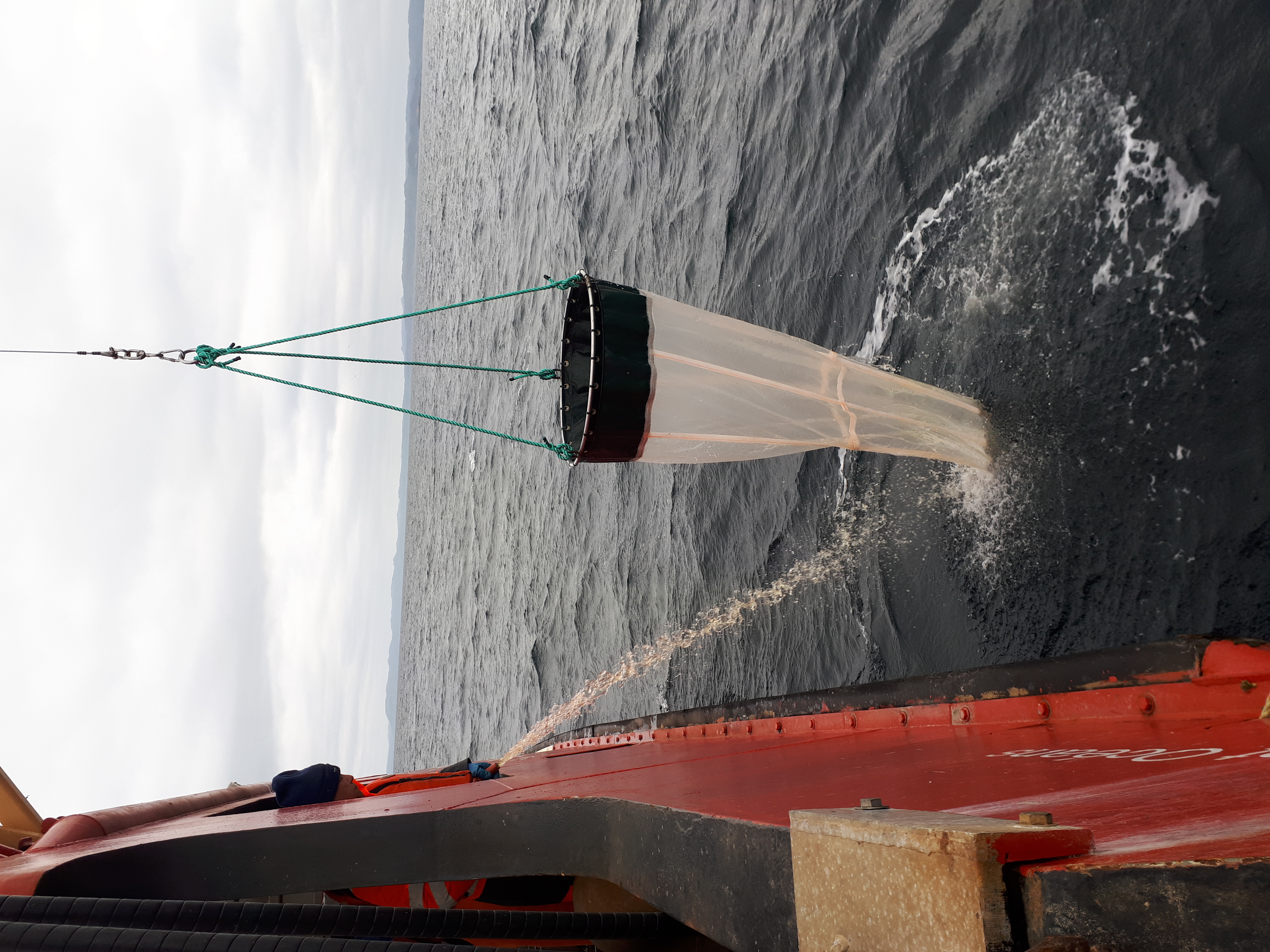
Sampling for plank-ton in Placentia Bay, Newfoundland.
Photo: Fisheries and Oceans Canada
Canadians can now access more than 80 new datasets for six distinct areas from across all three ocean coasts.
These data will be of particular interest to environmental non-government organizations, fisheries associations, researchers, scientists, port authorities, local governments and Indigenous communities involved in the management and planning of coastal ecosystem resources.
The data comply with international standards for scientific data management and stewardshipFootnote 1. The high-quality data are available to the public in a variety of formats (depending upon the dataset): tabular, textual, geospatial, photographic, video, acoustic and others.
Data were generated by partners as well as by Fisheries and Oceans Canada; more datasets are expected to be released over the coming years as analyses are completed.
Data collected by Fisheries and Oceans Canada are published on the Government of Canada's Open Data Portal.
Data collected by the program partners are owned by them and where possible, have been published on open data portals such as theSt. Lawrence Global Observatory or through other established data stewards and hubs.
To access the Coastal Baseline Environmental Program datasets, visit Coastal Environmental Baseline Program - Projects, Open data and Publications.
Partnering for Data
The Coastal Environmental Baseline Program was built through engagement with local communities, stakeholders and rights holders along Canada's Pacific, Arctic and Atlantic coasts - including Indigenous organizations, environmental non-governmental organizations, fisheries associations, academia, research centres and local government. This engagement enabled the consideration of diverse interests, values and local knowledge in the program's design and delivery.
A key component of the program was to determine which data should be collected in each ecosystem – see the illustration. Engagement activities helped to determine these components. Project partners, local communities, rights holders and stakeholders identified their interests and local data needs.
More than 150 projects were completed over five years. This was a result of funding external partner projects in addition to complementary Fisheries and Oceans Canada research in each coastal area, to ensure that data collection covered as many ecosystems components as possible and focussed on maximizing our baseline understanding of these coastal ecosystems.
Acknowledgements
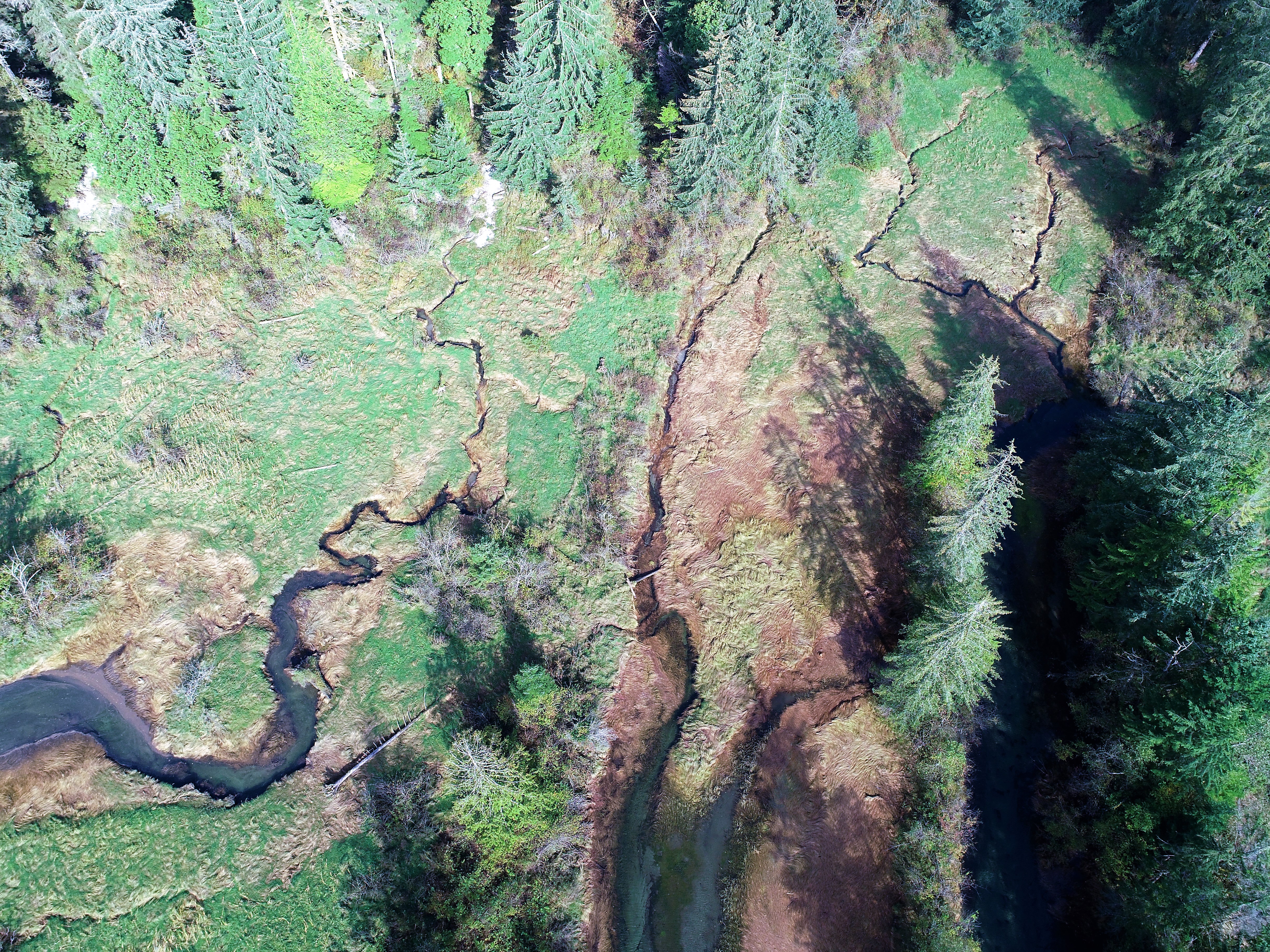
A coastal wetland near Vancouver, British Columbia.
Photo: Fisheries and Oceans Canada
While there are too many to fully acknowledge here, we wish to particularly thank all the communities and local organizations from across Canada who were engaged in the development and implementation of the Coastal Environmental Baseline Program. Their insight and support, combined with the collective efforts of the project partners and Fisheries and Oceans Canada teams, listed below, have enabled the success of this program.
National:
St. Lawrence Global Observatory
Port of Vancouver, Pacific region:
Coastal and Oceans Resources
DFO Coastal Environmental Baseline Program Pacific Team
DFO Ocean Sciences
DFO Ecosystem Sciences
DFO Stock Assessment and Research
DFO Aquatic Diagnostics, Genomics, and Technology
Ocean Wise Conservation Association
Tsawwassen First Nation
Tsleil-Waututh Nation
University of British Columbia
University of Victoria
Langara College
Port of Prince Rupert, Pacific region:
Coastal and Oceans Resources
DFO Coastal Environmental Baseline Program Pacific Team
DFO Ocean Sciences
DFO Ecosystem Sciences
DFO Stock Assessment and Research
Gitxaała Nation
Kitselas First Nation
Kitsumkalum Indian Band
Lax Kw'alaams First Nation
Metlakatla First Nation
North Coast Ecology Centre Society
Ocean Wise Conservation Association
Prince Rupert Port Authority
Skeena Fisheries Commission
University of Victoria
Iqaluit, Arctic region:
Arctic UAV Inc.
DFO Coastal Environmental Baseline Program Arctic Team
DFO Ecosystem Impacts
DFO Science and Marine Planning and Conservation
DFO Stock Assessment
Government of Nunavut
Memorial University of Newfoundland
Ocean Networks Canada Society
SmartICE Sea Ice Monitoring & Information Inc.
Université de Québec à Rimouski
University of Manitoba
University of Prince Edward Island
University of Waterloo
Lower St. Lawrence Estuary, Québec region:
Agence Mamu Innu Kaikusseht
DFO Coastal Environmental Basleine Program Québec Team
MPO Science démersales et benthiques
MPO Direction pélagiques et écosystémiques
MPO Direction des avis, information et soutien scientifiques
Explos-Nature
Interdisciplinary Centre for the Development of Ocean Mapping
Rive nord de l'estuaire ZIP Committee
Université de Québec à Chicoutimi
Université de Québec à Rimouski
Port of Saint John, Maritimes region:
Atlantic Coastal Action Program Saint John Inc.
DFO Coastal Environmental Baseline Program Maritimes Team
Eastern Charlotte Waterways Inc.
Fundy North Fishermen's Association
Huntsman Marine Science Centre
Maliseet Nation Conservation Council
McMaster University
Nature Conservancy of Canada
New Brunswick Federation of Naturalists Inc.
North Shore Micmac District Council - Anqotum Resource Management
Passamaquoddy Recognition Group Inc.
University of New Brunswick
Wolastoqey Nation in New Brunswick
Placentia Bay, Newfoundland and Labrador region:
Conservation Corps Newfoundland and Labrador
DFO Coastal Environmental Baseline Program Newfoundland & Labrador Team
DFO Environmental Science
DFO Aquatic Resources
Fish, Food and Allied Workers (FFAW/Unifor)
Humber Arm Environmental Association Inc.
Memorial University of Newfoundland
Newfoundland & Labrador Environmental Association Inc.
Northeast Avalon Atlantic Coastal Action Program Inc.
University of Manitoba
Photos © Fisheries and Oceans Canada. With thanks to photographers A. Devanney, B. Dupuis, L. Freeman, C. O'Laughlin, O. Rhoades and Pano Scrivanos/Inlailawatash.
Marine Life 2030
United Nations Decade of Ocean Science for Sustainable Development (2021-2030)
Access the 80+ datasets or learn more about the Coastal Environmental Baseline Program
Coastal Environmental Baseline Program - Projects, Open data and Publications
Contact us
FISHERIES AND
OCEANS CANADA
Communications Branch
200 Kent Street
Ottawa, ON, K1A 0E6
Telephone: 613-993-0999
Email: info@dfo-mpo.gc.ca
Website: https://www.dfo-mpo.gc.ca/science/partnerships-partenariats/research-recherche/cebp-pdecr/index-eng.html
- Date modified: