
Coastal Environmental Baseline Program
On this page
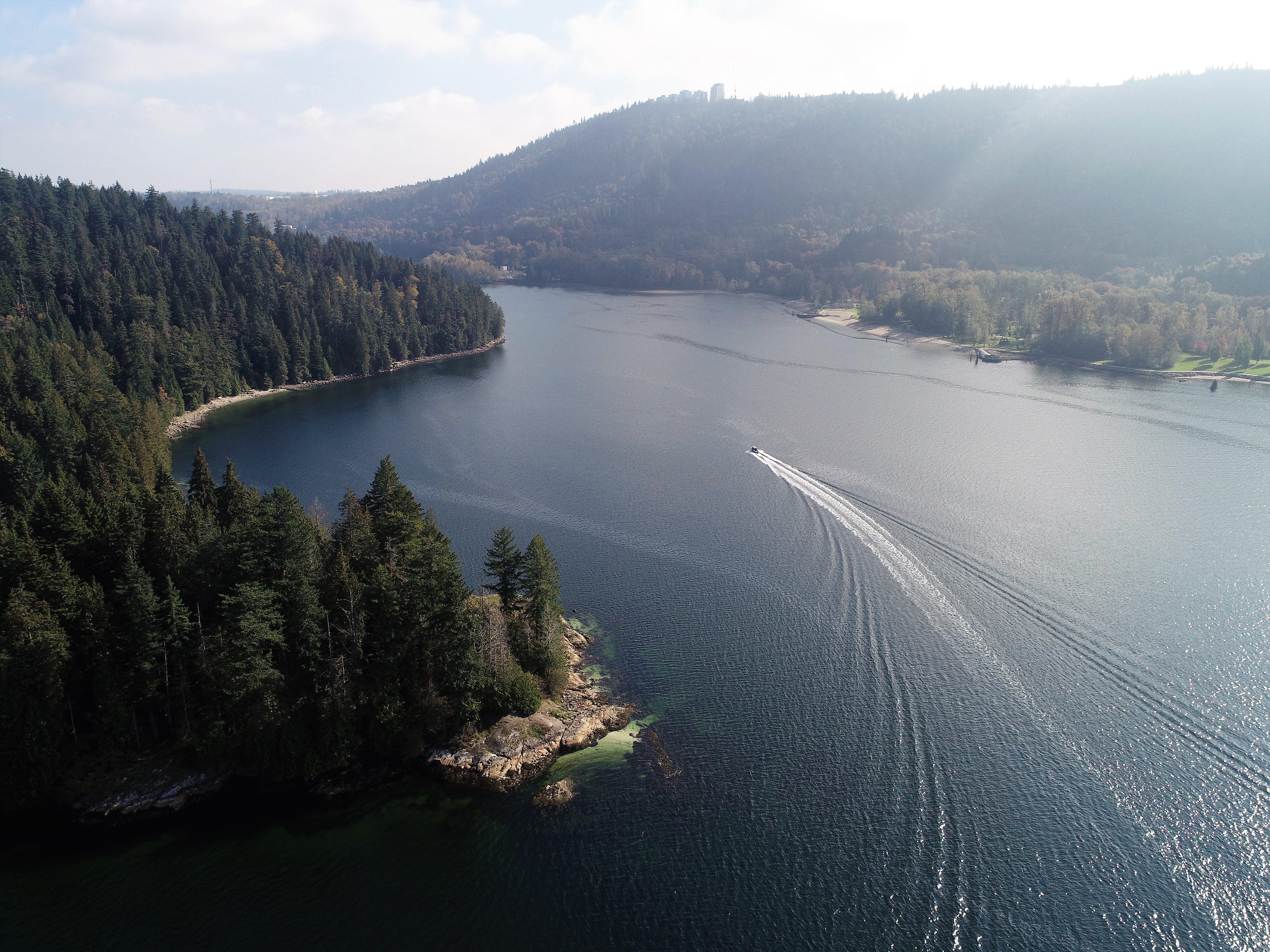
Belcarra, British Columbia. Photo: Fisheries and Oceans Canada.
We established the Coastal Environmental Baseline Program (Baseline Program) in 2017, as one of the initiatives under the Protecting the Marine Environment pillar of the Government of Canada’s Oceans Protection Plan. We contribute to coastal and waterway protection by providing funding for scientific activities that help us learn more about Canada’s coastal ecosystems.
Coastal ecosystems provide important habitat for species and essential ecosystem services both to local communities and the rest of Canada. These ecosystems are facing strong pressures, such as climate change, marine traffic and development. The more we know about these ecosystems, the better we can plan for and support coastal management.
Goals
The Baseline Program supports the collection of ecological data to describe the current state (baseline) of key coastal areas across Canada.
The data is collected by Fisheries and Oceans Canada scientists and a growing number of partners, including First Nations, Inuit, environmental non-government organizations, fisheries associations, academia and local governments.
The Baseline Program takes a collaborative approach to delivery through partner engagement and co-development of priorities for data collection.
Overview
As of 2024, the Baseline Program has undertaken 90 projects led by DFO scientists and has supported a further 142 projects with partners throughout Canada, providing an investment of more than $60 million towards coastal ecosystem science.
The projects consider a variety of physical and biological characteristics to better understand the current state of each coastal ecosystem.
Projects involve a variety of activities, including:
- field work
- performing laboratory analyses
- supporting technical training
- contributing to student stipends
- supporting local employment
- purchasing scientific equipment
- outreach and engagement activities
Data collected through the Baseline Program will be openly available and compatible with international standards. For access Baseline Program data visit Coastal Environmental Baseline Program - Projects, Open data and Publications.
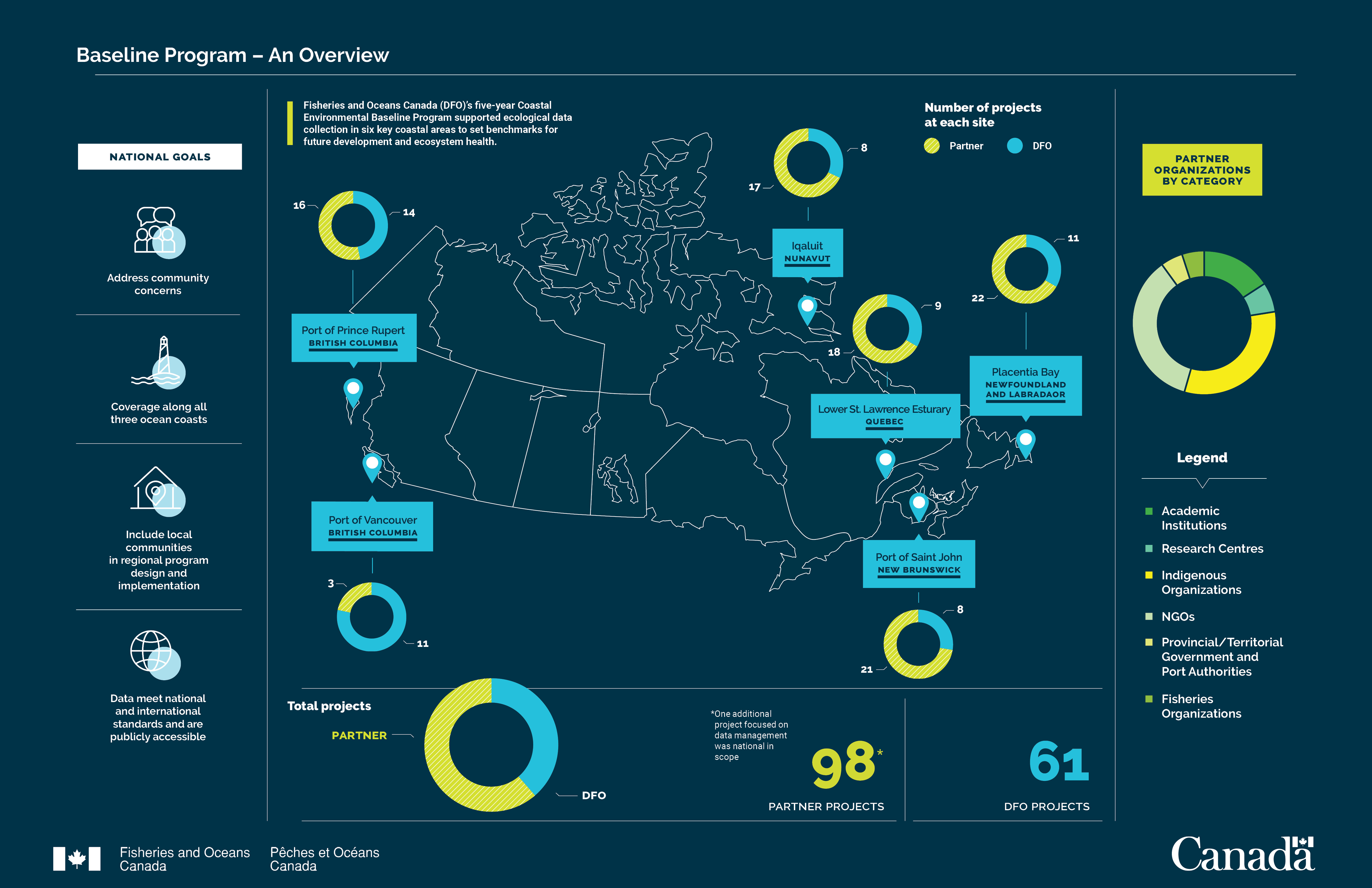
Infographic: Overview of the Coastal Environmental Baseline Program, it’s goals, project partners and locations.
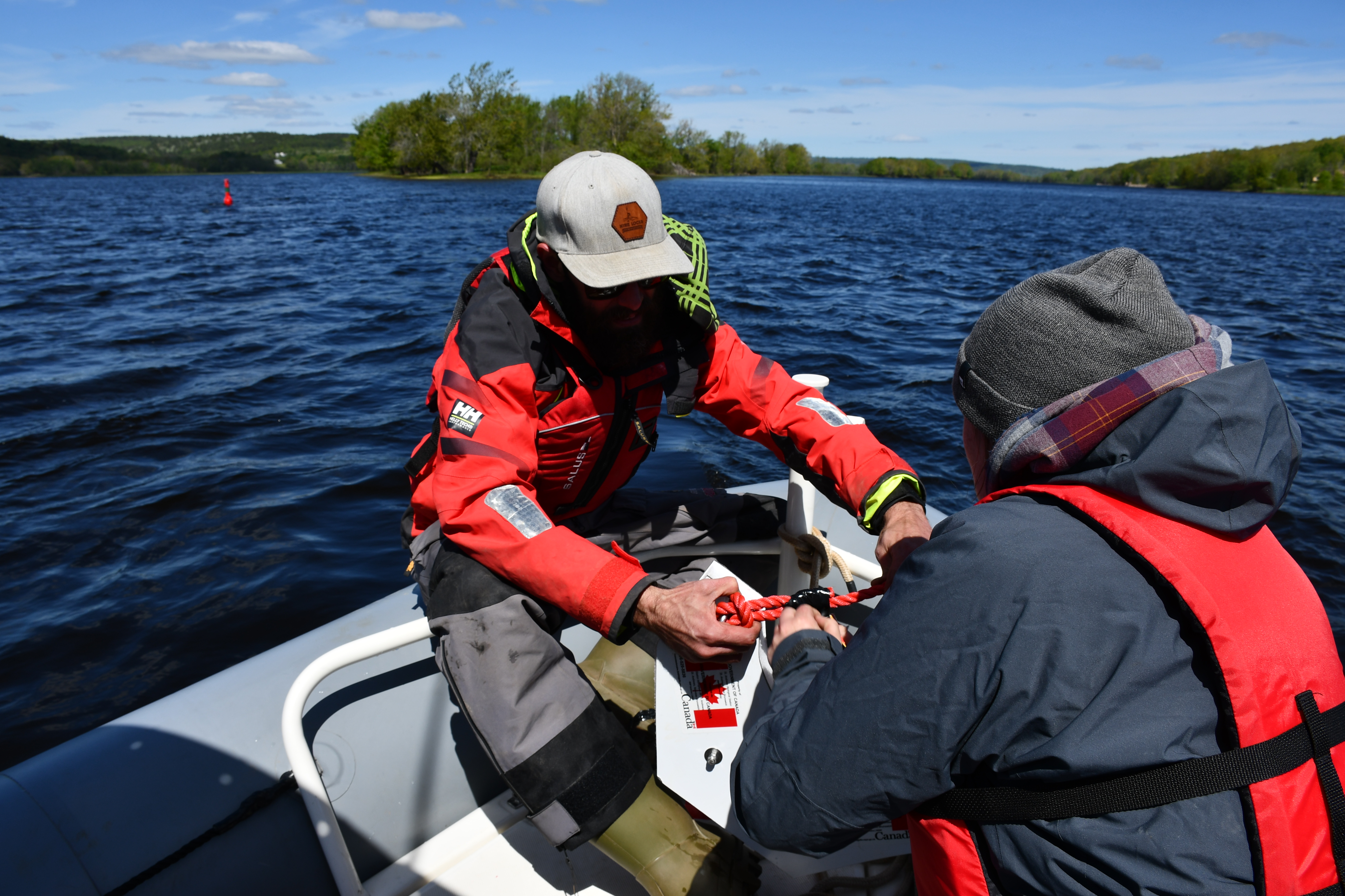
Two technicians taking water samples in the Port of Saint John, New Brunswick. Photo: Fisheries and Oceans Canada.
Projects (2018-2023)
The Baseline Program focused on six coastal ecosystems from 2018 to 2023. Find out more about projects at these key coastal sites:
- Placentia Bay, Newfoundland and Labrador
- Port of Saint John, New Brunswick
- Lower St Lawrence Estuary, Quebec
- Iqaluit, Nunavut
- Port of Vancouver, British Columbia
- Port of Prince Rupert, British Columbia
- National
A summary of the science undertaken and the results in these coastal ecosystems is available in the report Five Years of Coastal Science - The Coastal Environmental Baseline Program 2018-2023.
For more information, visit Introduction to the Baseline Program.
- Date modified: