
The Scotian shelf: an atlas of human activities
Co-editors
Heather Breeze
Tracy Horsman
Maps
Tracy Horsman
Heather Breeze
Stanley K. Johnston
Layout and Design
Francis Kelly
Writers
Heather Breeze
Scott Coffen-Smout
Derek Fenton
Tim Hall
Glen Herbert
Tracy Horsman
Paul Macnab
David Millar
Peter Strain
Philip Yeats
All rights reserved. No part of this information (publication or product) may be reproduced or transmitted in any form or by any means, electronic, mechanical, photocopying, recording or otherwise, or stored in a retrieval system, without prior written permission of the Minister of Public Works and Government Services Canada, Ottawa, Ontario, Canada K1A 0S5 or at Copyright.Droitdauteur@communication.gc.ca.
- Cat. No.
- Fs23-483-2005
Fs23-483/2005-PDF
Fs23-483/2005E-HTML - ISBN
- 0-662-69160-1
0-662-69170-9 (PDF)
0-662-40952-3 (HTML) - URL
- Fisheries and Oceans Canada
Published by:
Oceans and Coastal Management Division
Oceans and Habitat Branch
Fisheries and Oceans Canada, Maritimes Region
P.O. Box 1006
Dartmouth, NS B2Y 4A2
fax: (902) 426-3855
e-mail: essim@mar.dfo-mpo.gc.ca
DFO/2005-816
© Her Majesty the Queen in Right of Canada, 2005
Table of Contents
- Acknowledgements
- Introduction
- Reference Maps
- Jurisdictional and Political Boundaries
- Fisheries
- Introduction
- Fisheries Management Areas
- Groundfish Landings (1999-2003)
- Groundfish Landings by Gear Type (1999-2003)
- Seasonal Groundfish Landings (1999-2003)
- Cod, Haddock and Pollock Landings (1999-2003)
- Flatfish Landings (1999-2003)
- Halibut Landings (1999-2003)
- Redfish Landings (1999-2003)
- Silver Hake Landings (1999-2003)
- Herring Landings (1999-2003)
- Mackerel Landings (1999-2003)
- Bluefin Tuna Landings (1999-2003)
- Landings of Large Pelagic Species (1999-2003)
- Swordfish Landings (1999-2003)
- Albacore, Bigeye and Yellowfin Tuna Landings (1999-2003)
- Porbeagle, Mako and Blue Shark Landings (1999-2003)
- Crab Landings (All Species) (1999-2003)
- Snow Crab Landings (1999-2003)
- Crab Landings (Except Snow Crab) (1999-2003)
- Scallop Landings (1999-2003)
- Scallop Landings by Season (1999-2003)
- Offshore Clam Landings (1999-2003)
- Shrimp Landings (1999-2003)
- Offshore Lobster Landings (1999-2003)
- Special Management Areas
- Marine Traffic
- Oil And Gas Industry
- Other Activities
- Ocean Disposal And Marine Environmental Quality
Fisheries
Introduction
A variety of fishing activities occur in the Scotia-Fundy fisheries management region (the Scotian Shelf, Bay of Fundy and Gulf of Maine). Many of these activities have taken place for generations, such as fisheries for groundfish and coastal shellfish. Others are relatively new, such as fisheries for offshore clams and deep-sea crab. Many different gear types are used to catch a diversity of species, from sedentary clams to highly mobile tunas. These gears include otter trawl, seine, longline, gillnet, handline, rake, dredge, weir, trap, rod and reel, and harpoon. Vessel sizes also vary greatly, from small vessels used in coastal lobster fisheries to very large vessels used in offshore scallop and groundfish fisheries. More information on fishing gears and vessels can be found in the brochure “Atlantic Fishing Methods” published by Fisheries and Oceans Canada (1989).
Although groundfish fisheries have declined in importance over the last ten years, landings and landed value of invertebrate fisheries have increased (Fisheries and Oceans Canada 2004). The total value of commercial seafishery landings in the Scotia-Fundy region in 2003 was 788 million dollars, with more than 80 percent of that amount coming from invertebrate fishery landings (Fisheries and Oceans Canada 2005).
Management
Fisheries are managed using a combination of quotas, gear restrictions, seasons, area closures, and other restrictions related to size and other characteristics of the species sought. Different measures are used in different fisheries. For example, one fishery may use quotas while another may restrict the amount of gear that may be used. Another fishery may use both quotas and gear limits. Readers should be aware that the management measures described on the following pages are not complete and may change at any time. They should refer to integrated fisheries management plans, conservation harvesting plans, fishing license conditions, and variation orders for accurate and up-to-date information on fisheries management. Information is available through local Fisheries and Oceans Canada offices.
About the Fishery Maps
Source of information
The maps show commercial landings for the Scotian Shelf, Bay of Fundy and Georges Bank areas – NAFO Divisions 4V, 4W, 4X and the Canadian portions of 5Y and 5Z. Landings were combined for the period 1999-2003. Information on landings was taken from the ZIF (Zonal interchange format) and the MARFIS (Maritime Fishery Information System) databases. The information in these databases is maintained by Fisheries and Oceans Canada.
Methodology
For each of the maps showing fisheries landings, the Scotia-Fundy region was divided into units measuring two minutes by two minutes. At our latitude, this is approximately 3.6 kilometres (east-west) by 5.1 kilometres (north-south), with some variation. The boundaries of these two-minute cells were set to half-minute intervals so that the landings, recorded in the database at one minute intervals, are completely contained within the two-minute units. This means that landings are potentially recorded at four locations within each two-minute cell. The total landings reported for each two-minute cell for the entire five year period were summed. Thus, each sampling unit on the map may represent many fishing events that occurred over the five-year period.

Figure 1. Aggregating the fisheries landings.
Figure 1 is a fictional example showing a small portion of the Scotian Shelf divided into two-minute cells. In Figure 1a, each of the landings reported from that part of the Scotian Shelf is shown as a dot with the corresponding reported weight in kilograms beside it. In some cases, there are multiple landings corresponding to one dot, representing multiple fishing events reported for that latitude and longitude position. In Figure 1b, the sum of the landings for each rectangle is shown.
For each fisheries landings map, the two-minute cells were classified using five quantile breaks based on the sum of the landings within the cell. This means that there is the same number of cells in each category. The red cells have the highest reported landings (81-100 percentile) while the dark green cells have the lowest reported landings (0-20 percentile).
Readers should be aware that the breaks between the five different categories are different for each fishery. Thus, a red cell on one fishery map may have a much larger value than a red cell on another fishery map. For the maps showing different seasons in a fishery, quantile breaks were first assessed for the five-year period as a whole. The same divisions were then used for each season, making it possible to show how seasonal catches are distributed and how they contribute to the total annual catch.
Landings Information and Management Measures
Quantile breaks are a useful way of portraying landing and fishing effort information over the entire study area. This information cannot be used to interpret fish distribution, however, since various management regimes, which may be different across the region, will affect both fish landings and fishing effort. For that reason, we have included descriptions of some of the basic management measures for each fishery and have shown the management boundaries most commonly used in each fishery. However, other management lines and boundaries may also be used for fisheries management.
Errors and inaccuracies
The fisheries landings portrayed on maps in this section represent hundreds of thousands of reports of fishing activities. There are opportunities for errors to enter the fisheries landings databases, both reporting errors (e.g., the wrong position is recorded in a logbook or monitoring report) and data entry errors (e.g., the position is incorrectly entered into the electronic database). These errors are not surprising in a database of this size and they do not affect the general trends that are portrayed. However, as a result the reader may notice low landings reported from unlikely areas. For example, there are some sea scallop landings shown at depths of 2000 metres on the slope, a depth where there is no ongoing bottom fishery. We have not attempted to remove the landings that are probably erroneous, and the reader is encouraged to interpret the maps in light of the information on the fishery and its management that is provided.
As a further caution in interpreting the maps, only one point - one latitude and longitude position - has been used for each reported landing. However, fishing gear may cover a very large area that goes well beyond the reported position. For example, a trawler may cover several kilometres with one tow while a longliner may set a line of hooks that travels many kilometres from the starting position. At the scale of the Scotian Shelf, using only a single position to represent a fishing activity is not a big drawback. Nonetheless, the patterns shown in the subsequent maps should be considered general patterns of activity and not an absolute determination of where fishing does and does not occur.
Fisheries and Oceans Canada. 1989. Atlantic Fishing Methods. Underwater World Series. Ottawa: Communications Directorate, Department of Fisheries and Oceans.
Fisheries and Oceans Canada. 2004. Commercial Landings Seafisheries. Website. http://www.dfo-mpo.gc.ca/stats/commercial/land-debarq/sea-maritimes/s2004aq-eng.htm (16 February 2005).
Fisheries and Oceans Canada. 2005. 2003 Value of Atlantic Coast Commercial Landings, by Region. Website. http://www.dfo-mpo.gc.ca/stats/commercial/land-debarq/sea-maritimes/s2003av-eng.htm (15 March 2005).
Fisheries Management Areas

Fisheries Management Areas

Legend: Fisheries Management Areas
NAFO Divisions, Subdivisions, and Unit Areas
The Convention Area of the Northwest Atlantic Fisheries Organization (NAFO) encompasses most of the Northwest Atlantic. It has been divided into divisions and subdivisions that are used to manage most groundfisheries off Nova Scotia and New Brunswick. The Maritimes Region of Fisheries and Oceans Canada corresponding to divisions 4V, 4W, 4X and parts of 5Y and 5Z. 4VS and 4VN are subdivisions of 4V.
The boundaries of the NAFO Convention Area, Divisions and Subdivisions are based on those used by NAFO’s predecessor, the International Commission for the Northwest Atlantic Fisheries (ICNAF). The ICNAF area was originally divided into geographic units to collect fisheries statistics and track the status of fish stocks. Groundfish were the primary stocks of interest, although other species were included in the convention. A description of how these geographic areas were originally determined can be found in Halliday and Pinhorn (1991). The divisions came to be used for management and their use has spread to fisheries other than groundfish. Management measures related to invertebrate and pelagic fisheries may use the NAFO Divisions instead of or in addition to fishing areas specific to that fishery.
Smaller areas within the NAFO Divisions and Subdivisions are known as unit areas, subareas or statistical areas. For example, 4Wf is a unit area of NAFO Division 4W. The unit areas are not part of the NAFO Convention but are used by Canadian scientists and fisheries managers to track fisheries and stock status in geographic units smaller than the NAFO Divisions. The unit areas are also used for fisheries management measures.
Atlantic Fishery Regulations (1985)
The Atlantic Fishery Regulations (1985), under the Fisheries Act, provide management measures and delineate management areas for many fisheries off the Atlantic coast of Canada, from the Canada-U.S. international boundary to Ungava Bay. The NAFO Divisions are included in the regulations, as are other fishing areas, such as Herring Fishing Areas, Crab Fishing Areas, Lobster Fishing Areas, Mackerel Fishing Areas and Shrimp Fishing Areas. These fishing areas are not shown on the map opposite, but are shown on the maps pertaining to those species.
Halliday, R.G. and A.T. Pinhorn. 1990. The delimitation of fishing areas in the Northwest Atlantic. Journal of Northwest Atlantic Fishery Science 10: 1-37.
Groundfish Landings (1999-2003)

Groundfish Landings (1999-2003)

Legend: Groundfish Landings (1999-2003)
This map shows landings of the species traditionally considered to be “groundfish” including well-known commercial species such as cod, haddock, pollock, flatfishes (e.g., yellowtail, witch and winter flounders, and American plaice), silver hake, and redfish, and lesser known species such as white hake, cusk, skate, monkfish and sculpin. The map shows landings both from directed groundfish fisheries and from bycatch in other fisheries. Thus, there are very low landings from areas not known as traditional areas for the groundfish fishery, such as the slope of the shelf. Please refer to the “Introduction: Fisheries” section for more information on the portrayal of the landings.
Most groundfish are caught by mobile gear (otter trawl and other types of trawlers), with longline vessels landing the second highest proportion of the groundfish landings. The pie charts show the proportion landed by gear type in each NAFO area. Gear types that land less than 1 percent of the catch are grouped with “other.”
The management line dividing NAFO Division 4W from 4X is of great importance as directed fisheries for cod and haddock on the east side of the line - in other words, in 4W and also further east in 4V - have been closed since 1993. It is permitted to catch small amounts of these species as bycatch in the groundfish fisheries that remain open. The closure of the cod and haddock fisheries in 4VW resulted in profound changes in the industry. Many people and businesses left the fishing industry. For others, fisheries for invertebrates such as crab, scallop, and surf clam have become more important than the traditional groundfish fisheries.
In addition to the management areas shown here, time and area closures are in place for some groundfish fisheries. Some of the longer-standing time and area closures are discussed in more detail on the pages pertaining to specific fisheries.
Groundfish landings by Gear Type (1999-2003)

Groundfish landings by Gear Type (1999-2003)

Legend: Groundfish landings by Gear Type (1999-2003)
This map shows landings of the same species as the previous map; however the landings have been divided into the main gear types used in the groundfish fishery: otter trawl, longline, handline and gillnet. The same categories of landings have been used for all four maps to allow comparisons to be made.
While there is much overlap in the areas used by the different gears, there are some notable differences. Otter trawl and longline use are fairly widespread on the shelf, with the relative lack of fishing activity on the eastern shelf a reflection of the moratorium on key groundfish species in that area. Longliners make extensive use of the shelf edge and the deeper channels and have few landings from the deep basins of the central shelf. Conversely, trawlers report high landings from the central shelf basins due to the silver hake fishery carried out using that gear type in that area.
Most handline and gillnet landings are from the shelf off southwestern Nova Scotia and in the Bay of Fundy. Handline landings are grouped near the coast. Gillnet landings are more scattered, with few areas reporting landings. However, many of those areas do have relatively high landings, suggesting more effort is made in a few important areas.
Seasonal Groundfish Landings (1999-2003)

Seasonal Groundfish Landings (1999-2003)

Legend: Seasonal Groundfish Landings (1999-2003)
Groundfish are caught in all seasons of the year in the region. However, different areas are more or less important depending on the season of the year. The seasonal patterns reflect the seasonal movements of fish, management regulations, patterns of activity in other fisheries, and weather conditions. Each seasonal map uses the same categories, allowing landings from one season to be compared with another.
Some groundfish fisheries run year-round, with higher catches occuring at certain times of year. In the summer (July to September), fishing activity is relatively widespread, particularly on the western Scotian Shelf and in the Bay of Fundy where fisheries for cod and haddock are open. During the winter (January to March), groundfish fisheries on Georges Bank are closed. The landings shown on the map are bycatch from other fisheries, such as the scallop and herring fisheries; however, current regulations no longer allow these fisheries to land any groundfish bycatch. Weather conditions and ice cover restrict the fishery in 4VN (Sydney Bight and area) in winter and other areas are more important during that time of year.
The redfish fishery focuses on the main part of the Laurentian Channel through the summer and on the Laurentian Channel near the shelf edge in the fall (October to December) and winter. High groundfish landings are reported from the central shelf basins year-round, likely due to the silver hake fishery.
During the fall, relatively few landings are reported in coastal areas. There is a lobster fishery off southwestern Nova Scotia and in the Bay of Fundy that opens in the fall (mid to late November in most areas). Groundfish fishers with lobster licenses often switch to lobster at this time. This lobster fishery usually remains open until sometime in May. Off eastern Nova Scotia, including Cape Breton, there is a spring lobster fishery (usually late April or early May to the end of June) that involves fishers in that area.
Cod, Haddock and Pollock Landings

Cod, Haddock and Pollock Landings
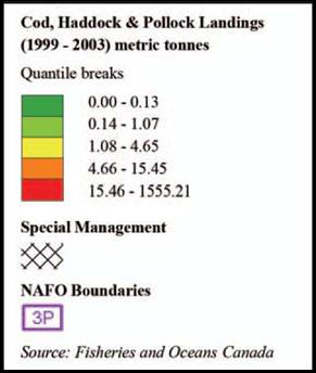
Legend: Cod, Haddock and Pollock Landings
Cod, haddock and pollock were traditionally the three groundfish species of importance caught off Nova Scotia. Landings of these species have declined in most areas in the last two decades and other species have become more important. With directed fisheries for cod and haddock closed on the eastern Scotian Shelf (NAFO Divisions 4VW)Footnote 1, landings of cod, haddock and pollock on the western Scotian Shelf are much higher than on the eastern Scotian Shelf. The pollock fishery on the eastern Scotian Shelf remains open; however, little effort is made to fish for pollock in that area due to the closures for the other two species. In many parts of the region, fishers catch these three species together. Ensuring that appropriate proportions of the three species are caught is an important concern for fishers and managers.
Fisheries for cod, haddock and pollock occur mainly on the large fishing banks and in the Bay of Fundy. The fishery is conducted using mobile gear (otter trawl) and fixed gear (longline, handline and gillnet). Parts of Browns and Georges Bank are closed at certain periods of the year to protect spawning haddock. In NAFO Division 4W, an area encompassing Western and Emerald Bank has been closed to groundfish fishing using mobile gear since 1987 and to all groundfish gears since 1993. This closure is to protect a nursery area for juvenile haddock.
There are restrictions on fishing in the Gully Marine Protected Area (MPA), the Lophelia Coral Conservation Area and the Northeast Channel Coral Conservation Area. The restrictions in the coral conservation areas are to protect cold-water coral communities, while restrictions in the Gully MPA are to protect both coral communities and other species and habitats. The location of the coral conservation areas and the marine protected area can be found on the map entitled “Special Management Areas: Marine Biodiversity.”
Flatfish Landings (1999-2003)

Flatfish Landings (1999-2003)

Legend: Flatfish Landings (1999-2003)
Several species of flatfish are managed under the same TAC (total allowable catch). In NAFO Divisions 4X5Y, these species are yellowtail flounder, American plaice, winter flounder and witch flounder (grey sole). In Divisions 4VW, the species are American plaice, yellowtail flounder, and witch flounder. On Georges Bank (NAFO Division 5Z), yellowtail flounder is the primary species caught and this stock is managed separately.
The flatfish TAC in 4VWX and 5Y has been combined because in the past, landings of the different flatfish species were not always reported separately. Landings from the four species mentioned above as well as from unspecified flounder are shown on this map. Landings reported as unspecified flounder made up 30 percent of the flatfish landings in 2002 in NAFO Divisions 4VW (DFO 2002). Comparisons with earlier logbook data indicate that these “unspecified” flounders are usually one of the four species mentioned above (Fowler and Stobo 2000).
In general, the fishing banks are important for the yellowtail and plaice fisheries, while deeper areas are more important for witch flounder. Winter flounder is uncommon on the eastern shelf and on the western shelf it is concentrated in only a few areas. Historically, the eastern Scotian Shelf (4VW) was more important than the western Scotian Shelf (4X), not including Georges Bank, for yellowtail and plaice fisheries. However, a general reduction in the groundfish fishery on the eastern shelf and a declining abundance of flatfish have resulted in low catches in the east. The yellowtail fishery on the eastern shelf has not been very active in recent years (including the years shown on the map) but was formerly concentrated on Sable Island Bank and the eastern part of Banquereau. American plaice is fished primarily in Sydney Bight and on Banquereau (DFO 2002). Farther west, Georges Bank is an important area for the yellowtail flounder fishery.
No flatfish fishing is allowed in the juvenile haddock nursery area (shown), the Lophelia Coral Conservation Area, the Gully Marine Protected Area and the Northeast Channel Coral Conservation Area (more information on the conservation areas and the marine protected area can be found with the map entitled “Special Management Areas: Marine Biodiversity”). There are also restrictions on fishing in the haddock spawning areas (shown).
G.M. Fowler and W.T. Stobo. 2000. Status of 4VW American Plaice and Yellowtail Flounder. CSAS Research Document 2000/144 (CSAS resdocs - 2000/144) .
Halibut Landings (1999-2003)

Halibut Landings (1999-2003)

Legend: Halibut Landings (1999-2003)
The halibut fishery is conducted separately from the fisheries for other flatfish. While other species of flatfish are caught mainly by mobile gear (largely otter trawl but also Danish and Scottish seine), halibut are mostly caught by bottom longline. This map shows commercial landings for the five-year period 1999-2003, but does not include landings from the commercial index survey. Survey landings total 100 tonnes or less each year over the entire survey area, which includes both the Scotia-Fundy region and the Grand Banks (Zwanenburg and Wilson 2000).
Halibut is found in deeper waters than other commercial flatfish species and the fishing grounds used are somewhat different. The deep channels and the area along the edge of the shelf have high landings. Other areas of hard bottom are also important for the fishery.
There are restrictions on fishing for halibut in the haddock spawning areas and the haddock nursery area (shown on map). As well, halibut fishing is not permitted in the Lophelia Coral Conservation Area and there are restrictions in the Northeast Channel Coral Conservation Area and the Gully Marine Protected Area (MPA). The map on “Special Management Areas: Marine Biodiversity Protection” shows the location of the conservation areas and the MPA.
Zwanenburg, K.C.T. and S. Wilson. 2000. The Scotian Shelf and Southern Grand Banks Atlantic halibut (Hippoglossus hippoglossus) survey - Collaboration between the fishing and fisheries science communities. Theme session on cooperative research with the fishing industry: Lessons learned. 2000 ICES Annual Science Conference, 27-30 September 2000, Brugge, Belgium.
Redfish Landings (1999-2003)

Redfish Landings (1999-2003)

Legend: Redfish Landings (1999-2003)
Redfish are caught along the shelf edge, in the Northeast and Laurentian channels, and in other deep areas of the Scotian Shelf and Bay of Fundy. The directed fishery is carried out by otter trawl. There are three different redfish management areas in the Maritimes Region, reflecting what is believed to be the stock structure. The management areas are different than the NAFO Divisions used in most other groundfish fisheries. Two of the management areas include parts of other DFO administrative regions.
For most of the year, the Unit 1 redfish management area is the Gulf of St. Lawrence. However, during the winter, fish from this stock move to the Laurentian Channel area, and NAFO Subdivision 4VN and the adjacent 3PN are part of the Unit 1 management area in the winter (January to May). There has been no directed fishery on this stock in the last few years as this area is under moratorium.
The Unit 2 redfish management area includes parts of the eastern Scotian Shelf (4VS and 4Wfg) and subdivision 3PS south of Newfoundland. 4VN is also part of this management area from June to December as is the 3PN subdivision near the Gulf of St. Lawrence. The landings shown in 4VN are from the summer and fall fishery on the Unit 2 redfish stock.
Unit 3 redfish includes most of 4W (4Wdehkl) and all of 4X. There is a special management area in this unit known informally as the “Bowtie.” The Bowtie is closed to fishing using small mesh gear (square mesh less than 130 millimetres) to protect small redfish. Small mesh gear is also not permitted in waters shallower than 50 fathoms (91 metres), in the Bay of Fundy north of 43°30', and in NAFO Area 5 (5Y and 5Z). As well, the haddock spawning area on Browns Bank has an extended closed period to redfish fishing from January 1 to June 30. The fishery uses small mesh gear and many of the restrictions are to prevent bycatch of small fish from other species.
Silver Hake Landings (1999-2003)

Silver Hake Landings (1999-2003)

Legend: Silver Hake Landings (1999-2003)
The directed fishery for silver hake is restricted to three areas: along the shelf edge and slope, and in Emerald and LaHave basins (see the map for the defined fishing areas). These defined windows are due to the small mesh used in the silver hake fishery and are meant to ensure that few other groundfish species are caught. A separator grate is also used to prevent catches of other groundfish. The grate allows the smaller silver hake to enter the net while larger species such as cod, haddock and pollock exit through the escapement window at the top. The fishery is carried out by mobile gear using an otter trawl. The fishery generally operates year-round with summer months being least active.
In the past, most of the silver hake fishery took place along the shelf edge and was conducted by foreign vessels. Since about 1995, the fishery has been conducted by domestic vessels and the focus has been on the two basins of the central shelf. A small test fishery in Georges Basin, in 4X north of Georges, started in 1999.
Herring Landings (1999-2003)

Herring Landings (1999-2003)

Legend: Herring Landings (1999-2003)
Management of the herring fishery uses both the Herring Fishing Areas (HFAs) delineated in the Atlantic Fishery Regulations (1985) and portrayed on the opposite page, and the NAFO Divisions. The embayment lines and the 25-mile line are also important management lines used to separate the offshore purse seine fishery from the nearshore fisheries, and to protect spawning fish.
The herring fishery takes place at different times of the year in different areas. The fishing season is year-round off southwest Nova Scotia (west of Baccaro Point, 65°30' west longitude) and in the Bay of Fundy; however, most fishing takes place at times and in areas with aggregations of feeding, overwintering, and spawning fish. The fishery in Chedabucto Bay, off Chebucto Head and off eastern Cape Breton is a winter fishery running from November to March. There is no fishery in the portion of HFA 20 that is in 4VS (see map).
Some areas are periodically closed to fishing to protect aggregations of spawning fish. The Trinity Ledge area off southwest Nova Scotia is usually closed from mid-August to mid-September, with some variation in dates each year.
Area 4VN (HFAs 17 and 18) is an area where different herring stocks from the Scotian Shelf, the Gulf of St. Lawrence and the Bras d’Or Lakes mix. It is managed separately from other areas of the Scotian Shelf. Seasons have been set in the inshore and offshore areas of 4VN based on the time periods that particular stocks are known to be present or absent.
Mackerel Landings (1999-2003)

Mackerel Landings (1999-2003)

Legend: Mackerel Landings (1999-2003)
The Mackerel Fishing Areas (MFAs) outlined in the Atlantic Fishery Regulations (1985) are the primary management areas for the mackerel fishery in Atlantic Canada. There are also trapnet management zones (not shown) for the nearshore trapnet fishery.
Off Nova Scotia most mackerel are caught in traps, largely in St. Margaret's and Mahone bays. Landings by trap are reported by statistical unit area and trapnet management zone, not by latitude and longitude. For that reason, this map looks different than the other fisheries maps. The colour-coded areas represent landings by gear other than trap, and the shaded areas near the coast represent trapnet fishing areas with high landings. The gillnet, weir and trapnet fishery takes place throughout the region from April to November while the mobile gear fishery occurs year-round off Cape Breton (MFAs 17, 18, 19). Mackerel is also caught by some of the purse seiners that are engaged in the herring fishery.
Mackerel is an important bait fish and is regularly caught by fishers engaged in other fisheries. Statistics for the bait fishery are not kept. More information on the fishery can be found in Grégoire et al. (2004).
Grégoire, F., C. Lévesque, J. Guérin, J. Hudon and J. Lavers. 2004. Atlantic mackerel (Scomber scombrus L.) fishery and biology in NAFO subareas 3 and 4 in 2003. Canadian Science Advisory Secretariat Research Document 2004/079 (CSAS resdocs - 2004/079) .
Bluefin Tuna Landings (1999-2003)

Bluefin Tuna Landings (1999-2003)

Legend: Bluefin Tuna Landings (1999-2003)
The bluefin tuna fishery is conducted in the summer and fall, when tuna are found in the waters off Nova Scotia. Landings can vary greatly from year to year, as bluefin tuna distribution is variable and dependent on water temperature and other oceanographic conditions. Total allowable catches (TACs) for bluefin tuna are set by the International Commission for the Conservation of Atlantic Tunas (ICCAT). The fish are valuable and landings are strictly monitored. License holders must purchase tags in advance of catching tuna. All tuna landed, both through directed fishing and as bycatch, must have a valid tag attached to the fish.
There are many different gear types involved in the fishery. Directed bluefin tuna fishing is carried out using angling (rod and reel), tended line, trap, and electric harpoon gear. There are restrictions on gear use in some areas. For example, in NAFO sub-unit area 4Wd, fishing is permitted using angling gear only.
Some bluefin tuna are taken in the St. Margaret’s Bay mackerel trap fishery. Limits in this fishery are controlled and tags must be purchased for all tuna harvested. Bluefin tuna are also caught as bycatch in the swordfish and other tunas longline fishery. Bycatch in this fishery is limited to the number of valid tuna tags in the license holder’s possession.
There is no bluefin tuna fishing permitted in NAFO Subdivision 4VN. The Hell Hole (Northeast Channel) is an important area for the fishery, as are certain areas near the coast of Nova Scotia, such as Emerald Basin.
Landings of Large Pelagic Species (1999-2003)

Landings of Large Pelagic Species (1999-2003)

Legend: Large Pelagic Landings (1999-2003)
Most of the fishery for large pelagic species (albacore, bigeye and yellowfin tunas, swordfish, and porbeagle, mako and blue sharks) takes place along the shelf edge and over deeper areas of the western Scotian Shelf and the Gulf of Maine. Bluefin tuna landings are not included on this map, as that fishery is conducted quite differently from the fishery for other large pelagic species.
Directed fishing for albacore, bigeye and yellowfin tunas and swordfish is carried out using pelagic (floating) longline gear in the commercial fishery. Shark species are caught as bycatch in this fishery. There is also a small directed fishery for porbeagle and blue sharks. The recreational fishery for sharks is largely hook and release. There is a swordfish harpoon fishery that takes place off southwestern Nova Scotia and to a lesser extent in other coastal areas.
Tunas, sharks and swordfish are wide-ranging species and stock management covers a much larger area than for other species. More details on management are provided in the sections corresponding to each species or species grouping.
Swordfish Landings (1999-2003)

Swordfish Landings (1999-2003)

Legend: Swordfish Landings (1999-2003)
The directed swordfish fishery takes place mainly from June to September, when swordfish are found in Canadian waters. Swordfish are highly migratory and many countries fish the same stock. Total Allowable Catches (TACs) for swordfish are set by the International Commission for the Conservation of Atlantic Tunas (ICCAT).
Pelagic (floating) longline gear is used to catch most of the Canadian quota, while the swordfish harpoon fishery accounts for up to 10 percent of annual landings. In the Scotia-Fundy region, the harpoon fishery occurs mostly in deeper waters of the central and western Scotian Shelf. The longline fishery is largely conducted along the slope, part of a continuum of swordfish fishing that occurs from Georges Bank to the Flemish Cap off Newfoundland, both inside and outside Canada’s exclusive economic zone.
Fishing Zone 1 (Gulf of St. Lawrence) and Fishing Zone 2 (Bay of Fundy) are closed to the swordfish longline fishery. The area west of 65°30'W may be closed until August to minimize bycatch of other large pelagic species. The longline fishery is not permitted to fish inside the Hell Hole (Northeast Channel) from July to November to reduce levels of bluefin tuna bycatch.
There is a seasonal closure in place to protect large female swordfish. The Broodstock Closure Area is closed to the harpoon fishery after September 1 each year. A smaller area within the Broodstock Closure Area, known as the Bluefin Exclusion Zone, is closed to longline fishers after August 1 to prevent bycatch of bluefin tuna.
Albacore, Bigeye and Yellowfin Tuna Landings (1999-2003)

Albacore, Bigeye and Yellowfin Tuna Landings (1999-2003)

Legend: Albacore, Bigeye and Yellowfin Tuna Landings (1999-2003)
The fishery for albacore, bigeye and yellowfin tunas is known to fishers and managers as the “other” tuna fishery to distinguish it from the bluefin tuna fishery. It takes place mainly from September to November, when these fish are present in our waters. Like swordfish, tunas are highly migratory and many countries fish for these species. Catch limits are set by the International Commission for the Conservation of Atlantic Tunas (ICCAT).
A directed fishery for the three tuna species began in the mid-1990s. Previously, these species were caught as bycatch in the swordfish longline fishery. The fishery is conducted using pelagic (floating) longline gear. Some fishers use trolling gear, a method which uses multiple lines with lures and hooks towed behind a fishing vessel. The fishery occurs along the shelf edge and slope. Off Nova Scotia, the slope of the western Scotian Shelf is a more important area for this fishery than the slope of the eastern Scotian Shelf (Stone 1998).
The same management areas are in place as for the swordfish longline fishery. Fishing Zone 1 (Gulf of St. Lawrence) and Fishing Zone 2 (Bay of Fundy) are closed to the fishery. Fishing is not permitted inside the Hell Hole (Northeast Channel) from July to November to reduce levels of bluefin tuna bycatch. An area along the coast of Nova Scotia, known as the Bluefin Exclusion Zone, is closed from August 1 to the end of the season to prevent bluefin bycatch.
Stone, H. 1998. Fish and fisheries: Large pelagic fisheries. In: W.G. Harrison and D.G. Fenton, eds. The Gully: A scientific review of its environment and ecosystem. Canadian Stock Assessment Secretariat Research Document 98/83. pp. 258-282 (CSAS resdocs - 1998/083) .
Porbeagle, Mako and Blue Shark Landings (1999-2003)

Porbeagle, Mako and Blue Shark Landings (1999-2003)

Legend: Porbeagle, Mako and Blue Shark Landings (1999-2003)
Pelagic sharks (largely porbeagle, blue, and shortfin mako) were traditionally and are still caught as bycatch in the swordfish longline fishery. A directed fishery for shark started in the early 1990s that targeted porbeagle and blue sharks. Porbeagle shark is the preferred species. Short-fin mako is retained as bycatch as are other species of pelagic shark which are caught in smaller numbers.
The commercial fishery is largely conducted using pelagic (floating) longline gear, although it can also be conducted using angling (rod and reel) gear and tended line. Pelagic sharks continue to be caught as bycatch in the bluefin tuna, swordfish and other tunas longline fisheries. The recreational fishery is carried out by rod and reel and is a hook and release fishery, except during shark derbies authorized by Fisheries and Oceans Canada. The recreational fishery, targeting blue shark, is becoming more popular.
The commercial fishery occurs along the slope. Catches are also taken in the deep basins of the shelf and Gulf of Maine.
There are restrictions on where and when fishing may occur. Most of these measures are to prevent bycatch of bluefin tuna and the timing of these restrictions may vary from year to year. NAFO area 4VN is closed from September 1 to December 31 to protect female sharks about to bear young. The area west of 65°30'W may be closed until August to minimize bycatch of other large pelagic species. An area near the coast of Nova Scotia, from Liscomb Point to Cape Sable (Bluefin Exclusion Zone), is closed from August to the end of the December to avoid catching bluefin tuna. The Hell Hole (Northeast Channel) is also closed from July until November to reduce bluefin bycatch. The coastal area of 4Wd within 10 miles of the coast (not shown) may also be closed in the period from August to November to prevent bluefin bycatch.
Crab Landings (All Species) (1999-2003)

Crab Landings (All Species) (1999-2003)

Legend: Crab Landings (All Species) (1999-2003)
There are commercial fisheries for red and snow crabs on the Scotian Shelf, as well as exploratory fisheries for Jonah crab, toad crab, stone crab and rock crab. The crab fisheries, particularly for snow crab, have become increasingly important since the decline of the groundfish fishery.
Crabs are fished using conical or rectangular crab traps and, for some species, modified lobster traps. The fisheries target male crabs (retention of all female crab is prohibited) and there are minimum size limits. The different crab fisheries tend to focus on different areas of the shelf.
The snow crab fishery takes place on the eastern Scotian Shelf, where environmental conditions are more suitable for the species. Red crab is fished in the deep waters of the continental slope. The Jonah crab fishery occurs in both offshore and coastal areas of southwestern Nova Scotia and southern New Brunswick. Jonah crab was originally caught as bycatch in the lobster fishery. Like Jonah crab, rock crab was also originally caught as bycatch by the lobster fishery and is primarily found in shallow, nearshore areas. The exploratory toad crab and stone crab fisheries take place off eastern Nova Scotia, although the crabs are also found off southwest Nova Scotia.
Snow Crab Landings (1999-2003)

Snow Crab Landings (1999-2003)

Legend: Snow Crab Landings (1999-2003)
The snow crab fishery is concentrated on the eastern Scotian Shelf, in Crab Fishing Areas (CFAs) 20-24. Only certain habitats in that area are suitable for fishing; thus landings came from relatively few areas and large areas have no crab fishing at all. The fishery generally opens in June or July (depending on the CFA) and continues into the fall. The closing date varies from year to year. The fishery uses traps.
The snow crab fishery off Cape Breton was small and located near the coast until the late 1970s, when the number of license holders expanded. Starting in the late 1980s, licenses were issued to fish in areas of CFA 24 further offshore. In the mid-1990s, the number of license holders expanded again as licenses were granted to some First Nations groups. In addition, temporary access was provided to eastern Nova Scotia fishers not holding snow crab licenses, including fishers who had been negatively affected by the downturn in the groundfish fishery. Allocation of quota and area fished was tied to whether or not the fisher was traditionally a snow crab license holder or a temporary entrant to the fishery. The fishery expanded to the edge of the shelf and the number of management areas and subareas also expanded. Under the current management plan temporary access is being converted to permanent status and all subarea lines are being removed. Subarea lines are not shown on the map.
An exploratory fishery in NAFO Division 4X (the western portion of CFA 24) was initiated in 1994. Unlike the eastern Nova Scotia fishery, catches are relatively low from 4X (generally less than 350 tonnes per year), the season extends from November to May and only one area is considered commercially important.
Crab Landings (Except Snow Crab) (1999-2003)

Crab Landings (Except Snow Crab) (1999-2003)

Legend: Crab Landings (Except Snow Crab) (1999-2003)
The fisheries for the crab species other than snow crab - red crab, Jonah crab, rock crab, toad crab, and stone crab - are much smaller in scale than the snow crab fishery. There are few license holders in each fishery and, for most species, the fishery is less than two decades old. A variety of management units are used, which are different in each crab fishery. These units include crab fishing areas, lobster fishing areas, and NAFO divisions. The reader should refer to other maps found in this section for the location of these management units.
An inshore experimental fishery for Jonah crab started during the 1983-84 fishing season, following decades of bycatch of Jonah crab by lobster fishers in southwest Nova Scotia and southern New Brunswick. This fishery was short-lived and a second experimental phase started in 1994-95. Several of the licenses in Lobster Fishing Area (LFA) 33 were converted from exploratory to commercial licenses in 2001. In 2001-2003, there was an offshore experimental Jonah crab fishery in NAFO Division 4W in the area more than 50 nautical miles from shore, with variable results. Most landings in the Jonah crab fishery are from the Bay of Fundy, Crowell Basin and Browns Bank, with landings also from Georges Basin and Bank. The offshore Jonah crab fishery occurs with the offshore lobster fishery, with offshore lobster license holders provided with a quota for Jonah crab.
An experimental red crab fishery occurred from the late 1960s until the mid-1970s, ending because of poor economic performance. Another short-lived exploratory fishery began in the mid-1980s, lasting for only two seasons. In the early 1990s, there was renewed interest in red crab and the fishery started again. This fishery has continued to the present in the deep waters along the shelf edge.
Like Jonah crab, rock crab was caught as bycatch in the lobster fishery for years. An inshore directed fishery off the Atlantic coast of Nova Scotia and in the Bay of Fundy started in the mid-1990s. The lobster fishery continues to catch both Jonah and rock crabs as bycatch. In LFA 33, off southwest Nova Scotia, lobster fishers are not permitted to retain Jonah crab.
There have been exploratory fisheries for stone crab and toad crab on the eastern Scotian Shelf since the mid-1990s. Few license holders are involved and landings have been low.
Scallop Landings (1999-2003)

Scallop Landings (1999-2003)

Legend: Scallop Landings (1999-2003)
Scallop fisheries occur in a variety of areas off Nova Scotia and New Brunswick, including coastal areas along the Bay of Fundy and southwest Nova Scotia, within the Bay of Fundy, and on offshore banks. There are both recreational and commercial fisheries in inshore areas. The commercial fishery is conducted by scallop drags or scallop rakes, with different types of scallop drags in use in different areas.
The fishery is managed by setting total allowable catches for different management areas and by setting meat counts (yields) for those areas. For most of the areas, the target species is the sea scallop (Placopecten magellanicus).
The offshore management areas are subunits of Scallop Fishing Areas (SFAs) 25, 26 and 27: Georges Bank (A), Georges Bank (B), Browns Bank (North), Browns Bank (South), German Bank, the eastern Scotian Shelf (excluding Banquereau), and Banquereau. St. Pierre Bank (off Newfoundland, landings not shown) is also managed as part of this fishery. There is an exploratory fishery for Icelandic scallop (Chlamys islandica) on Banquereau. The most important area for the offshore scallop fishery is Georges Bank. Middle Bank has been voluntarily closed to scallop fishing since 1997 due to low yields.
The inshore management areas are the Bay of Fundy and Lurcher Shoal to the southern boundary of Scallop Fishing Area 28 (43°40' line) and an inshore area out to 12 miles from the coast (SFA 29), stretching from the 43°40' line to Cape North, Cape Breton. The Bay of Fundy and Lurcher Shoal areas are fished by three fleets (Full Bay, Mid Bay and Upper Bay). Portions of the coastal area are fished by the Full Bay fleet while the coastal area east of Baccaro is fished by the East of Baccaro fleet. The management regime includes year-round access to some areas while in other areas there is seasonal access to prevent interactions with other fisheries. Historically the area off Digby, Nova Scotia in the Bay of Fundy has been the most important area for the inshore fishery. More information on historic trends in the scallop fishery can be found in Black et al. 1993.
The scallop fishery is currently the second most valuable fishery in the Scotia-Fundy area, after lobster. Preliminary figures for 2003 put the landed value of scallops in the region at $120 million (DFO 2005).
DFO. 2005. 2003 Value of Atlantic Coast Commercial Landings, by Region (thousand dollars). (15 March 2005).
Black, G.A.P., R.K. Mohn, G. Robert, and M.J. Tremblay. 1993. Atlas of the biology and distribution of the sea scallop Placopecten magellanicus and Iceland scallop Chlamys islandica in the Northwest Atlantic. Canadian Technical Report of Fisheries and Aquatic Sciences No. 1915.
Scallop Landings by Season (1999-2003)

Scallop Landings by Season (1999-2003)

Legend: Scallop Landings by Season (1999-2003)
The offshore scallop fishery occurs year-round in the Maritimes Region; however, not all areas are open all year. German Bank is generally open from June 1 to November 15. The closure during the late fall and spring is to avoid conflicts with the lobster fishery that takes place in the area from late November until the end of May. Part of Georges Bank is open only from March 1 to December 31st. There may be particular area closures if catch rates or yields (measured in number of meats/500 grams) are low.
The inshore management regime is complex, with some areas available to the fleets year round and other areas fished seasonally to avoid interactions with other gear and species. The fishing seasons may not match the seasonal divisions shown here.
Each seasonal map shown here uses the same categories, meaning that landings for one season can be compared with another season. Much of Georges Bank shows high landings year-round, reflecting the area’s importance to the offshore fishery. There is little activity on the eastern Scotian Shelf during the winter. There are high landings in the area off Digby in the Bay of Fundy for much of the year, reflecting the importance of this area to the inshore fishery.
Offshore Clam Landings (1999-2003)

Offshore Clam Landings (1999-2003)

Legend: Offshore Clam Landings (1999-2003)
An offshore clam fishery has been carried out on the Scotian Shelf since 1986, focussing on Banquereau. The primary species of interest are the Arctic surfclam (Mactromeris polynyma) and the ocean quahog (Arctica islandica). Vessels licensed for the offshore fishery must fish east of 65°30' W longitude and at least 20 miles from shore. Fishing is not permitted in the Bay of Fundy nor in the Gulf of St. Lawrence north of a line drawn from Cape Breton Island to Burgeo Island, Newfoundland.
Ocean quahogs were once part of the TAC for this fishery and were dropped from the management plan due to a lack of effort for the species. There was a renewed interest in fishing this species and an exploratory quahog license was recently issued for Sable Island Bank, where quahogs are found in higher density than Banquereau. As yet, there have been no landings in the exploratory Sable Island Bank fishery. Propeller clams and cockle clams (Greenland cockles) are also caught in the offshore clam fishery.
There is an inshore hard shell clam fishery conducted in defined coastal areas off southwestern Nova Scotia from Pennant Point to the 65°30' W boundary, in St Mary’s Bay and off southwestern New Brunswick. The inshore fishery directs for ocean quahogs with bycatch of other hard shell clams permitted. Other landings reported near the coast of Nova Scotia are bycatch from other fisheries.
Both the inshore and offshore fisheries use a hydraulic clam dredge and catch several other species as bycatch, some of which have potential for commercial importance.
Shrimp Landings (1999-2003)

Shrimp Landings (1999-2003)

Legend: Shrimp Landings (1999-2003)
Northern shrimp are caught on the eastern shelf using shrimp trawls (small-meshed otter trawls) and traps. The shrimp trawl fishery is concentrated on the deep holes of the eastern Scotian Shelf and an inshore area off eastern Cape Breton. The trap fishery is active in Chedabucto Bay. Vessels based in the Gulf of St. Lawrence and along the Atlantic coast of Nova Scotia are active in the trawl fishery.
The three Shrimp Fishing Areas (SFAs) of the eastern Scotian Shelf - SFAs 13, 14, and 15 - are managed together using one total allowable catch (TAC). The fishery operates year-round. The trap fishery is restricted to a nearshore area to separate the trawl and trap fisheries. While Chedabucto Bay is the most important area for the commercial trap fishery, an experimental trap fishery was recently set up in Shrimp Fishing Area 16 (4X). The experimental fishery has focused on St. Margaret’s and Mahone bays.
Prior to the introduction of a separator grate for the small-meshed shrimp trawls in the early 1990s, the shrimp fishery was not very active on the Scotian Shelf due to problems with groundfish bycatch and low prices for shrimp. With the introduction of the separator grate, more licenses were made available and landings increased. In a period of high stock abundance in the late 1990s, temporary licenses were made available. With the decline in stocks and the TAC in 2002, these licenses were not renewed in 2002-03 (see DFO 2004 for more information).
DFO. 2004. Northern shrimp on the eastern Scotian Shelf (SFA 13-15). DFO Science Stock Status Report 2004/045.
Offshore Lobster Landings (1999-2003)

Offshore Lobster Landings (1999-2003)

Legend: Offshore Lobster Landings (1999-2003)
The offshore lobster fishery occurs in Lobster Fishing Area (LFA) 41, an area that includes part of the Gulf of Maine, Georges Bank, the Northeast Channel, the banks of the eastern shelf, and the shelf edge and slope. Most landings are from the Gulf of Maine and along the shelf edge from Georges Bank to LaHave Bank. Other landings shown on the map are bycatch from other fisheries.
The offshore fishery first began in the early 1970s, in an area outside the former lobster fishing area boundaries, 92 kilometres from the coast. In 1979, LFA 40 was established on Browns Bank. This area is closed to lobster fishing to protect lobster broodstock believed to occur on the bank. Crab fishing is also not permitted.
The fishery is carried out using traps. Unlike the inshore fishery, there is no limit on the number of traps; however a TAC (total allowable catch) is set for the offshore fishery. There are few participants in the offshore fishery, with only eight licenses in total.
Jonah crab is caught along with lobster, and offshore lobster license holders are given a quota for Jonah crab. Rock crab is also caught in this fishery and retained. Only male crabs that have reached commercial size are allowed to be retained.
- Date modified: